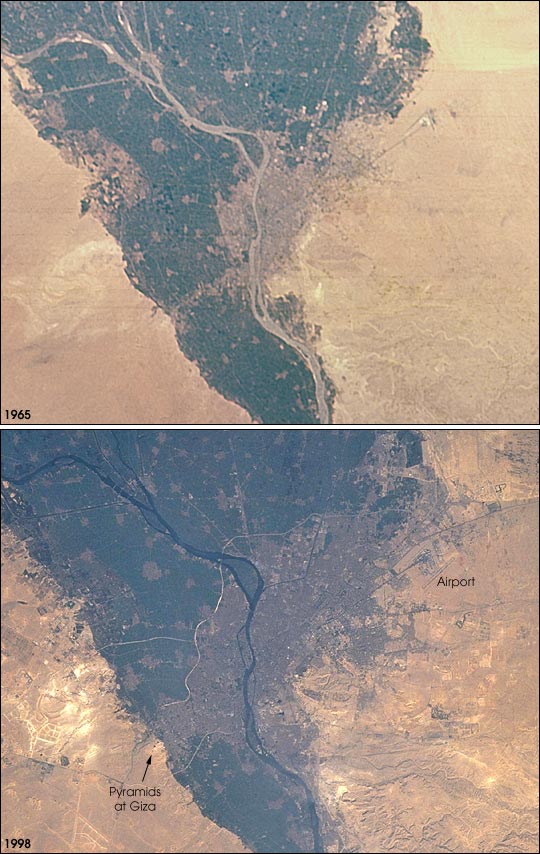


The population of the Cairo metropolitan area has increased from less than 6 million in 1965 when the first picture was taken to more than 10 million in 1998 (United Nations Population Division, World Urbanization Prospects). Population densities within the city are some of the highest in the world, and the urban area has doubled to more than 400 square kilometers during that period. Extraordinary rates of population growth are expected to continue, with a predicted population around 14 million by 2015.
Images Gem05-1-45778 and STS088-739-91 were provided by the Earth Sciences and Image Analysis Laboratory at Johnson Space Center. Additional images taken by astronauts and cosmonauts can be viewed at the NASA-JSC Gateway to Astronaut Photography of Earth.