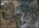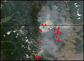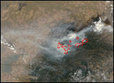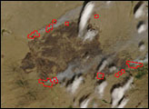

Strong winds and dry conditions were challenging firefighters combating the Winters Fire in northern Nevada in late July 2006. As of July 31, the blaze was estimated to have burned 187,065 acres of sagebrush and grassland. Two small towns, ranches, mining operations, and telecommunications infrastructure were threatened by the fire, which was showing extreme behavior. This image of the fire was captured by the Moderate Resolution Imaging Spectroradiometer (MODIS) on NASA’s Terra satellite on July 30. Places where MODIS detected actively burning fire are outlined in red. The fire was active in many places on its perimeter. The burned land is dark brown. Areas of sparse vegetation or arid land are tan, while pockets of denser vegetation appear in shades of green.
The high-resolution image provided above has a spatial resolution of 500 meters per pixel and shows much of the western United States, including a cluster of smoky fires in northern California. The MODIS Rapid Response System provides daily images of this area in additional resolutions and formats.
NASA image courtesy the MODIS Rapid Response Team, Goddard Space Flight Center
Since late July 2006, firefighters have been working to contain numerous wildfires in several Western states. This image from September 12, 2006, shows multiple large fires in Washington, Oregon, and Idaho.


