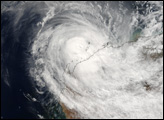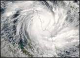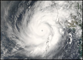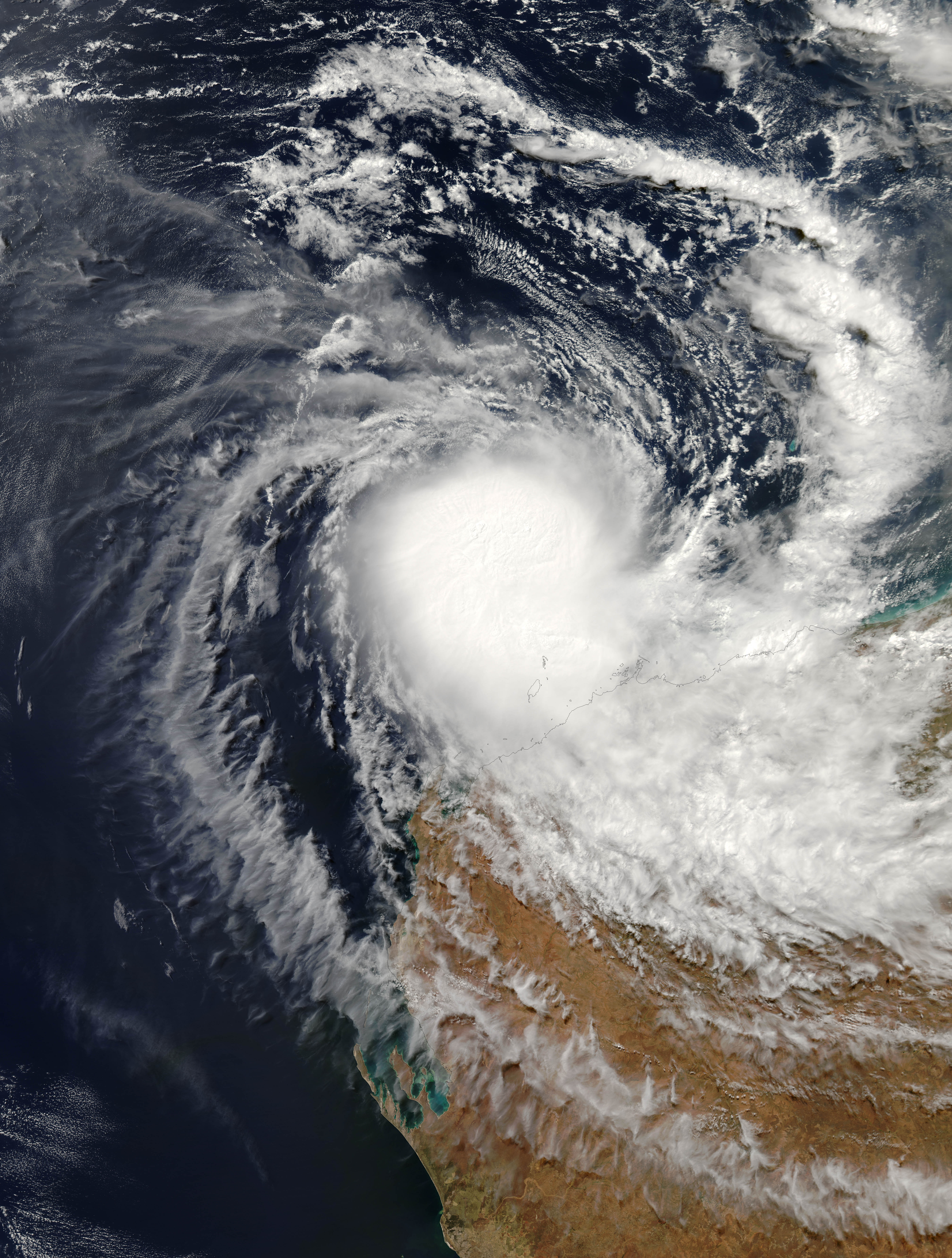
Tropical Cyclone Hubert formed off the northwestern coast of Australia on April 5, 2006. Cyclones form in this area from December through April each year. In April, the start of the Asian Monsoon season gradually shifts storm activity northward to bring the cyclone season to a close. The Australian Bureau of Meteorology had been predicting an average season for cyclones in 2006, with about five named storms of which two might come ashore. With the formation of Hubert, the season became slightly more active than predicted. Unlike Cyclone Glenda, which preceded it by a few days, however, Hubert was not a powerful system and was not predicted to develop much before coming ashore.
This photo-like image was acquired by the Moderate Resolution Imaging Spectroradiometer (MODIS) on the Aqua satellite on April 6, 2006, at 2:15 p.m. local time (06:15 UTC). Cyclone Hubert at this time had a basic spiral form, but lacked the well-developed eye and tight-wound shape of a powerful storm. Sustained, peak winds in the storm system were roughly 100 kilometers per hour (65 miles per hour) around the time the image was captured.
The high-resolution image provided above is provided at the full MODIS spatial resolution (level of detail) of 250 meters per pixel. The MODIS Rapid Response System also provides this image at additional resolutions.
NASA image by Jeff Schmaltz, MODIS Rapid Response Team, Goddard Space Flight Center.
alert message