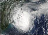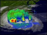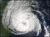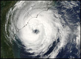

Hurricane Ophelia lived up to its name as it wound haphazardly north along the U.S. Eastern Seaboard during the second week of September 2005. The storm was a still two days away from making landfall when the Moderate Resolution Imaging Spectroradiometer (MODIS) on NASA’s Aqua satellite captured this image at 2:30 p.m. Eastern time on September 13, 2005. At the time, Ophelia had winds of 110 kilometers per hour (70 miles per hour) with stronger gusts. The slow-moving storm is forecast to dump heavy rain on the Outer Banks of North Carolina before turning out to sea on its northeastward course.
The large image provided above has a resolution of 250 meters per pixel. The image is available in additional resolutions from the MODIS Rapid Response Team.
NASA image courtesy Jeff Schmaltz, MODIS Land Rapid Response Team at NASA GSFC
Hurricane Ophelia moved slowly up the East Coast of the United States in early September 2005.


