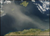
An area of low pressure over the U.S. Southwest began to collide with humid air flowing north on March 14, 2025. The combination powered a destructive weather front that unleashed a chaotic weekend of winds, thunderstorms, hail, dust, and wildfires as the front pushed east through several U.S. states.
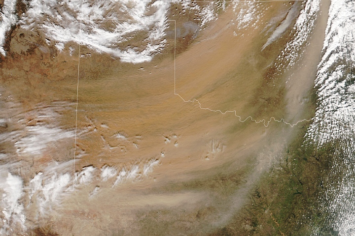
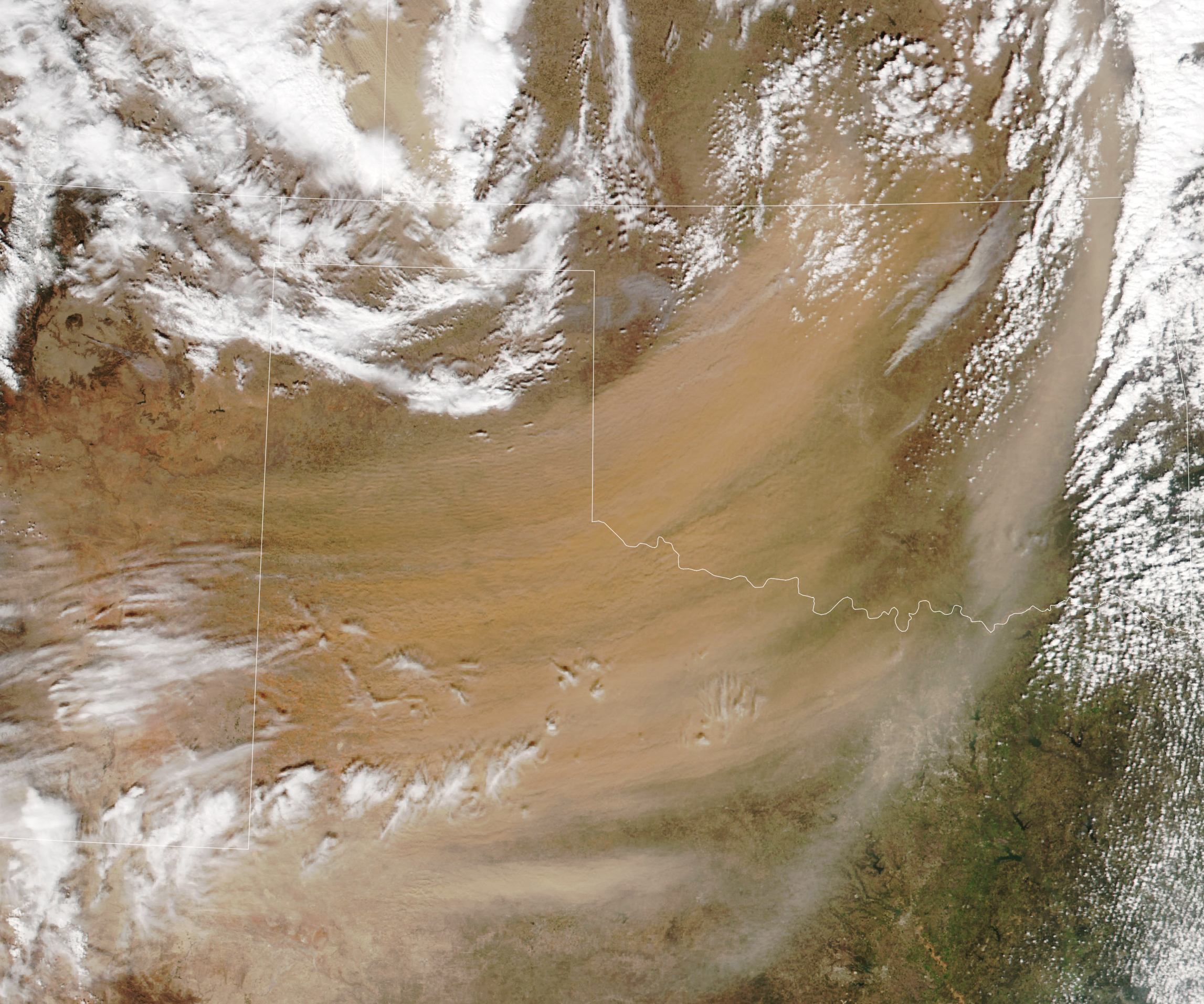
Dust streamed northeast across Texas and Oklahoma behind a line of thunderstorms when the VIIRS (Visible Infrared Imaging Radiometer Suite) on the NOAA-21 satellite captured this image on March 14, 2025. Amidst the blanket of dust, smoke plumes are visible streaming from wildland fires burning near several towns in Oklahoma, including Camargo, Iconium, Langston, Leedey, Maramec, Merrick, Orlando, Pawhuska, and Stillwater.
In Oklahoma, hurricane-force winds gusted up to 85 miles (137 kilometers) per hour, triggering a massive dust storm and fanning fast-moving grass fires that caused the state’s governor to declare a state of emergency in 12 counties. The high winds and fires damaged more than 400 homes and structures, including at least 70 homes in Stillwater that were destroyed. The extreme weather also caused tens of thousands of power outages and triggered deadly traffic accidents.
More than 170,000 acres of land burned, according to The Oklahoman. Many fires raged in parched grasslands that had been abnormally dry and drought-prone in recent weeks, according to the U.S. Drought Monitor.
“Wildfires are really many hazards at once,” said Doug Morton, a remote sensing scientist at NASA’s Goddard Space Flight Center, citing dangers including the direct threat to life and property, health hazards posed by the smoke, and issues of visibility that make road and air travel dangerous. “In Oklahoma, the mixture of dust and smoke compounded the problem and led to treacherous conditions,” Morton said.
The same storm system generated dozens of tornadoes, some of which touched down in Arkansas, Missouri, Illinois, Indiana, Mississippi, Alabama, and Georgia, taking dozens of lives and flattening homes in several communities.
NASA Earth Observatory image by Lauren Dauphin, using VIIRS data from NASA EOSDIS LANCE, GIBS/Worldview, and the Joint Polar Satellite System (JPSS). Story by Adam Voiland.
alert message