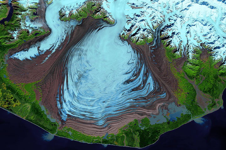

Venezuela’s Humboldt Glacier has met its demise. The loss is the latest blow to our planet’s dwindling tropical glaciers, which have been shrinking and disappearing as temperatures have warmed.
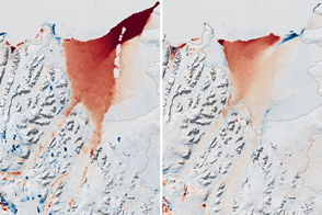
This image pair shows the change in the glacier’s ice extent between 2015 (left) and 2024 (right). Images were acquired with the OLI (Operational Land Imager) on Landsat 8 and OLI-2 on Landsat 9, respectively. Both images show the region toward the end of its dry season to minimize the influence of seasonal snow cover on the appearance of ice remnants.
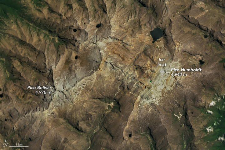
Humboldt Glacier has long been perched high in the Sierra Nevada de Mérida, a range in the northern extent of South America’s Andes Mountains. In 2015, scientists estimated that this glacier spanned about 0.1 square kilometers (25 acres). By 2024, the ice area had shrunk to cover approximately one-tenth of that. Although there is no universally accepted size criterion defining a glacier, scientists generally agree that an ice field of this size is stagnant, meaning it is too small to flow downslope under the pressure of its own weight. By that definition, Venezuela is now glacier-free.
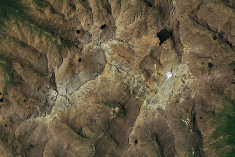
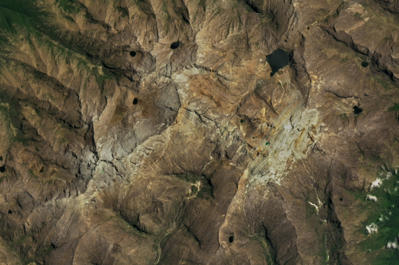
Humboldt has been Venezuela’s last glacier since 2009, following the loss of other glaciers on nearby peaks. Despite its proximity to the equator, the glacier survived this long in part because of its altitude. Glaciers in the tropics—the region of Earth straddling the equator between latitudes of about 30°N and 30°S—exist because of the cold, snowy climate found at high elevations. Humboldt Glacier clung to a slope and saddle at the base of Pico Humboldt, which stands just shy of Pico Bolívar, the country’s tallest peak. Topography might have also played a role in its relative longevity. Surrounded by exceedingly steep slopes, Humboldt’s ice sat on a slightly gentler slope where snow could accumulate and compact into glacial ice during past colder conditions.
But altitude and topography have not been enough to sustain the glacier indefinitely. Evidence from satellite and aerial images, ground observations, and historical sources indicate that Humboldt Glacier has long been in decline. Spanning 3 square kilometers in 1910, it now covers about 0.01 square kilometers, making Venezuela the first postglacial nation in the Andes.
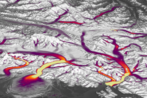
Glaciers elsewhere in the tropics are showing a similar response to warming. The glaciers on Kilimanjaro in Tanzania and Puncak Jaya in Indonesia, for example, have become stagnant ice fields. Satellites continue to be an important tool for scientists mapping these changes and studying how the landscape and ecosystems respond.
NASA Earth Observatory images by Michala Garrison, using Landsat data from the U.S. Geological Survey. Image interpretation and science review by Christopher Shuman, NASA/UMBC. Story by Kathryn Hansen.