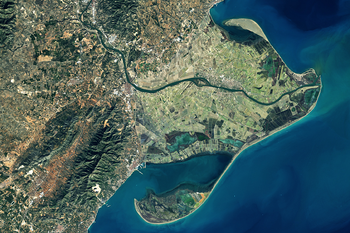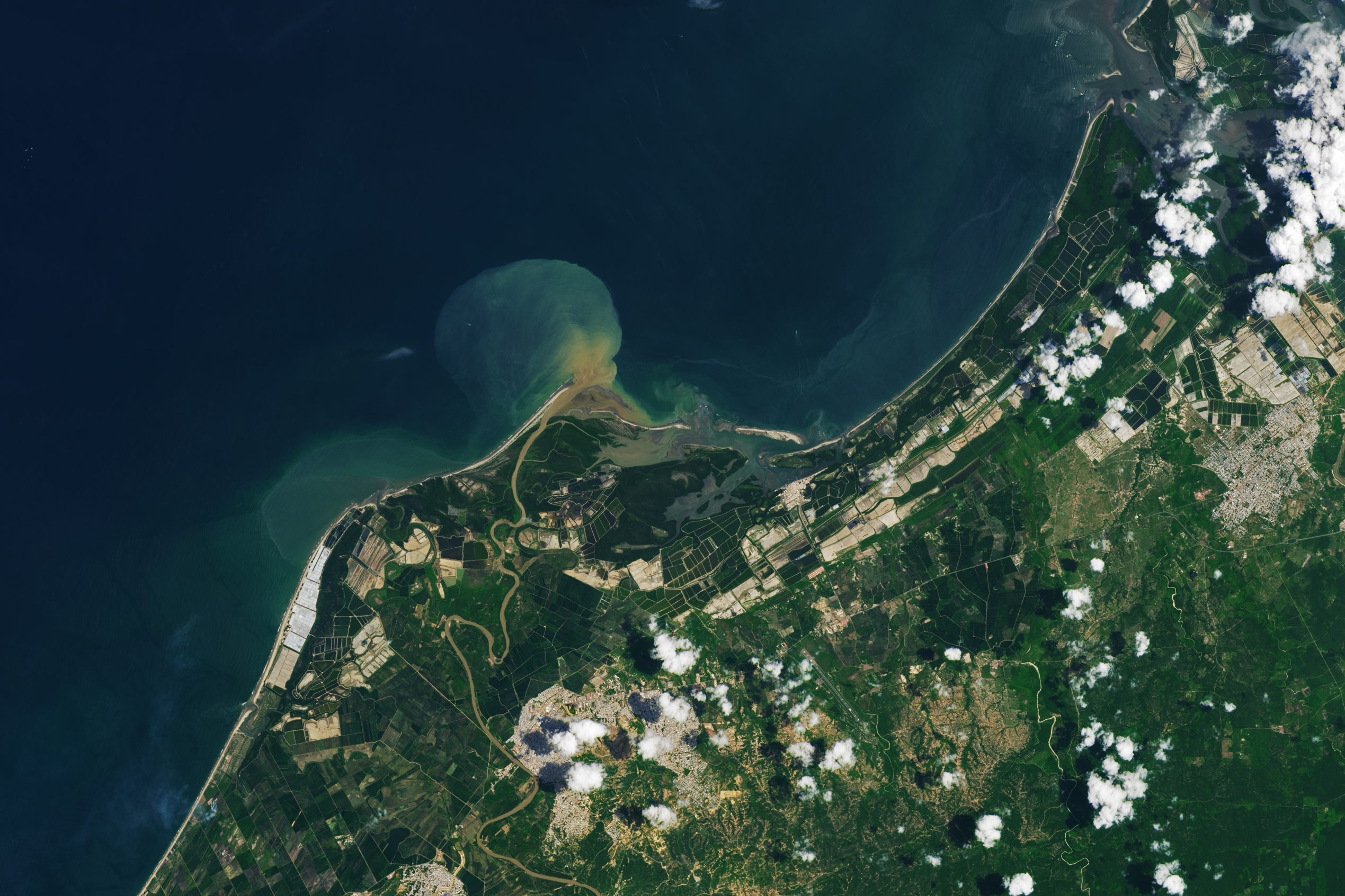
Near the border of Peru and Ecuador, the Tumbes River winds its way through forests and farmlands, past the city of Tumbes, and into the Pacific Ocean. Along the coastline of the river delta, rectangular aquaculture ponds are prevalent. Much of Peru’s shrimp production, farmed in ponds like these, occurs in the Tumbes region.
In Peru, as elsewhere, shrimp farms are typically built along the shore where saltwater is easily accessible. Green and white aquaculture ponds extend across the Tumbes River Delta shown in this image, acquired on March 14, 2024, by the OLI-2 (Operational Land Imager-2) on Landsat 9. The ponds on the west side of the delta are likely topped with white pond covers, providing some shade. Shading ponds can improve shrimp yields and curtail water use by reducing evaporation.
Shrimp aquaculture came to Peru in the early 1970s, and the industry has since undergone vast expansion. But the growth has come at the expense of natural ecosystems. Using aerial photographs and satellite data from Landsat dating back to the 1970s, researchers have found that aquaculture ponds in the Tumbes River Delta have encroached upon mangrove forest, savanna, and dry forest ecosystems. The researchers found that shrimp farms have replaced 17 percent of the mangrove forests in Peru.
Mangrove forests protect coastlines from erosion and storm damage, and they provide habitat for many marine species. They are also uniquely efficient carbon sinks—places where carbon is removed from the atmosphere and stored. Humans have caused the loss of more than a quarter of known mangrove forests over the last 50 years, according to NASA research, and aquacultural development has been one of the drivers of this loss.
The farmed shrimp industry has increased from less than 100,000 metric tons produced globally in 1980 to more than 5 million metric tons in 2023. The Tumbes River Delta is 20 miles west of Ecuador, which is currently the world’s top producer of farmed shrimp.
NASA Earth Observatory image by Lauren Dauphin, using Landsat data from the U.S. Geological Survey. Story by Emily Cassidy.
alert message