The Earth Observatory has published its last Image of the Day on this website. Please join us on our new home at science.nasa.gov/earth/earth-observatory.
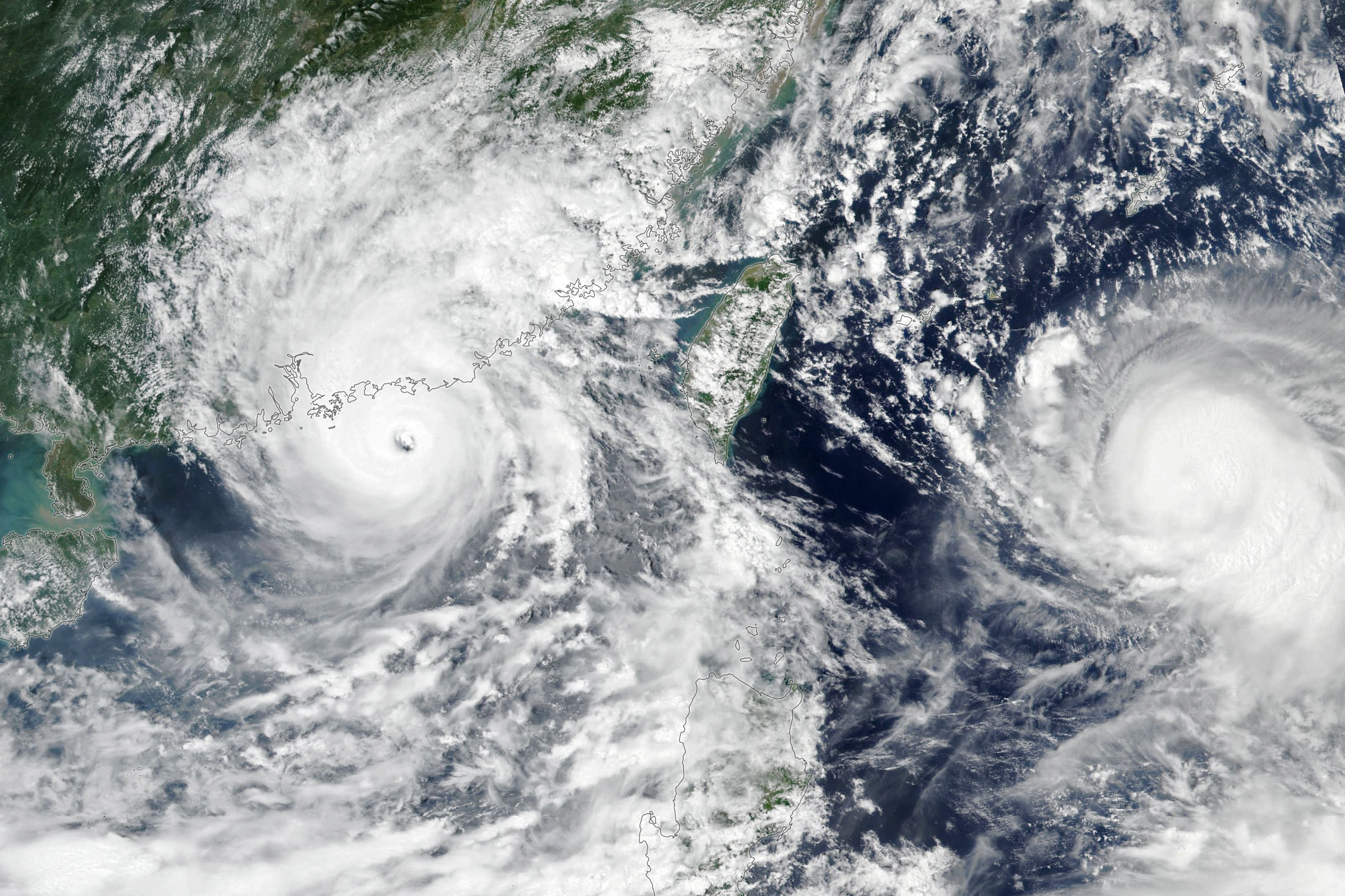
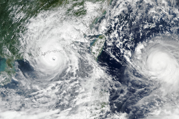
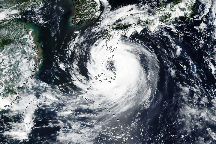
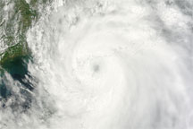
The center of Typhoon Saola brushed past Hong Kong on September 1, 2023, as it proceeded on its westward trajectory along China’s coast.
The Visible Infrared Imaging Radiometer Suite (VIIRS) on the NOAA-NASA Suomi NPP satellite acquired this image of Typhoon Saola at approximately 1 p.m. local time. Around this time, sustained wind speeds reached 220 kilometers (140 miles) per hour, making it the equivalent of a category 4 hurricane. The storm hugged the coastline as it moved west throughout the day, with its center passing approximately 40 kilometers (25 miles) to the south of Hong Kong after 10 p.m. local time.
The Hong Kong Observatory issued its most severe storm warning, the first time it has done so since Typhoon Mangkhut in 2018. Coastal areas braced for heavy rain, dangerous winds, and strong storm surge. The water in Hong Kong’s Tolo Harbour was expected to rise 3-4 meters (10-13 feet) above the normal tide level. Businesses closed, and flights, ferries, and other transit services were canceled. Some students saw what would have been their first day of school postponed.
On its way toward China, Saola passed near but did not make landfall over the Philippines. Still, it dumped heavy rain, caused landslides and flooding, and displaced thousands of people there, according to news reports. The storm also reached super typhoon status, characterized by sustained winds over 240 kilometers (150 miles) per hour, before being downgraded on September 1.
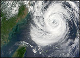
Farther out to sea, Typhoon Haikui was moving west toward Taiwan. On September 1, sustained wind speeds measured 140 kilometers (85 miles) per hour and were projected to increase.
NASA Earth Observatory image by Lauren Dauphin, using VIIRS data from NASA EOSDIS LANCE, GIBS/Worldview, and the Suomi National Polar-orbiting Partnership. Story by Lindsey Doermann.


