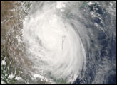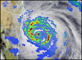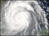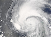

Tropical Storm Emily is shown here in the Atlantic Ocean several hundred kilometers north of the Brazilian coast on July 12, 2005. The image was captured by the Moderate Resolution Imaging Spectroradiometer (MODIS) on the Terra satellite at 12:55 UTC (8:55 Eastern Daylight Time). The fledgling storm didn't have the characteristic look of a tropical storm at the time; it appeared to be just a collection of severe thunderstorms.
At the time of this observation, however, winds were around 40 knots (75 km/h), sufficient to classify it as a tropical storm. Emily was heading westward at around 15 knots (roughly 28 km/h). As of July 13, Emily was being predicted to gather power as it moved into the Caribbean and to organize into a full-fledged hurricane with predicted top wind speeds around 100 knots (185 km/hr) before making landfall on Mexico’s Yucatan Peninsula some time around July 16. However, predicting hurricane strength and intensity is challenging, and Emily might be either stronger or weaker than expected, and could still turn northward towards the U.S. Gulf Coast regions.
NASA image created by Jesse Allen, Earth Observatory, using data obtained from the Goddard Land Processes DAAC.
In mid-July, Tropical Storm Emily began building strength before heading into the Caribbean Sea.


