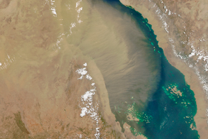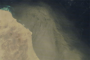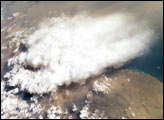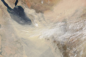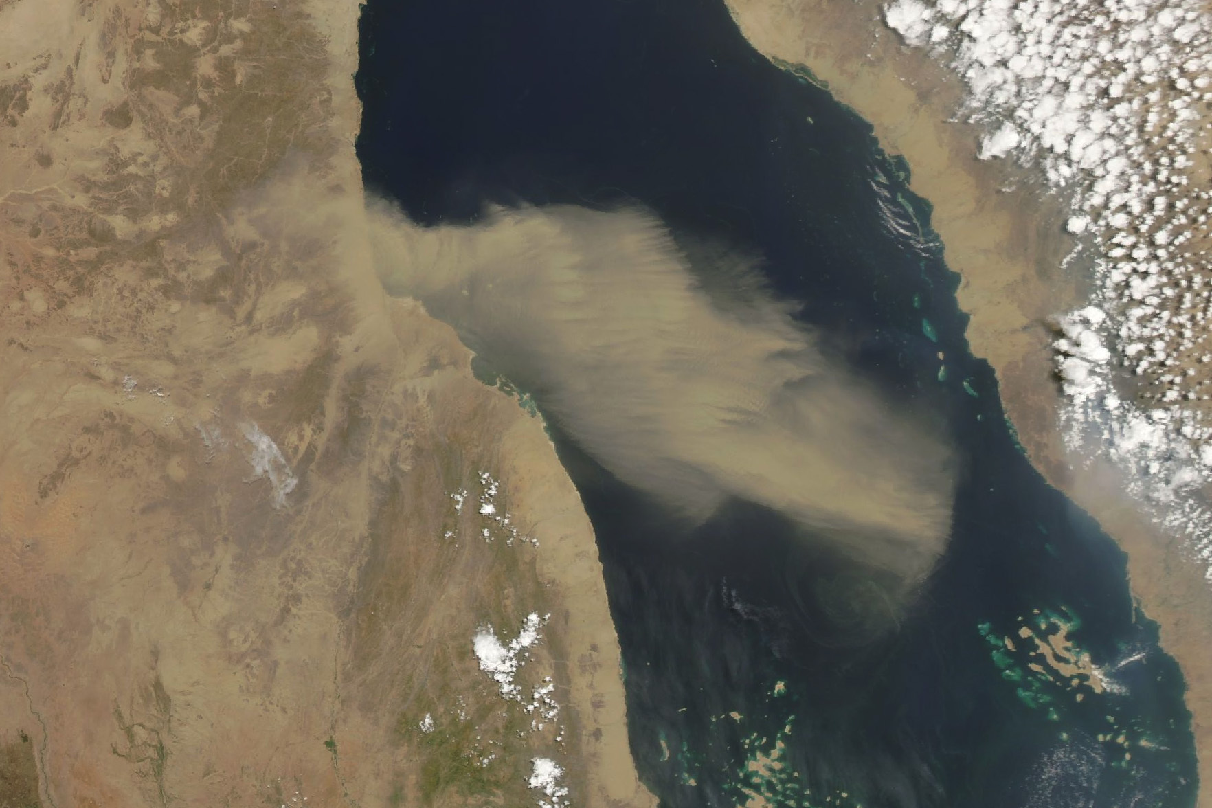
Mountain chains border both sides of the Red Sea, the long narrow inlet of the Indian Ocean that separates Saudi Arabia to the east from Egypt, Sudan, and Eritrea to the west. One major exception is the Tokar Gap, a 100-kilometer (60-mile) break in the Red Sea Hills that serves as a conduit for both winds and dust.
In the summer, strong surface winds frequently stream through the gap from the southwest, often funneling narrow plumes of dust from the Tokar Delta over the Red Sea. That process was on display on June 24, 2023, when the Moderate Resolution Imaging Spectroradiometer (MODIS) on NASA’s Aqua satellite captured this image of a tongue of dust from Sudan pushing through the gap from the west. In the winter, the winds reverse and winds typically gather over the Red Sea and move through the gap toward the southwest.
A 2019 analysis of weather conditions that fuel summer dust storms indicated that stronger winds moving through the Tokar Gap—and warmer air and soil temperatures—have increased the amount of airborne dust found in this area since 2002. The research was conducted using NASA’s Modern-Era Retrospective analysis for Research and Applications, Version 2 (MERRA-2), a reanalysis model that combines observations with past short-range weather forecasts rerun with modern weather forecasting models. Observations of dust from MODIS, the Multi-angle Imaging SpectroRadiometer (MISR), and the Sea-viewing Wide Field-of-view Sensor (SeaWiFS) were among the NASA data sources used to validate the findings from MERRA-2.
Because airborne dust particles have properties that can both suppress and enhance rainfall, other researchers are using many of these same data sources to study whether dust storms in this area may be altering local rainfall patterns.
NASA Earth Observatory image by Wanmei Liang, using MODIS data from NASA EOSDIS LANCE and GIBS/Worldview. Story by Adam Voiland.