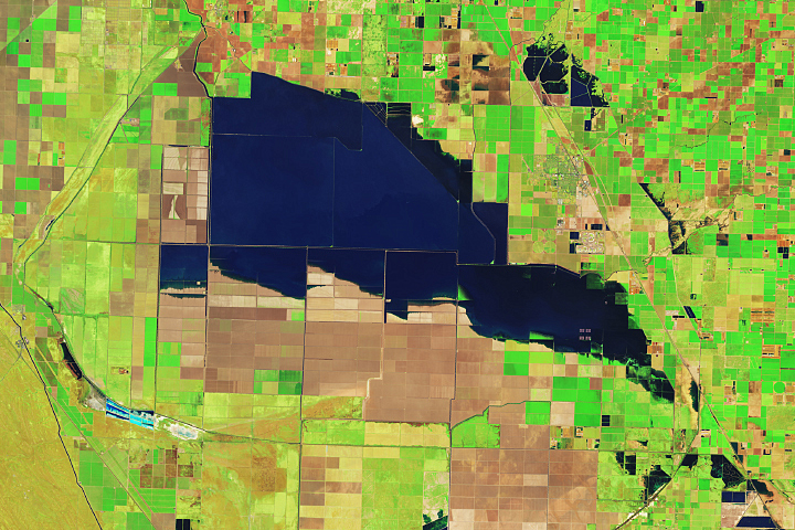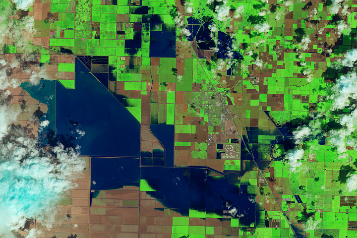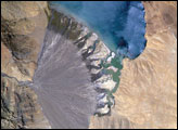
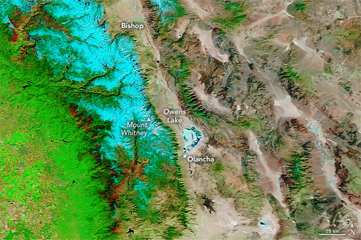
California's Owens Lake has been mostly dry since the construction of the Los Angeles Aqueduct in 1913. The project siphoned water from the eastern slopes of the Sierra Nevada range and Owens River Valley to the city of Los Angeles, 220 miles (354 kilometers) to the south, drawing down the lake.
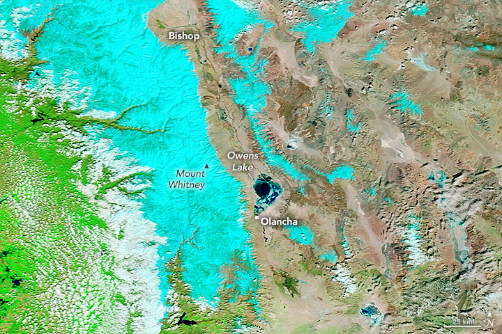
That changed in March 2023 after floodwaters pooled on the west side of the aqueduct, eroded soil that supported the concrete-lined channel, and contributed to the collapse of three of its sections near Olancha. To drain and repair the damaged section of the aqueduct, the Los Angeles Department of Water and Power (LADWP) opened spill gates letting water run downstream. According to news reports, some of that floodwater joined with water from other sources and poured over the lakebed of Owens Lake.
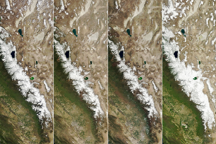
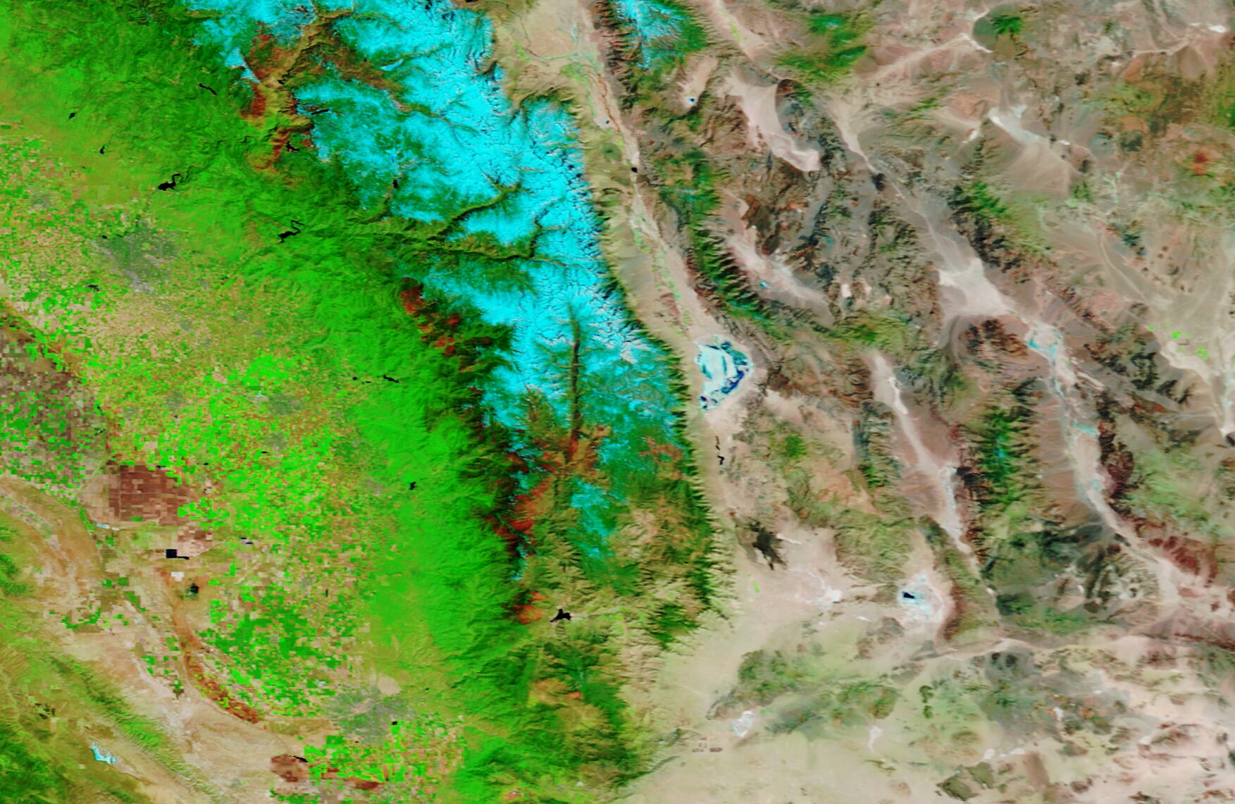
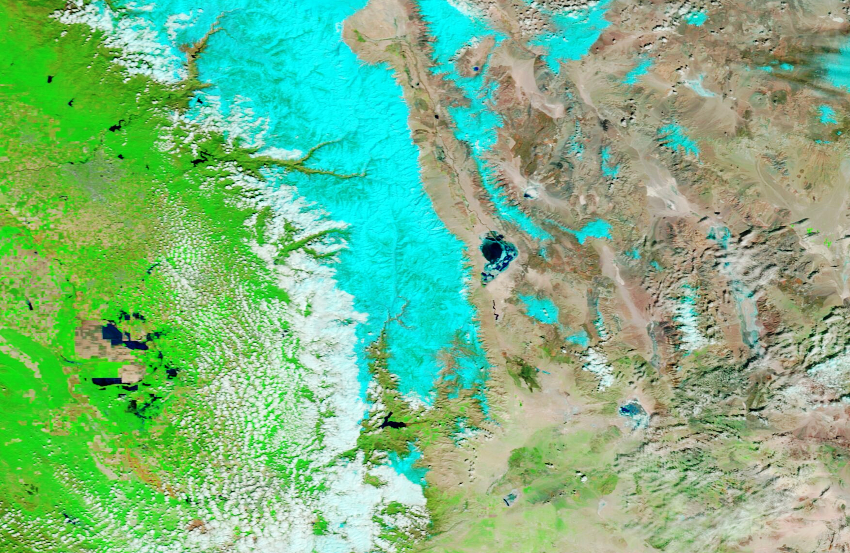
Two weeks later, on March 25, the Moderate Resolution Imaging Spectroradiometer (MODIS) on NASA’s Terra satellite acquired this image (right) of Owens Lake. The image is false color, which makes the water (dark blue) stand out from its surroundings. Snow appears light blue and vegetation is green. The image on the left shows the same area in March 2022.
This is the first time the Los Angeles Aqueduct has been breached by extreme weather, according to the Los Angeles Times. But it is not the first time the lakebed has flooded since the construction of the aqueduct. Since the early 2000s, LADWP has occasionally flooded parts of the lake with shallow water to prevent dust from becoming airborne and potentially affecting human health.
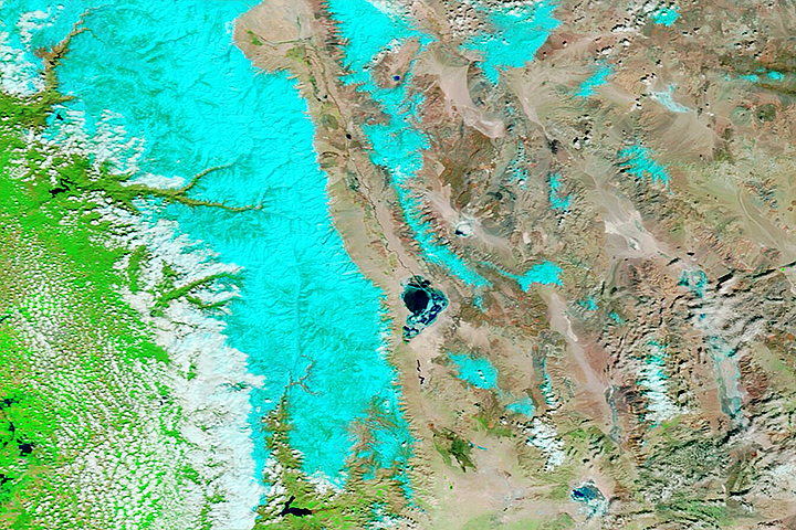
However, the aqueduct’s breach came after an atmospheric river brought 5 to 13 inches of rain to parts of Central California on March 9 and 10. Heavy precipitation in the state in 2023 led to a record amount of snow on the southern Sierra Nevada range (shown in light blue in the image above). Yet, the past three years have been some of California’s driest.
Recent research indicates that climate change has made these water cycle extremes more common. Matthew Rodell, a hydrologist based at NASA’s Goddard Space Flight Center, led a recent study that used data from the NASA/German Gravity Recovery and Climate Experiment (GRACE) and GRACE Follow-On (GRACE-FO) satellites to characterize extreme wet and dry events over the past 20 years. GRACE satellites monitor miniscule, month-to-month changes in Earth’s gravity field that scientists can use to determine where on Earth water is accumulating or diminishing.
The researchers ranked 1,056 extreme events during the two-decade period and found that the most intense droughts and wet events were becoming more frequent. During the first 13 years of the study, there was an average of three major extreme wet or dry events per year. Yet between 2015 and 2021, seven of the planet’s 10 warmest years, there was an average of four such extreme events per year.
According to Rodell: “What we’re seeing in California—this weather whiplash between extreme dry and wet conditions—is becoming more common as a result of climate change.”
NASA Earth Observatory images by Lauren Dauphin, using MODIS data from NASA EOSDIS LANCE and GIBS/Worldview. Story by Emily Cassidy.
alert message