Today’s Image of the Day is part of a series highlighting wintertime photographs of Earth shot by astronauts on the International Space Station. View the full collection here.
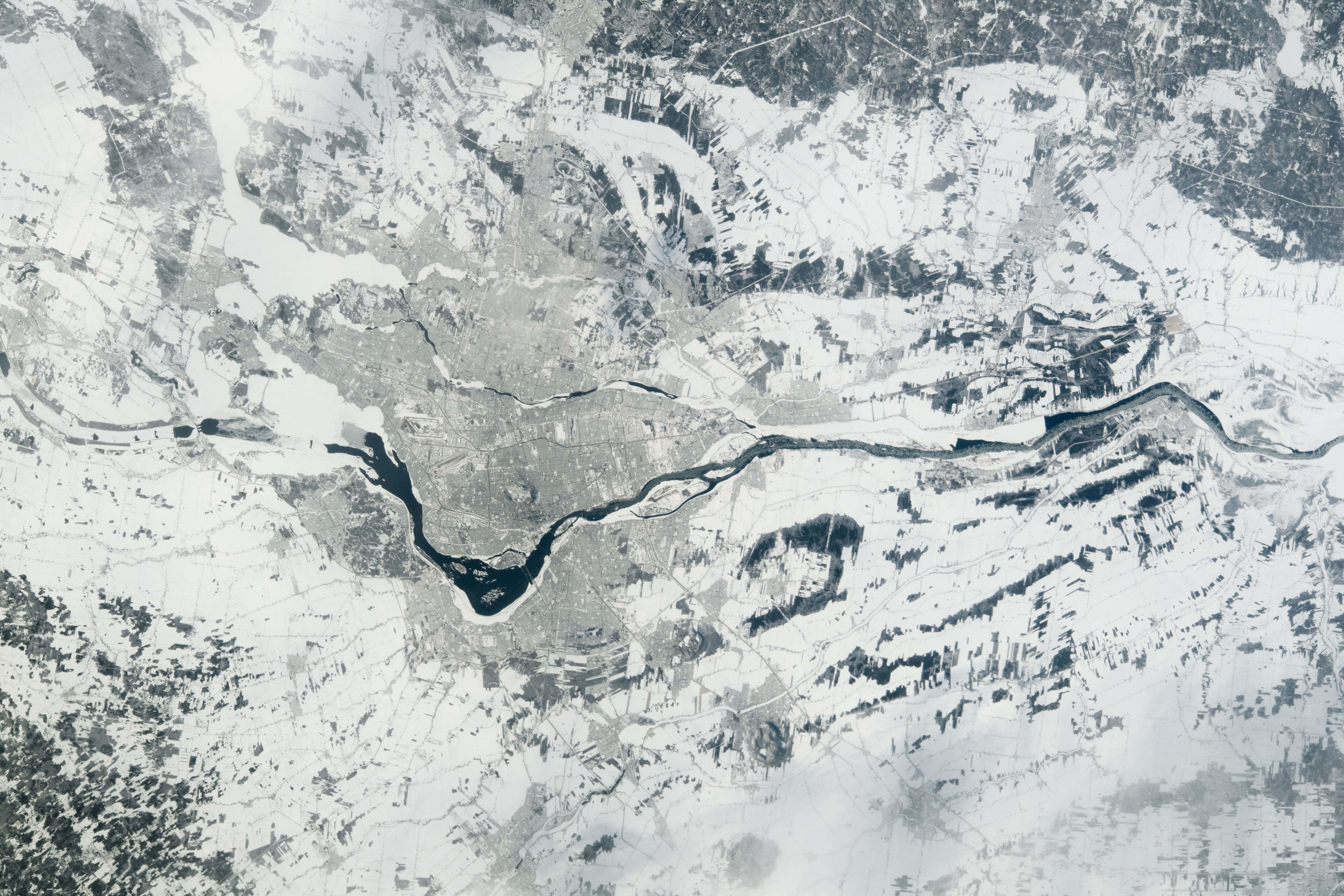
The St. Lawrence River cuts across snowy Quebec in this photograph taken from the International Space Station on February 1, 2022.
About 12,000 years ago, retreating glaciers left a large inlet, called Champlain Sea, in this area of southeastern Canada. The sea eventually drained and left the St. Lawrence and Ottawa rivers, as well as over 200 islands and islets known as the Hochelaga Archipelago. During the 1600s to 1800s, the St. Lawrence River—which connects the Great Lakes to the Atlantic Ocean—acted as a highway for the lucrative fur trade and was an important link between North America and Western Europe. To this day, the river is a major transportation corridor.
Montreal’s urban development cuts into the snow cover where the St. Lawrence bends, on the left side of the photo. The city occupies most of Montreal Island, the largest island of the Hochelaga Archipelago.
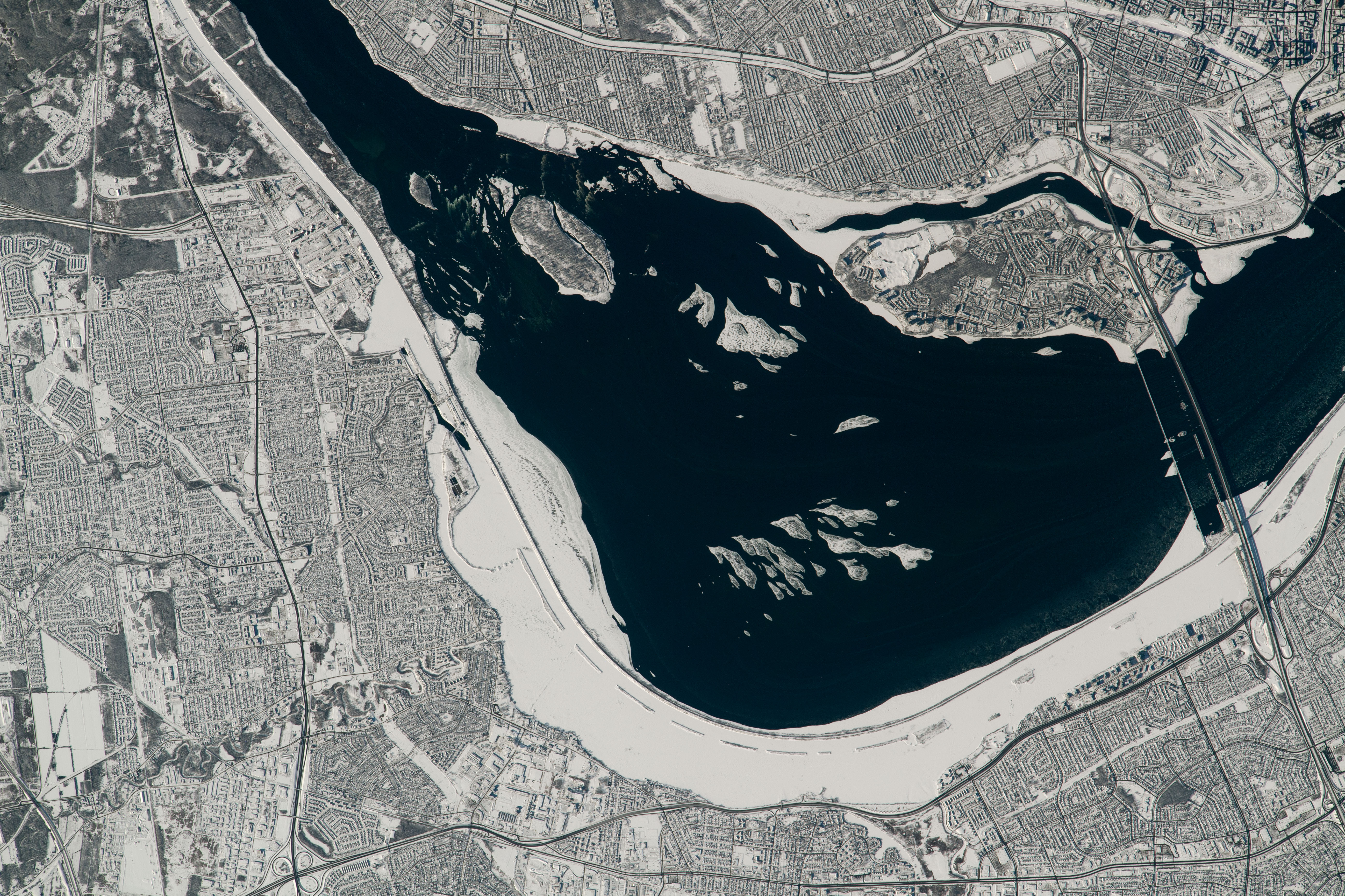
This detailed photo of Montreal—taken from the International Space Station on February 5, 2022—shows a few islands and smaller islets in the St. Lawrence. The Samuel De Champlain bridge crosses over the river into downtown. The bridge also crosses Nun’s Island, which was named after the sisters of the Notre-Dame congregation who owned the island from the late 1700s until the 1950s. Now the island is a suburb of Montreal.
Farther upriver is Heron Island, a migratory bird sanctuary. The 600-hectare (2.3-square-mile) refuge was established in 1937 to protect the nesting habitat for the great blue heron and several other bird species. According to the Canadian government, the number of heron nests on the island have been declining since 2000.
Astronaut photographs ISS066-E-133423 and ISS066-E-138984 were acquired with a Nikon D5 digital camera using focal lengths of 130 millimeters and 1150 millimeters, respectively. They are provided by the ISS Crew Earth Observations Facility and the Earth Science and Remote Sensing Unit, Johnson Space Center. The images were taken by a member of the Expedition 66 crew and have been cropped and enhanced to improve contrast, and lens artifacts have been removed. The International Space Station Program supports the laboratory as part of the ISS National Lab to help astronauts take pictures of Earth that will be of the greatest value to scientists and the public, and to make those images freely available on the Internet. Additional images taken by astronauts and cosmonauts can be viewed at the NASA/JSC Gateway to Astronaut Photography of Earth. Story by Emily Cassidy.
alert message