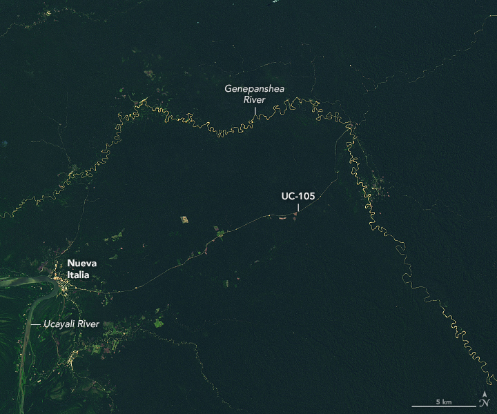
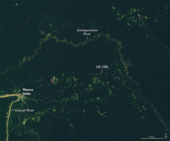
A thin brown line east of the Ucayali River snakes through an expanse of green rainforest in eastern Peru. The road—originally called OX1 and now UC-105—first appears in Landsat satellite imagery in 1987. Landsat images indicate that the surrounding forest stayed mostly intact for more than two decades, despite the activity of oil and logging companies.
But starting in 2017, large clearings have sprung up on either side of the road, and networks of smaller roads connected to it have pushed deeper into the rainforest. “The pace of change in the past five years is staggering,” said David Salisbury, a University of Richmond professor who has been doing field work in the region for decades. “It’s also a preview of what is to come if this road is paved and extends all the way to Puerto Breu. Most of the deforestation in the Amazon rainforest happens within 5 kilometers (3 miles) of roads.”
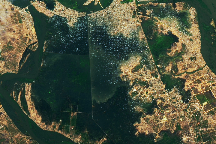
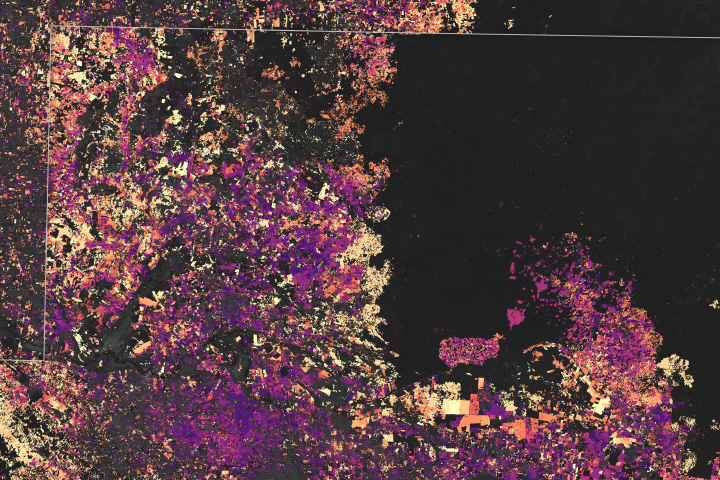
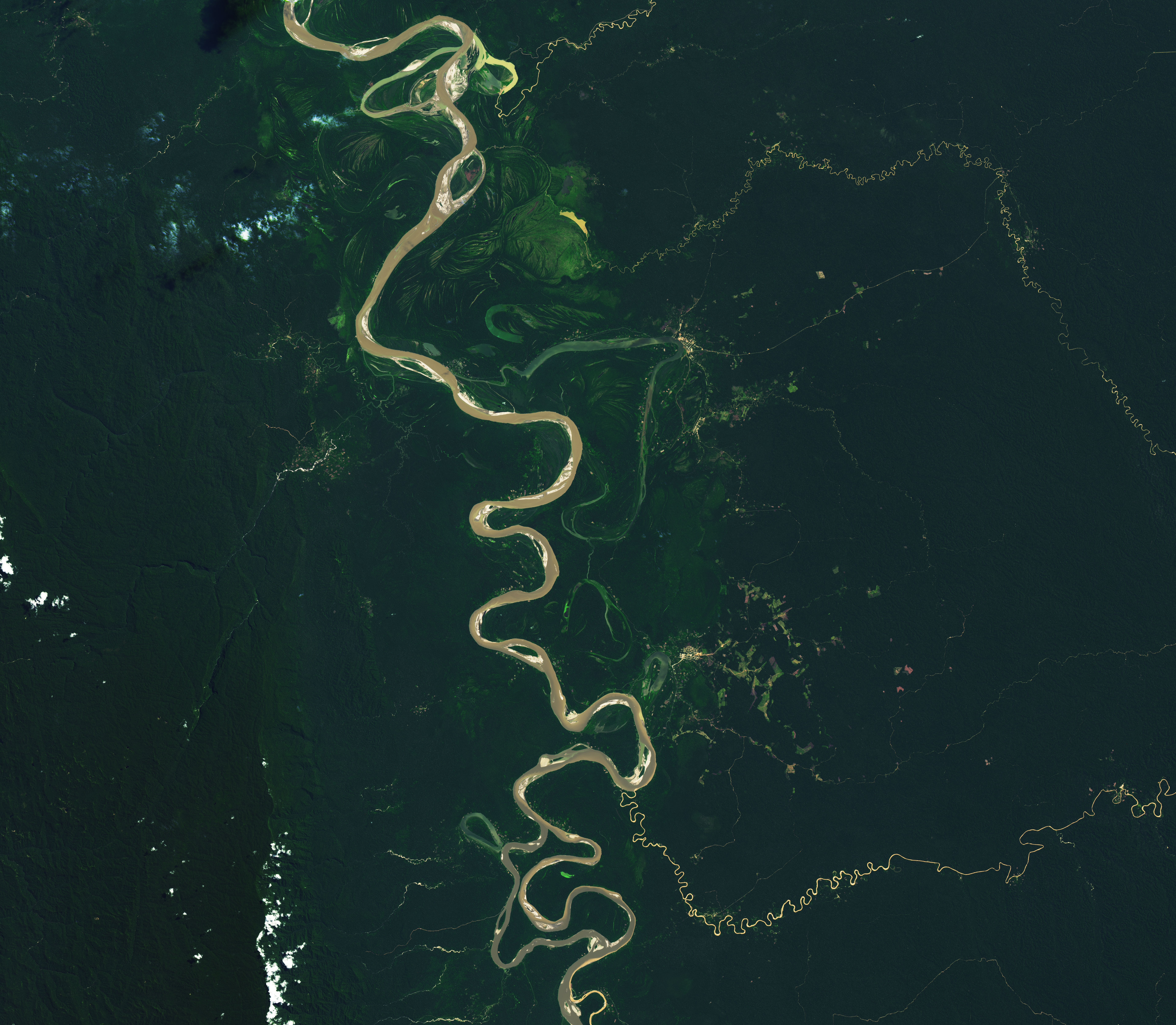
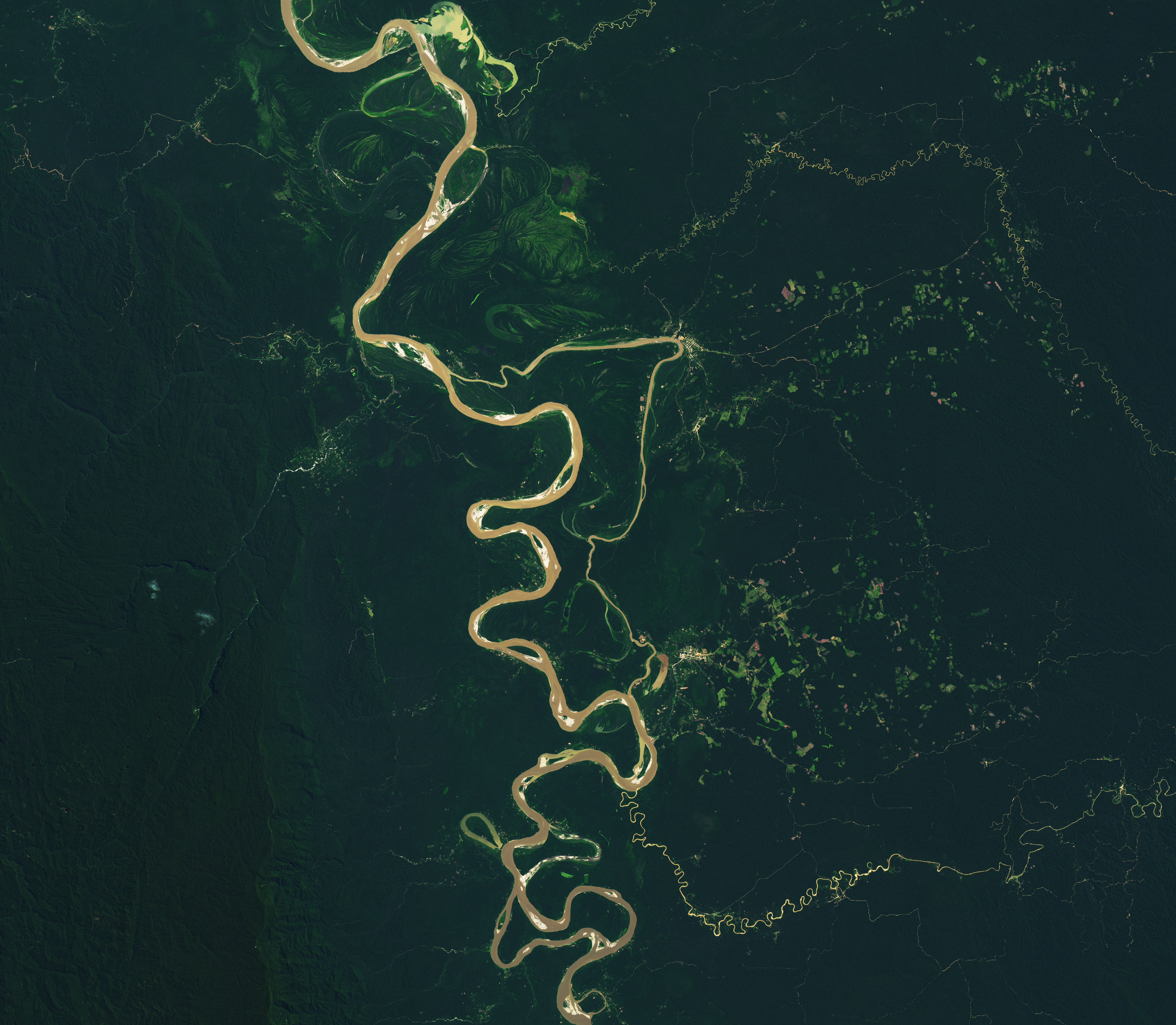
The pair of satellite images above show the extent of the change between the Ucayali and Genepanshea rivers. The first image, acquired by the Operational Land Imager (OLI) on Landsat 8, shows the area in 2017, when just the road and a modest amount of deforestation were visible. By 2022, deforested areas had proliferated, in part due to the arrival of a new wave of land speculators, coca farms, ranches, and even small airstrips, explained Salisbury.
The original road, first established by an oil company in the late-1980s, connected Nueva Italia’s port on the Ucayali River with wells drilled near the Sheshea and Tamaya Rivers. The company abandoned the road after a few years and vegetation had started to grow over it. But starting in 1999, a logging company began to reestablish, widen, and extend the road. Over the next decade, a network of trails spread outward from the main road as loggers harvested mahogany and cedar from the area, transporting the timber to the Ucayali River and floating it to the Peruvian city of Pucallpa.
This “selective logging” only affected a small number of trees and left most of the forest canopy intact. However, roadbuilding for selective logging is often the first step in a process that leads eventually to clearcutting, and this area has followed that pattern.
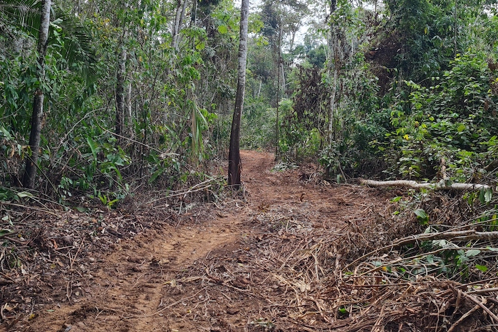
The road again fell into disrepair in the late 2000s, but renewed efforts by logging and other interests to rehabilitate it started to intensify in the early 2010s, with the intent of linking Peru’s Ucayali Province to the state of Acre in western Brazil. As the road has become more established, deforestation has followed. More than 60 square kilometers (23 square miles) were cleared within 5 kilometers of the road between 2000 and 2021, according to one analysis conducted by the Monitoring of the Andean Amazon Project. Salisbury expects that trend to accelerate if proposals to pave key parts of the road come to fruition. The photo above, taken in 2021, shows a section of the road in eastern Peru about 15 kilometers southeast of the border with Brazil.
Salisbury and University of Richmond colleague Stephanie Spera recently traveled to Ucayali to lead workshops in Pucallpa and Puerto Breu. They met with local people representing 13 Indigenous groups, and learned about how the changes they have observed in satellite imagery compare to what people are experiencing on the ground.
“Our top goal was to give our Indigenous counterparts, who are local forest and climate experts, the opportunity to see if their lived experience and long-term observations of the forests, humidity, seasonality, and rainfall matched up with forest and climate trends our University of Richmond team was picking up in our satellite imagery analysis,” said Salisbury.
With funding from NASA’s Earth Sciences Applied Sciences program and working in collaboration with SERVIR Amazonia, Salisbury and colleagues with the Amazon Borderland Spatial Analysis Team at the University of Richmond are building a suite of tools based on remote sensing that can be used to track how changes along the road are influencing several environmental variables.
While some local people support opening the road and pursuing logging or other activities that could provide important sources of income, many Indigenous groups in both Peru and Brazil have raised concerns about the pace of change and oppose plans to expand the road westward toward Puerto Breu. “In Apiwtxa, we see the Nueva Italia-Puerto Breu Road as a direct threat to how we live,” said Francisco Piyako, former President of the Organization of the Indigenous Peoples of the Juruá River (OPIRJ). “The logging [and] drug trafficking interests will end our communities.”
“The roads are the key,” said Salisbury. “Roads are the most damaging infrastructure to the Amazon rainforest because of the deforestation and forest degradation that inevitably follows them. And too often the only thing standing between new roads in remote forested regions are the local people who are often in harm’s way, marginalized, and have the unfair burden of trying to protect the forests.”
NASA Earth Observatory images by Lauren Dauphin, using Landsat data from the U.S. Geological Survey. Photo by William Villacorta/Upper Amazon Conservancy. Story by Adam Voiland.