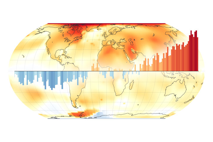
The Earth Observatory has published its last Image of the Day on this website. Please join us on our new home at science.nasa.gov/earth/earth-observatory.
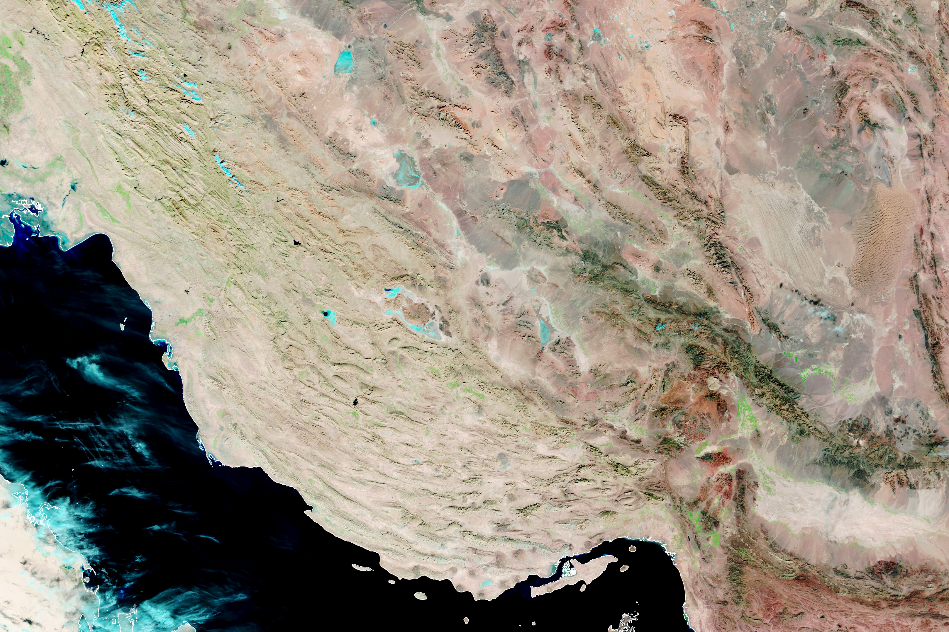
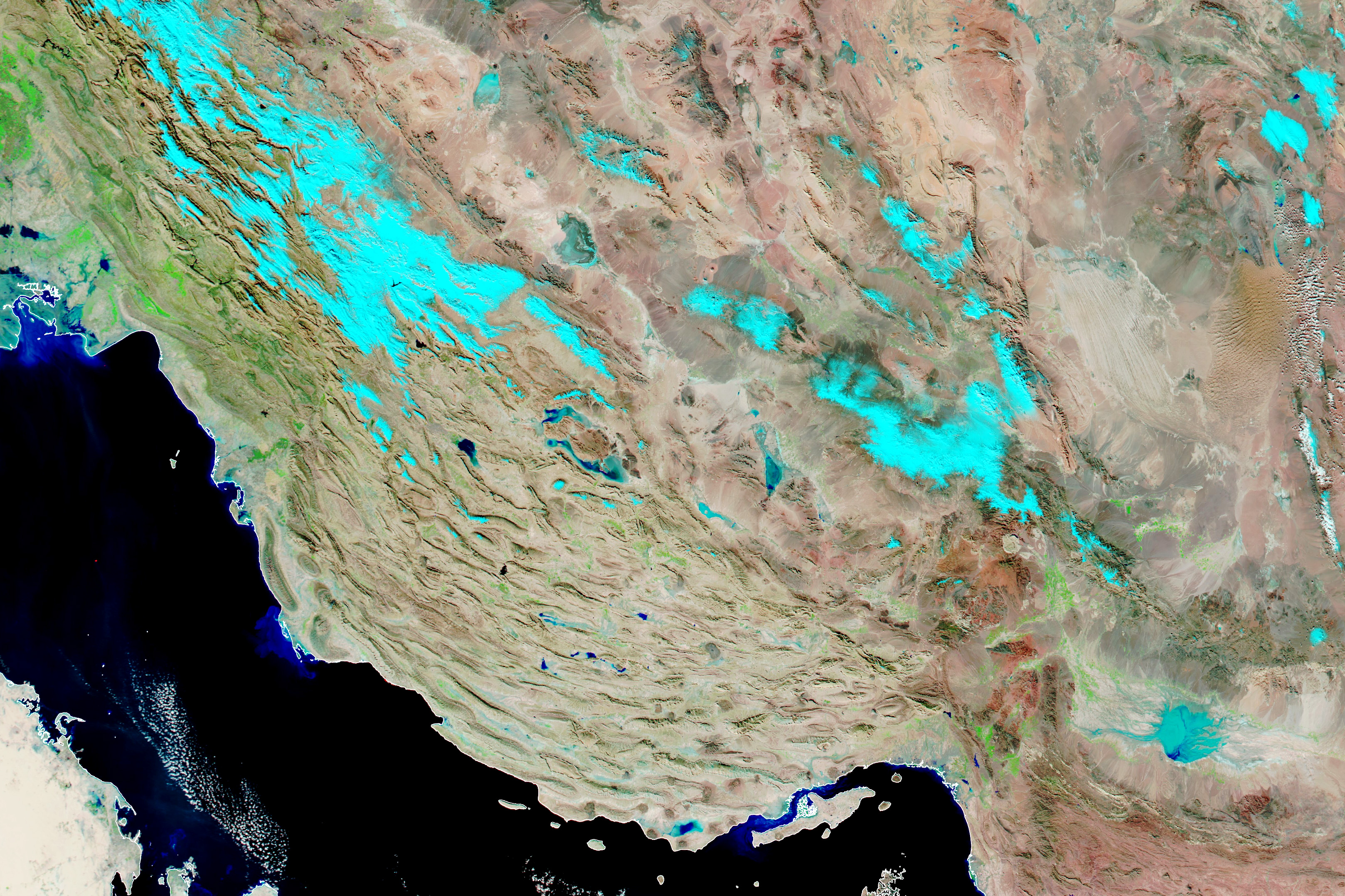

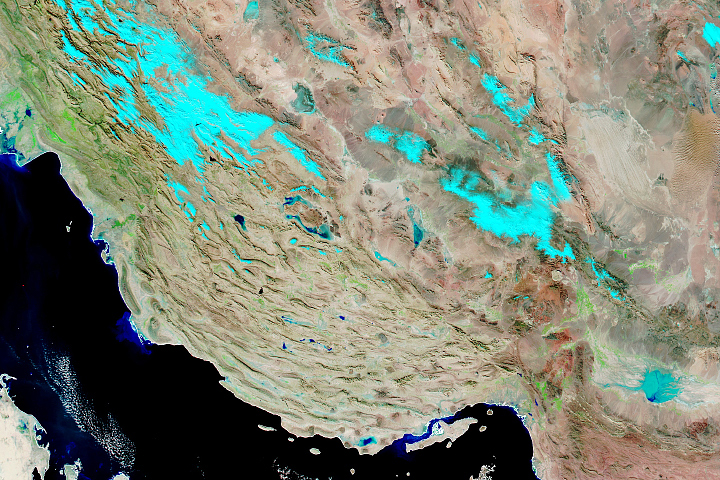
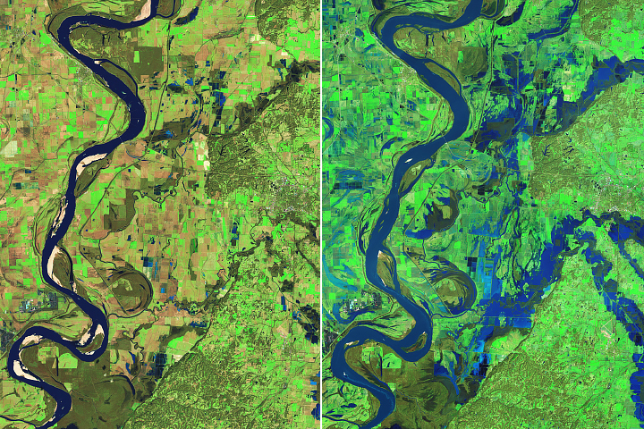
For much of 2021, drought gripped southern Iran, parching crops, drying wells, and fueling protests over water. The first week of 2022 brought the opposite problem—a series of potent rain and snow storms overwhelmed rivers and unleashed widespread flooding.
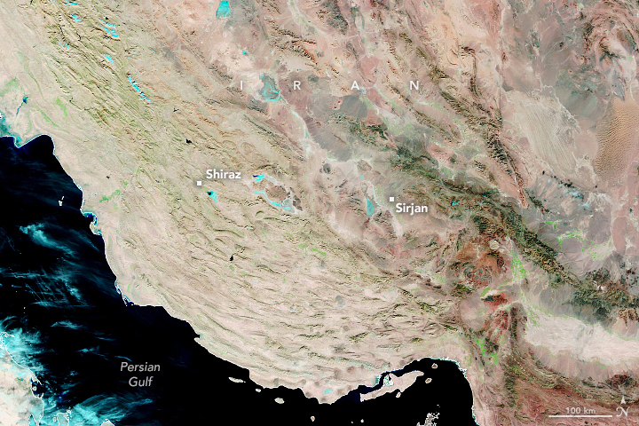
The Moderate Resolution Imaging Spectroradiometer (MODIS) on NASA’s Aqua satellite captured imagery of flooding in southern Iran on January 7, 2022. For comparison, the second image shows the same area on December 14, 2021, before the storms hit. The images are false color, using a combination of visible and shortwave infrared light (bands 7-2-1) to make it easier to distinguish between land and water. Dry land appears brown; vegetated areas are green. Areas covered by water are dark blue.
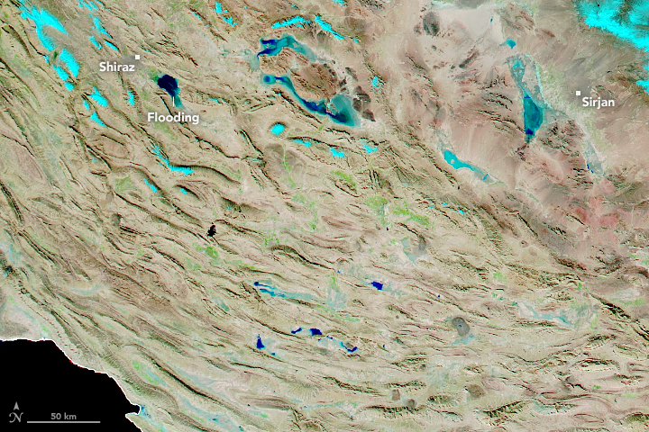
News and social media reports showed destructive flood waters that washed out bridges, swept away cars, swamped homes, and inundated farmland. The floods have killed at least 10 people and damaged hundreds of homes and vehicles, according to the Iranian Red Crescent Society.
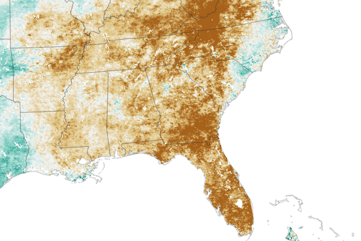
The recent burst of rain will not necessarily end Iran’s drought or water challenges immediately. While storms can replenish moisture on the surface, it takes a sustained period of wet weather to replenish groundwater, which many people in this region rely on for irrigation. Data collected by the Gravity Recovery and Climate Experiment Follow-On (GRACE-FO) satellites show that reserves of shallow groundwater in the region’s aquifers, though improved, were still low in some parts of southern Iran on January 10, 2021, according to GRACE-FO data published by the University of Nebraska.
NASA Earth Observatory image by Lauren Dauphin, using MODIS data from NASA EOSDIS LANCE and GIBS/Worldview. Story by Adam Voiland.


