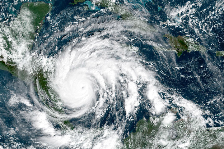
The historic 2020 Atlantic hurricane season is not done yet. Hurricane Delta, the 25th named storm of the season, is expected to make landfall on the U.S. Gulf Coast on October 9, bringing life-threatening storm surges and dangerous winds. Forecasters expect the storm will make landfall within 50 miles (80 kilometers) of where category 4 Hurricane Laura landed earlier this season.
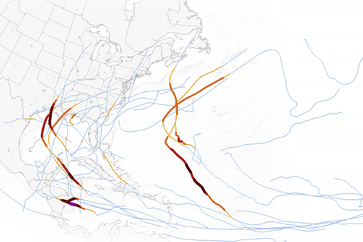
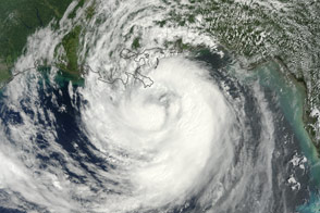
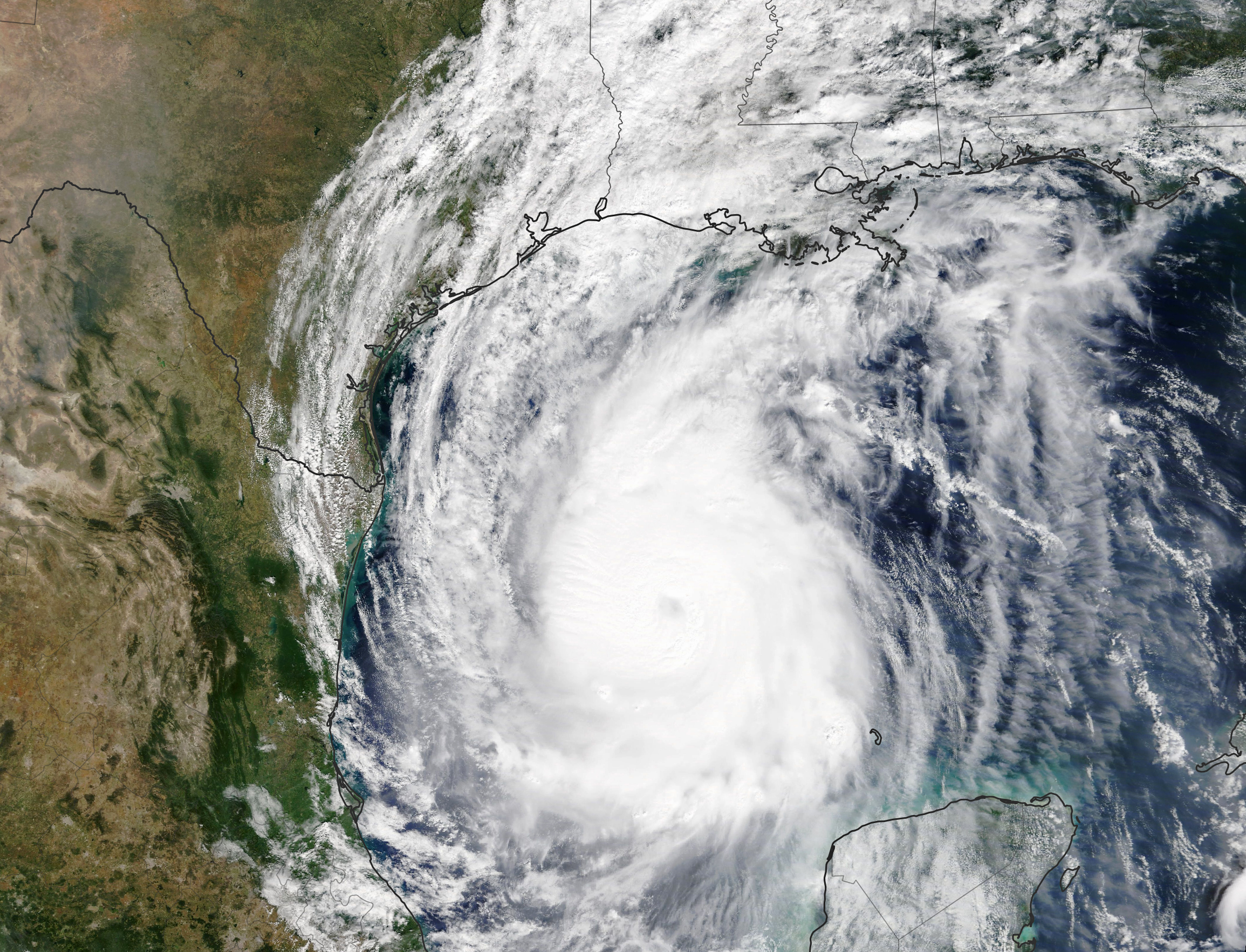
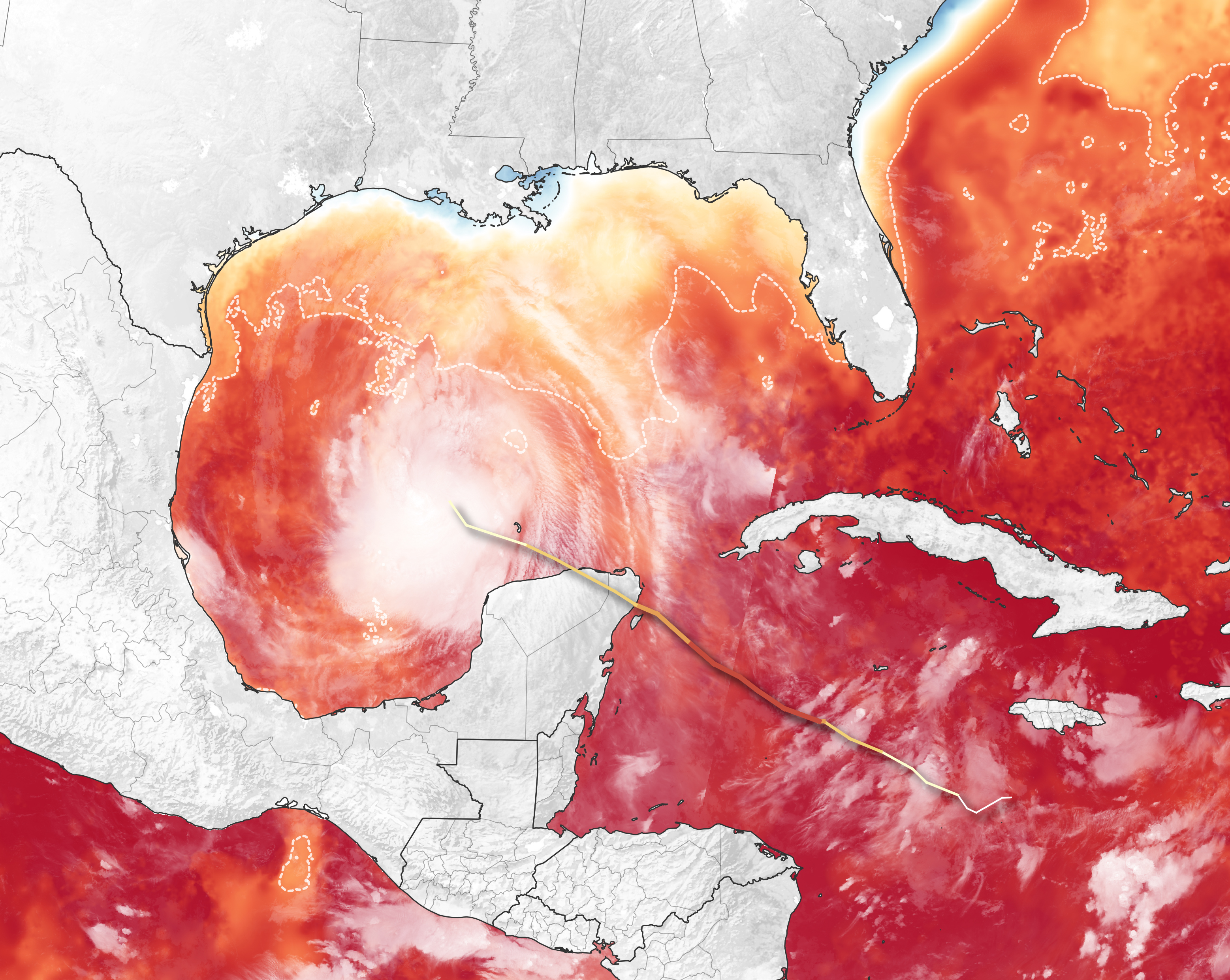
The natural-color image above shows Delta in the early afternoon on October 8; it was acquired by the Moderate Resolution Imaging Spectroradiometer (MODIS) on NASA’s Terra satellite. The map below shows the track of the storm between October 5 and October 8 overlaid on a map of sea surface temperatures (SSTs) in the Gulf of Mexico as measured on October 6, 2020. The SST data come from the Multiscale Ultrahigh Resolution Sea Surface Temperature (MUR SST) project, based at NASA’s Jet Propulsion Laboratory. MUR SST blends measurements of sea surface temperatures from multiple NASA, NOAA, and international satellites, as well as ship and buoy observations. The brightness temperature image of Delta was acquired by the Visible Infrared Imaging Radiometer Suite (VIIRS) on Suomi NPP in the early morning of October 8.
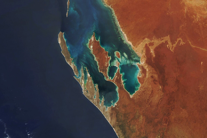
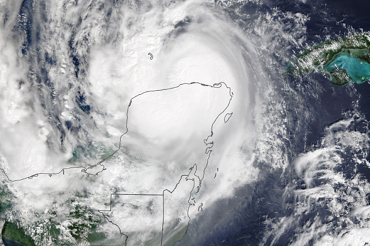
Hurricane Delta made landfall on the northeastern edge of the Yucatan Peninsula as a category 2 storm on October 7. The storm brought torrential downpours and sustained winds up to 100 miles (160 kilometers) per hour. It knocked out power and took down trees near the resort areas of Cancun and Cozumel. Thousands of tourists and residents were forced to evacuate. The weakened storm then entered the Gulf of Mexico and gained new strength as it moved over warm water again.
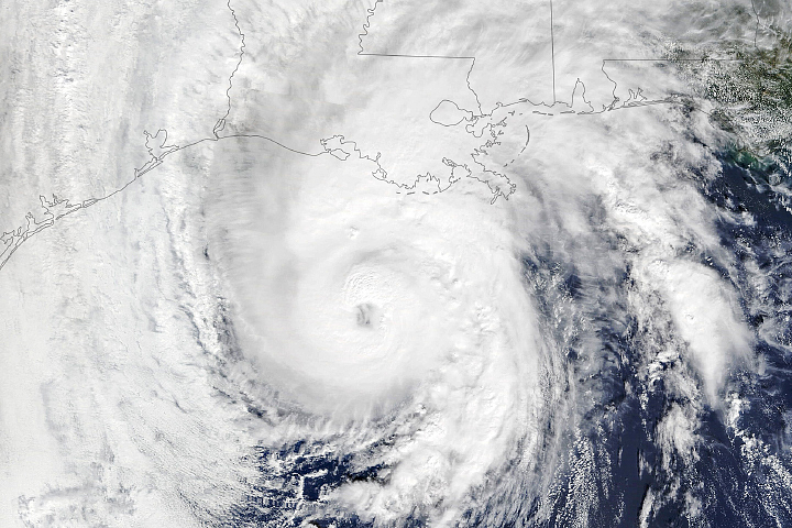
The National Hurricane Center predicted the storm will turn to the northeast and hit the Louisiana coast on October 9. As it approaches the coast, ocean temperatures are expected to be around 82°F (28°C), high enough to sustain and possibly strengthen the storm.
Forecasters warned of storm surges between 7 to 11 feet (2 to 3 meters) along portions of the Louisiana coast. Heavy rainfall could also lead to flash flooding along the central Gulf Coast and in the Lower Mississippi Valley.
NASA Earth Observatory images by Lauren Dauphin, using MODIS data from NASA EOSDIS/LANCE and GIBS/Worldview, VIIRS data from NASA EOSDIS/LANCE and GIBS/Worldview and the Suomi National Polar-orbiting Partnership, sea surface temperature data from the Multiscale Ultrahigh Resolution (MUR) project, and storm track information from Weather Underground. Story by Kasha Patel.