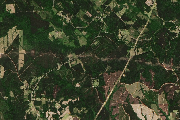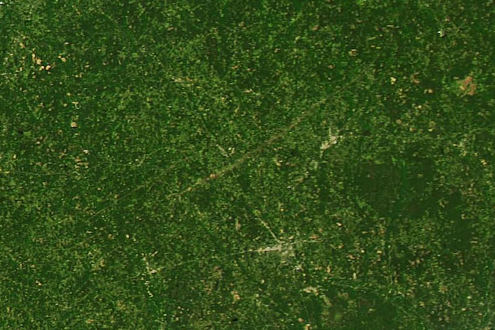

Severe storms with high winds ripped through much of the southern and eastern United States in mid-April, with tornado warnings stretching from Florida to Virginia. More than a dozen tornadoes were confirmed in Mississippi, including one on April 12, 2020, that scarred the landscape to such a degree that it could be seen from space.
The scar is visible in a natural-color image (top), acquired on April 14, 2020, with the Moderate Resolution Imaging Spectroradiometer (MODIS) on NASA’s Aqua satellite. It shows where the tornado uprooted vegetation and spread debris along a path nearly 70 miles long from Jefferson Davis County to Clarke County in the southeast part of the state. Preliminary reports from the National Weather Service indicate that the storm was an EF4—the second-highest intensity on the Enhanced Fujita scale.
The signature of the scar is also apparent in the second image, which shows land surface temperature data also acquired by Aqua MODIS. Damaged areas appear warmer than the surrounding landscape because bare ground heats up faster than vegetated areas. (A similar phenomenon was observed in 2018 in the damage associated with hail storms.)
Other tornados also marked the landscape in the area, although the scars appear more subtle in satellite images. For example, an EF3 tornado tracked for nearly 83 miles from Lawrence to Jasper counties in southeast Mississippi. According to news reports, the deadly outbreak of storms left tens of thousands of people in the state without power and destroyed hundreds of homes.
NASA Earth Observatory images by Joshua Stevens, using MODIS data from NASA EOSDIS/LANCE and GIBS/Worldview, and the Level 1 and Atmospheres Active Distribution System (LAADS) and Land Atmosphere Near real-time Capability for EOS (LANCE). Story by Kathryn Hansen.
Image of the Day Atmosphere Land Severe Storms Human Presence Remote Sensing
One of the more intense tornados to raze the ground in April 2020 left a scar visible from space.
Image of the Day for April 16, 2020
With an average of over 1,000 tornadoes recorded each year, the United States has more tornadoes than any other country.

