The Earth Observatory has published its last Image of the Day on this website. Please join us on our new home at science.nasa.gov/earth/earth-observatory.
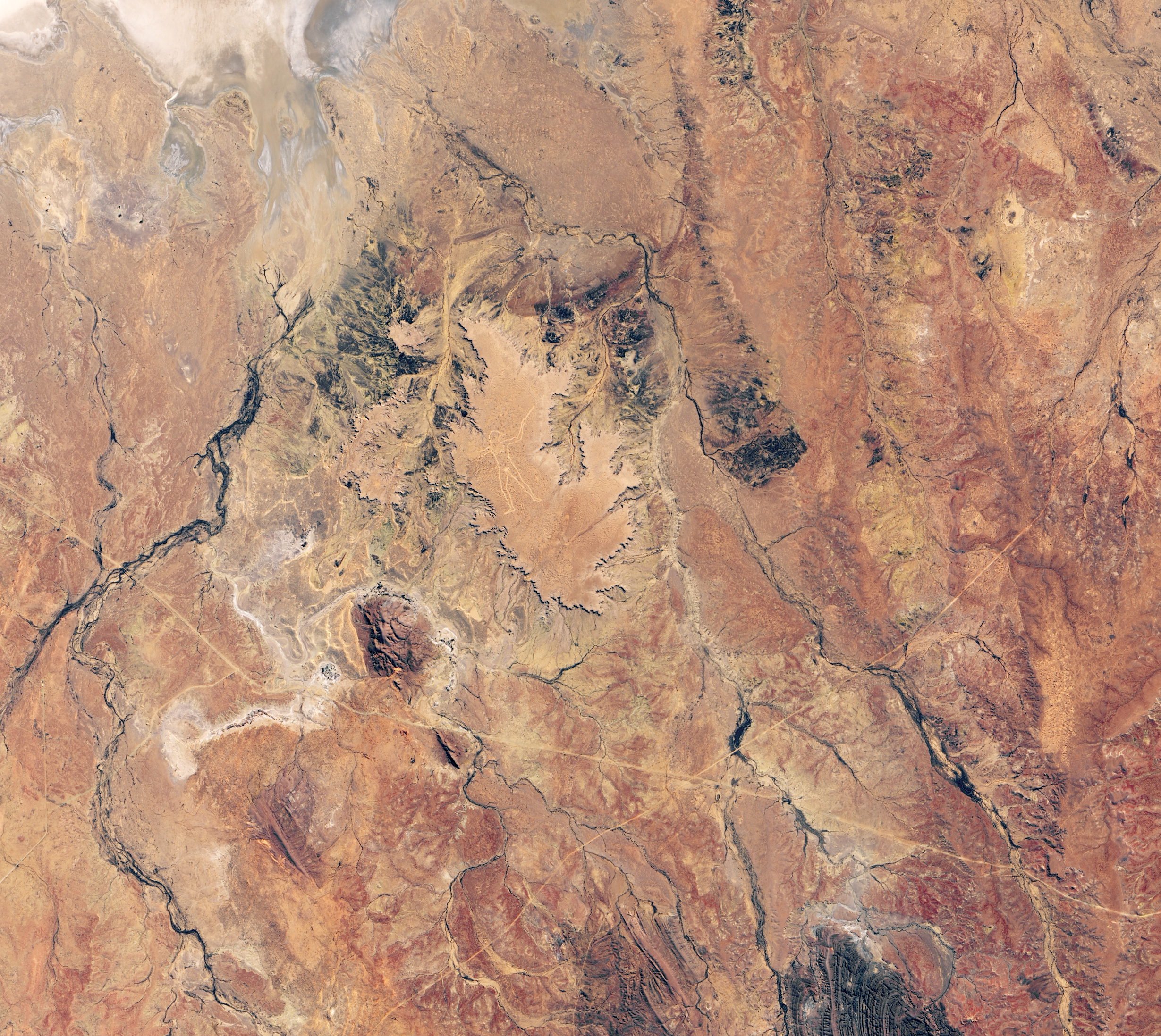
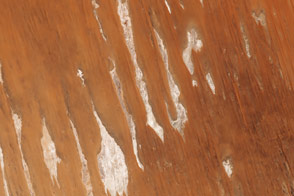
Since a pilot first noticed Marree Man in 1998, the mysterious work of earthen art has attracted international attention. Etched into a plateau in South Australia, the artwork depicts a hunter with what appears to be a stick or boomerang in his hand.
Spanning 3.5 kilometers (2.2 miles) from top to bottom, Marree Man is a geoglyph—a design made from earthen materials that is so large it is best viewed from above. An example of an even larger geoglyph is the Nazca Lines in Peru.
For many years, Marree Man, named after a nearby town, was a prominent feature in Landsat satellite images of the area, but the lines faded over the years. By 2013, they were hardly visible in the natural-color images acquired by the Operational Land Imager (OLI) on Landsat 8.
In August 2016, local business owners, concerned about the loss of what had become a tourist draw, decided to restore the fading geoglyph. With accurate GPS coordinates for the original in hand, they used a construction grader to redraw Marree Man over a period of five days.
The restoration team thinks the updated geoglyph will last longer than the original because they created wind grooves, designed to trap water and encourage the growth of vegetation. Over time, they hope vegetation will turn the lines green. The OLI acquired this image of the feature on June 22, 2019.
Who created the geoglyph and why has long been a topic of controversy and remains unknown, despite the recent announcement of a cash reward for credible information about it. There are indications that an artist living in Alice Springs may have created Marree Man, though other clues suggest that the creator may have been an American.
NASA Earth Observatory image by Lauren Dauphin, using Landsat data from the U.S. Geological Survey. Story by Adam Voiland.