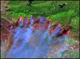

Ten large fires rage across southern California in this true-color Moderate Resolution Imaging Spectroradiometer (MODIS) image taken on October 27, 2003 by NASA’s Aqua satellite. Starting in the north, the first cluster of red dots is a combination of the Piru, Verdale, and Simi Incident Fires, which have burned a combined 113,680 acres of land. The next line of dots consists of the Old, Grand Prix, and Mountain Fires. The small cluster closer to the coast is the Roblar 2 Fire. Going south, the Paradise Fire (top), the Cedar Fire (center), and the Otay Fire (bottom) form a massive veil of smoke over San Diego. Overall, well over 200,000 acres have burned in the fires.
Image courtesy Jacques Descloitres, MODIS Rapid Response Team at NASA GSFC
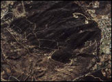
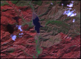
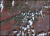
Multiple massive wildifres burned in southern California during the last week of October 2003. This series of images shows the fires and the damage they caused as seen from a variety of satellites.


