
TRMM Eyes Great Plains Severe Thunderstorms
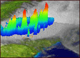
On Sunday, May 4, a super outbreak of tornadoes and severe thunderstorms swarmed across the southern Plains region of the United States. According to the Storm Prediction Center, there were 275 reports of large hail, 89 reports of wind damage and 84 tornadoes. On this day, 187 tornado warnings were issued across Tennessee, Arkansas, Missouri, Kansas, Oklahoma, North Dakota and South Dakota. The Tropical Rainfall Measurement Mission, which contains the world's only spaceborne weather radar, overflew several of these deadly thunderstorm cells late on May 4.
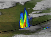
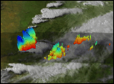
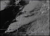
The image shows the white, cloudy tops of several thunderstorm cells from the vantage of the GOES satellite. The TRMM orbit (dark shading) is superimposed on this cloudy background. There is a particularly intense storm cell located over western Oklahoma (left side of image). Whereas the GOES satellite shows this to be a single, isolated storm, the TRMM precipitation radar reveals that it is actually composed of three smaller precipitation cores in various stages of development. The vertical scale of the rain features has been greatly exaggerated to show details. The dark blue colors correspond to the tallest rain cells (approaching 15-16 km depth) while red colors indicated shallower rain features. This particular "multicell" storm produced damaging hail as it moved from west to east across Oklahoma.
For more TRMM views of this historical thunderstorm day, visit the TRMM website (trmm.gsfc.nasa.gov).
Image created by Hal Pierce of the NASA Goddard Space Flight Center
Between May 4-6, 2003 severe thunder storms brought heavy rainy, hail, damaging winds and tornadoes to the southern plains and the Southeast US.


