September 8 12:00:00, 2002JPEG
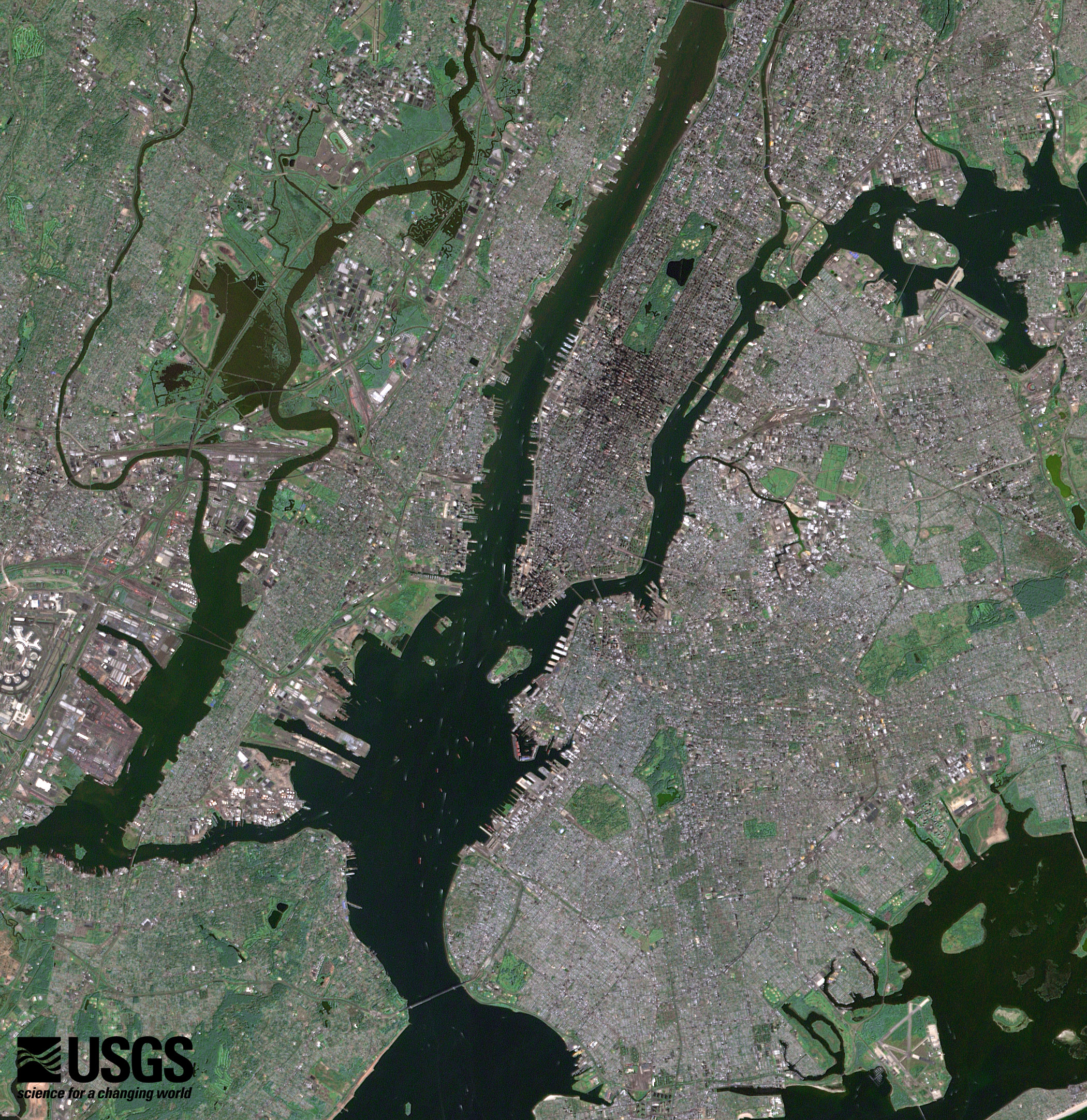
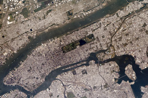
The southern end of Manhattan, as well as Ellis Island, New Jersey, and Queens are visible in this image from a perfectly clear day in September, 2002.
Image provided by the USGS EROS Data Center Satellite Systems Branch.
The most populous city in the United States has several connections to this national holiday.
Bright city lights along the coastline and interior delineate the eastern coast of the United States at night.
In this part of the southern Philippines, the aquatic life sustains the livelihoods of many islanders.
This false-color satellite image shows greater New York City. The Island of Manhattan is bordered by the Hudson River to the west and the East River to the east. In the middle of Manhattan, Central Park appears as a long green rectangle running roughly north-south with a large lake in the middle. Also visible are parts of Staten Island and Long Island.
alert message