|

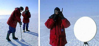
(left) Chief Scientist Dr. Claire Parkinson operates the ice auger while Webcast Moderator
Steve Graham describes the process during a "polar" webcast. (right) Communications Engineer
Andre Fortin completes an Iridium phone call from the North Pole.

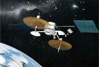
Artist's rendering of the TDRS-1 satellite.
 Communications and Science
|
|
Imagine this: Out in space at an altitude of 22,300
miles, a 16 year—old, 2.5—ton NASA Tracking and Data Relay Satellite
(TDRS-1) points her 24 Karat gold—plated 16—ft antenna right on the spot
where a small group of NASA engineers and scientists have just landed
their ski plane on the ice floes (floating sheets of ice) at the North Pole. Quickly they unload
the "big blue box" containing their portable ECOMM satellite ground
station, connect the video camera, mount the 18-inch "pizza pan" antenna
on its tripod, and whip it around to find the TDRS-1 satellite at only
0.9 degrees above the horizon. Suddenly, they're connected to the
Internet and students all over the world are participating in a virtual
field trip to the North Pole! "What's that you have in your hand?",
asks a student from Pennsylvania. "This is an ice auger bit and here's
how we are using it to measure the thickness of the ice floes at the
North Pole," answers the Chief Scientist. This is outrageous
educational outreach, reaching the next generation of our planet's
caretakers right on their own computers.
This story–A Spot on the Ice Flow–was featured on NPR's Morning Edition.
|

