Monitoring Wetlands | |||
Monitoring wetlands was a natural expansion of the Dartmouth Flood Observatory effort to document the background state of rivers. Wetlands are part of a river’s natural flood control system, taking in water and then slowly releasing it. Some wetlands are permanent, but others are subject to regular seasonal flooding. The distinctive types of soil and vegetation in seasonal wetlands affect not only local or regional biogeochemical cycles, but global ones as well. |
|||
 |
 |
Wetlands store large quantities of carbon in both vegetation and in their mucky soil, which means that as they change—getting bigger or smaller, or warming up and drying out—their influence on the global carbon cycle changes. Also, wetlands are the largest source of methane emissions worldwide, and methane is a powerful greenhouse gas. How much methane wetlands emit can vary depending on how flooded they are. Keeping tabs on where and when seasonal wetland flooding is underway will help scientists create more realistic models of the role of naturally occurring greenhouse gases in the climate system. |
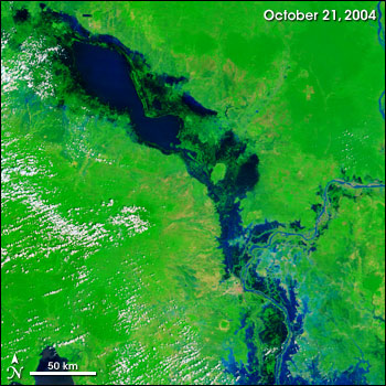
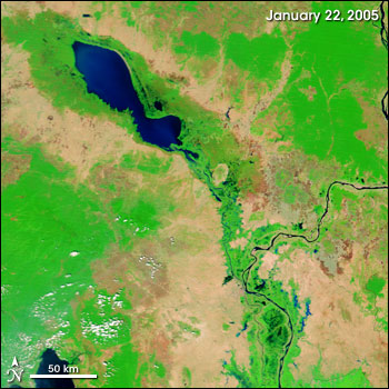
The Tonle Sap Wetlands in Cambodia experience dramatic seasonal change. During the wet season (left) water carried from the interior of Asia overflows Tonle Sap Lake. Several months later, the water recedes, fertilizing the soil. (Images courtesy MODIS Rapid Response System) |
