| |
 |
New! Terra Spacecraft Quicktime VR Model. A VR model of the Terra
spacecraft which you can manipulate to view all sides and angles (via Terra site). |
|
 |
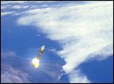
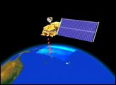
Terra was successfully launched on December 18, 1999, from Vandenberg Air Force
Base. (4.6MB) |
 |
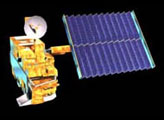
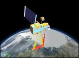
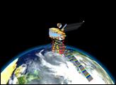
Solar Panel Deployment
Terra's solar panel supplies the 3 kilowatts of
power needed by the spacecraft. Its deployment is the first major event after Terra separates from its
fairing. (3.3MB) |
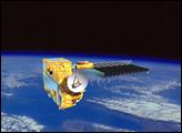 |
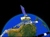
High Gain Antenna Deployment
Communication to and from Terra will be
conducted through a high gain antenna and NASA's Tracking and Data Relay Satellite System (TDRSS). This
allows data to be collected independent of the satellite passing over ground stations. (1.6MB) |
 |
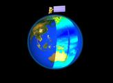
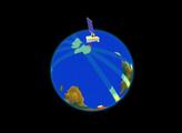
Terra's Orbit
Terra will operate in a near-circular, sun-synchronous
orbit with an inclination of 98.2 degrees. The spacecraft will cross the equator twice each orbit—once
at 10:30AM (local time) moving from north to south, and once at 10:30PM from south to north. (4.2MB)
|
 |
Advanced Spaceborne Thermal Emission and Reflection Radiometer
(ASTER)
ASTER will provide high-resolution images of land surface, water, ice, and clouds in
visible, short-wave IR, and thermal IR wavelengths. (3MB)
·ASTER web site
|
 |
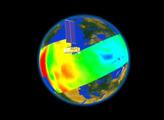
Clouds and the Earth's Radiant Energy System (CERES)
CERES will
measure the Earth's energy balance—comparing the amount of energy from the sun that reaches the
Earth's surface vs. the amount of heat energy emitted by the Earth and its atmosphere. (3.2MB)
·CERES web site
|
 |
Multi-angle Imaging Spectro-Radiometer (MISR)
MISR will observe the
Earth's surface from nine different angles simultaneously, providing 3D images and information about the
angular properties of clouds and particulates. (3.9MB)
·MISR web
site
|
 |
Moderate-resolution Imaging Spectroradiometer (MODIS)
MODIS will
provide comprehensive measurements of ocean life (phytoplankton), land vegetation, cloud cover, and
fires. (3.2MB)
·MODIS web site
|
 |
Measurements of Pollution in the Troposphere (MOPITT)
MOPITT will
measure two important pollutants—carbon monoxide and methane—in the lower atmosphere
(troposphere). (3.3MB)
·MOPITT web site (Canadian Space Agency)
·MOPITT web site
(University of Toronto)
|
 |
Combined Swaths of Terra's Instruments
Terra will conduct many of its
observations simultaneuosly, allowing for new ways of integrating different types of data. (3.3MB)
|
 |
 About Terra About Terra |
|
