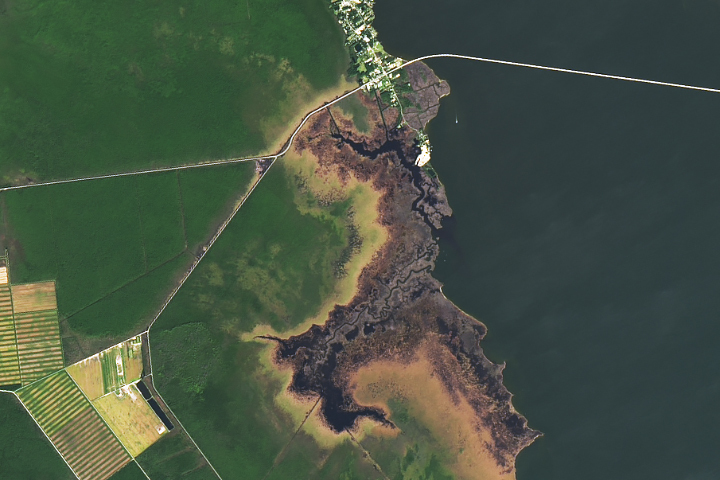
Update on October 30, 2024: This Landsat image shows ghost forests in North Carolina. Congratulations to Eric JF Kleijssen for being the first reader to identify the location. Read more about the area in “Ghost Forests Creep into North Carolina.”
Every month on Earth Matters, we offer a puzzling satellite image. The October 2024 puzzler is shown above. Your challenge is to use the comments section to tell us where it is, what we are looking at, and why it is interesting.
How to answer. You can use a few words or several paragraphs. You might simply tell us the location, or you can dig deeper and offer details about what satellite and instrument produced the image, what spectral bands were used to create it, or what is compelling about some obscure feature. If you think something is interesting or noteworthy, tell us about it.
The prize. We cannot offer prize money or a trip on the International Space Station, but we can promise you credit and glory. Well, maybe just credit. Within a week after a puzzler image appears on this blog, we will post an annotated and captioned version as our Image of the Day. After we post the answer, we will acknowledge the first person to correctly identify the image at the bottom of this blog post. We also may recognize readers who offer the most interesting tidbits of information. Please include your preferred name or alias with your comment. If you work for or attend an institution that you would like to recognize, please mention that as well.
Recent winners. If you have won the puzzler in the past few months, or if you work in geospatial imaging, please hold your answer for at least a day to give less experienced readers a chance.
Releasing comments. Savvy readers have solved some puzzlers after a few minutes. To give more people a chance, we may wait 24 to 48 hours before posting comments. Good luck!


Roanoke Marsh, just south of Manns Harbor.
35.851715, -75.763038
Roanoke Marsh, North Carolina 27953, USA
Marshes onto the Croatan Sound
Virginia Dare Memorial Bridge visible
Area used to be the home of Dasamongueponke tribe before the arrival of the first English settlers (Richard Grenville 1585).
Venice lagoon
The Earth Matters October Puzzler is a Landsat image of the Dare County landfill on US 264 in eastern North Carolina. The water body is Croatan Sound. The landfill serves greater Dare County, including the Outer Banks.
Oahu … fire
This is an image of the town of Manns Harbor, NC, the Croatan Sound, and what appears to be an estuary. The bridge crossing the large expanse of water revealed that it was most likely either near the outer banks of NC or the Florida Keys. The bridge leads to Roanoke, just out of frame.
philippines
The cause is due to the release of excessive chemicals.