Even after 50 years, the day of Apollo 11 Moon landing remains a vivid memory in many minds. But even generations that were not born before July 20, 1969, can appreciate the monumental achievement through numerous historical accounts, video, and photographs.
Inspection of EO’s 20-year archive turned up numerous occasions on which we have celebrated the Apollo program and the Moon—Earth’s only natural satellite. Below we highlight a few of our favorites. Still hungry for more Earth and Moon imagery? Check out our gallery “Earth From Afar.”
Apollo 11 Launch Pad
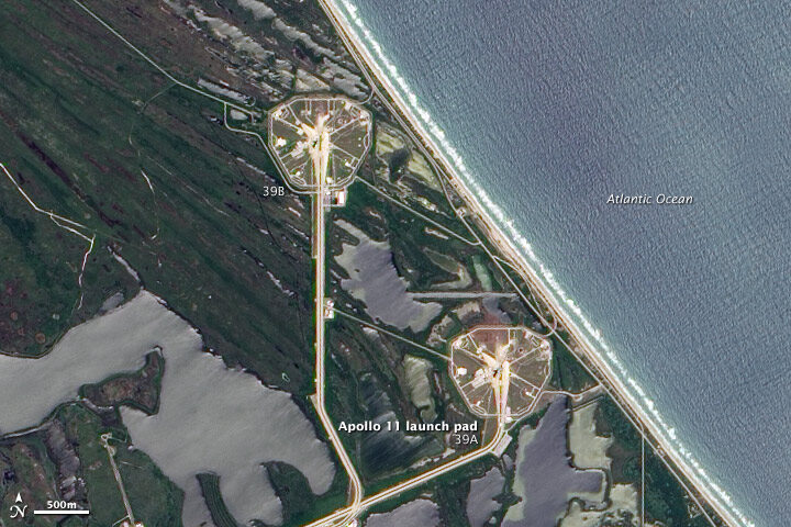
On July 16, 1969, Apollo 11 lifted off from launch pad 39A at Cape Canaveral, a headland along Florida’s Atlantic coast. Neil Armstrong, “Buzz” Aldrin, and Michael Collins began their journey to the Moon. On June 9, 2002, the Advanced Land Imager (ALI) on NASA’s Earth Observing-1 satellite captured this true-color image of launch pad 39A and neighboring pad 39B.
By launching from the east coast of Florida, NASA took advantage of both geography and physics. Rockets could aim eastward and fly over the Atlantic Ocean, far away from heavily populated areas should anything go wrong. And within the continental United States, Florida is closest to the Equator. Launching from a locality close to the Equator enables the rocket to harness Earth’s orbital energy to boost its own trajectory. Read more.
Looking Back from Apollo 11
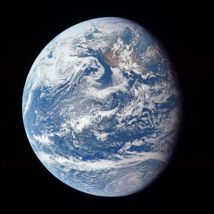
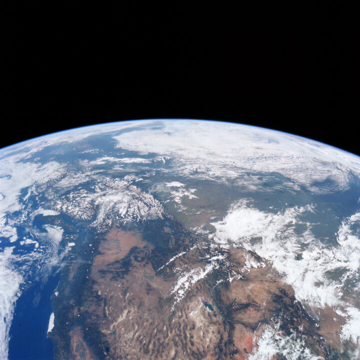
These two photographs were taken by the crew on their outbound journey from Earth to the Moon. Apollo 11 launched from Cape Canaveral at 9:32 a.m. on July 16, 1969, and these photos were captured that day. The top view shows the full disk of Earth, with bits of California, the Pacific Northwest coast, and Alaska peeking through the cloud cover in a scene otherwise dominated by the Pacific Ocean. The second, closer view shows more of the western United States and Canada, with the Rocky Mountains filling much of the center of the scene and the Arctic ice cap at the top. Read more.
Apollo 11 Landing Site
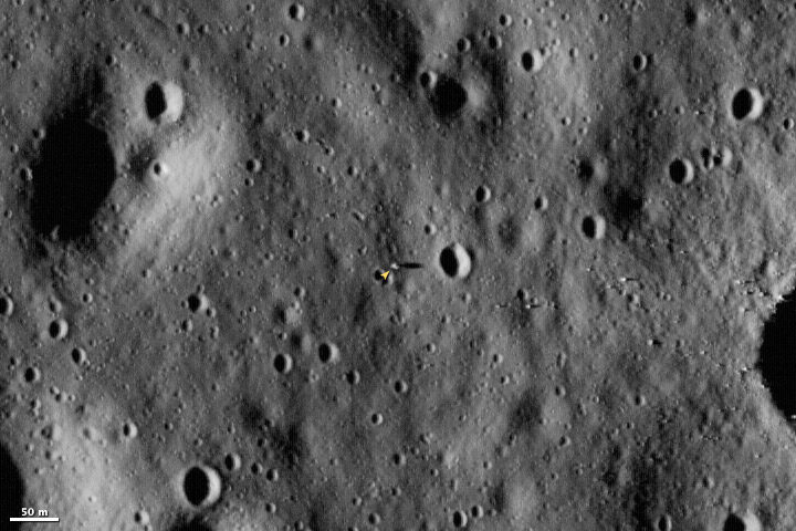
The Lunar Reconnaissance Orbiter launched on June 18, 2009, and began sending back images of the Moon on June 23. Launched to map the surface of the Moon, LRO was still moving towards its near-surface orbit when it acquired this image of the Apollo 11 landing site. When the orbiter reaches its final orbit, it will image the Moon’s surface at a resolution of 0.5 meters, providing an image that is about two times more detailed than the one shown here. Read more.
A Different Perspective on the Harvest Moon
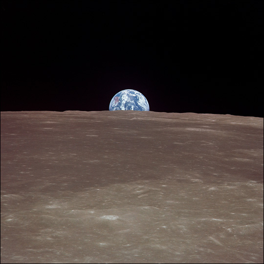
This image from Apollo 11 shows the Earth rising over the limb of the Moon much as the Harvest Moon does from our planetary perspective. Over the stark, scarred surface of the Moon, the Earth floats in the void of space, a watery jewel swathed in ribbons of clouds.
While the Harvest Moon has allowed humans throughout history to coax “just a little more” from the Earth’s bounty before the onset of winter, images of our home from the Moon helped raise awareness of the Earth as a rare (and perhaps unique) planetary ecosystem. The Apollo 11 images provided a global backdrop for the building U.S. environmental movement, including a surge of citizen-led environmental cleanups in the 1960s and 70s, and implementation of key national environmental policies. Read more.


