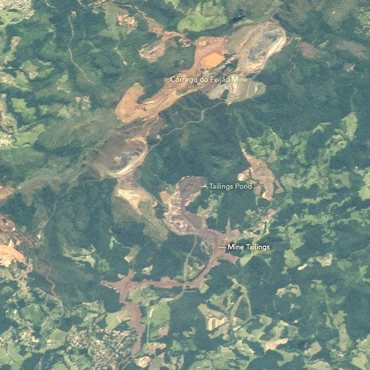
A few days after we published a Landsat 8 image of a deadly dam collapse and flood in Brazil, astronauts photographed the scene from the International Space Station on February 2, 2019.
The tailings pond label points to the source of the mine waste. When an earthen dam on the southwestern edge of that pond collapsed on January 25, it sent a torrent of sludge pouring down a valley toward the Paraopeba River. Over a distance of roughly 8 kilometers (5 miles), the mine sludge overran the mine’s headquarters, a hotel, and a residential area. Videos published by news agencies and AGU’s Landslide Blog offer a remarkable view of the dam collapsing and sludge rushing forward at roughly 120 kilometers (75 miles) per hour.
NASA’s Earth Science Disasters Program has developed an interactive version of the astronaut photograph that allows you to explore the area before and after the disaster. More astronaut photos of the event are available here.


