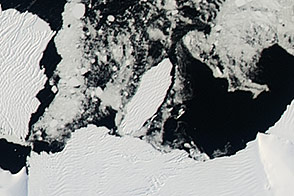
In March 2000, the largest iceberg ever recorded broke away from Antarctica’s Ross Ice Shelf. Now, in its 18th year drifting with the currents and being battered by the wind and sea, a piece of this original berg could be nearing the end of its voyage.
When iceberg B-15 first broke away, it measured about 160 nautical miles long and 20 nautical miles wide. That equates to an area of 3,200 square nautical miles, or about the size of Connecticut. B-15 has since fractured into numerous smaller bergs, and most have melted away. Just four pieces remain that meet the minimum size requirement—at least 20 square nautical miles—to be tracked by the National Ice Center.
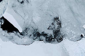
When astronauts aboard the International Space Station shot this photograph on May 22, 2018, B-15Z measured 10 nautical miles long and 5 nautical miles wide. That’s still well within the trackable size. But the iceberg may not be tracked much longer if it splinters into smaller pieces. A large fracture is visible along the center of the berg, and smaller pieces are splintering off from the edges.
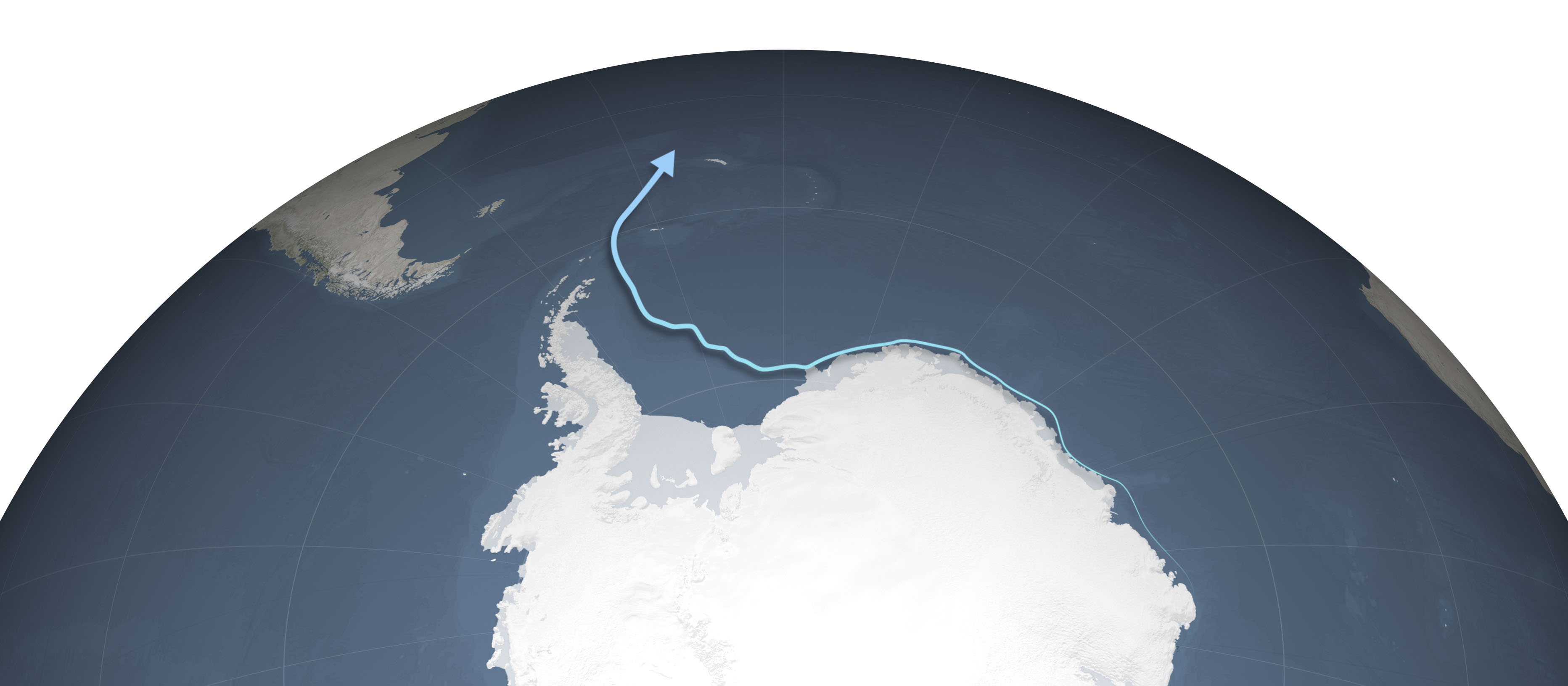
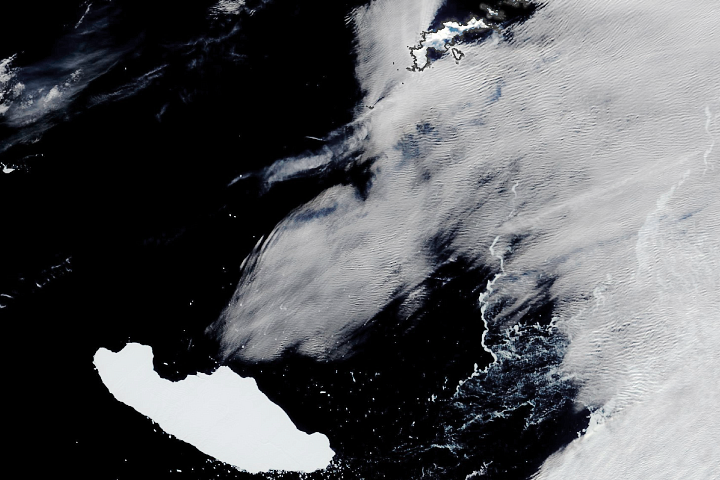
Melting and breakup would not be surprising, given the berg’s long journey and northerly location. A previous image showed B-15Z farther south in October 2017, after it had ridden the coastal countercurrent about three-quarters of the way around Antarctica bringing it to the Southern Ocean off the tip of the Antarctic Peninsula.
Currents prevented the berg from continuing through the Drake Passage; instead, B-15Z cruised north into the southern Atlantic Ocean. When the May 2018 photograph was acquired, the berg was about 150 nautical miles northwest of the South Georgia islands. Icebergs that make it this far have been known to rapidly melt and end their life cycles here.
As NASA glaciologist Kelly Brunt previously noted about icebergs this close to the equator: “They tend to pond with water, which then works its way through the iceberg like a set of knives.”
Astronaut photograph ISS055-E-74583 was acquired on May 22, 2018, with a Nikon D4 digital camera using an 200 millimeter lens and is provided by the ISS Crew Earth Observations Facility and the Earth Science and Remote Sensing Unit, Johnson Space Center. The image was taken by a member of the Expedition 54 crew. The image has been cropped and enhanced to improve contrast, and lens artifacts have been removed. The International Space Station Program supports the laboratory as part of the ISS National Lab to help astronauts take pictures of Earth that will be of the greatest value to scientists and the public, and to make those images freely available on the Internet. Additional images taken by astronauts and cosmonauts can be viewed at the NASA/JSC Gateway to Astronaut Photography of Earth. NASA Earth Observatory map by Joshua Stevens, using data from the Antarctic Iceberg Tracking Database. Story by Kathryn Hansen.