Map of the Rio Grande Basin |
|||
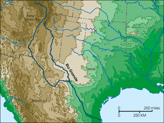 | |||
The Rio Grande flows through arid parts of Colorado and New Mexico, and along the southern two-thirds of its length forms the border between Texas and Mexico. It is a primary source of fresh water for nearby communities. (Map copyright Cartesia Software) |
|||
