The Earth Observatory has published its last Image of the Day on this website. Please join us on our new home at science.nasa.gov/earth/earth-observatory.
Going Global |
|||
Lehner didn’t refuse the requests for more maps because he doubted their importance. He just didn’t feel that World Wildlife Fund had the resources to handle such a big project. Instead, he asked his contacts at U.S. Geological Survey and elsewhere when they would make SRTM-based elevation maps that included stream and river channels. No one had immediate plans. “But at World Wildlife Fund, we still needed this product,” he says. |
|||
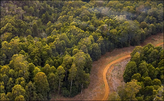
Lehner realized that if he and his colleagues were going to get the maps they needed, he would have to assemble them himself. Lehner began making plans to scale up his Amazon Basin case study, adapting geographic information system software and writing his own computer scripts to refine the shuttle topography data. The whole process required significant computing power. Ideally, he would have used a supercomputer but, on a limited budget, he made do with personal computers (PCs) instead. “To process the globe, my estimate today is that it would take one year of pure processing time on four computers,” he says. As it was, he ran about six PCs, all of them working in parallel. Lehner had to cut the data into pieces for each machine to work on, but the computers still “had to know each other” and occasionally check one another’s data. At one point, the six-computer arrangement went awry. The master drive serving all PCs failed. “I always had backups, but the one key drive was destroyed,” he said. He spent two weeks recovering the data. Lehner’s final, crucial step involved manually inspecting and correcting the maps, making sure rivers appeared where they should be—and not where they shouldn’t. For example, in flat, partially deforested areas, “rivers” formed along deforested areas and roads because of the difference in elevation between the bare ground and the top of the adjacent forest canopy. He and a small support team made nearly 100,000 manual corrections to improve the maps. |
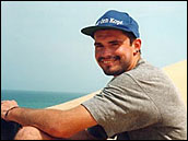
Bernhard Lehner had mapped watersheds with elevation data before while studying the Amazon’s Madre de Dios region, but scaling that project up to the global level was a much more significant challenge. (Photo courtesy World Wildlife Fund.) |
||
 |
|||
World Wildlife Fund is calling this global hydrological mapping project “HydroSHEDS.” After hundreds of hours of computing time and thousands of manual corrections, Lehner unveiled a digital map of water channels for South America in April 2006. The other continents should follow in 2007. |
To make HydroSHEDS, Lehner and his support team made approximately 100,000 manual corrections of the elevation-based river maps. For example, the difference in elevation between the top of a forest canopy and a road would have appeared to be a potential river channel. (© 2006 rocketdude.) |
||
