
Coral Reefs |
|||
Healthy coral reefs sustain local and national
economies through fisheries, coastal protection, and tourism. Despite
these benefits, it has been estimated that 58 percent of coral reefs
globally are threatened by human activities (Bryant et al. 1998).
Scientists still lack basic data about the locations, spatial extent,
and health of reefs. Major efforts are underway in the U.S. and around
the world to improve the mapping information on coral reefs. Astronaut
photographs are a unique data source for these efforts because photos of
the reefs have been collected for many years, and the images are
available in the public domain. Of particular value is the fact that
the astronauts took advantage of opportunities when cloud cover was
minimal to take the photographs. Astronaut photographs can be used as
primary data for maps of the locations of reef crests and as
supplemental data for use with other satellite images, especially when
it is important to distinguish small clouds from reef areas. |
|||
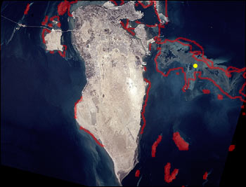
 Astronaut photographs are being used as base maps in an international
compilation of information on coral reefs, known as ReefBase. Images have also been included in a prototype
reef data distribution system that uses a global map based on 1.1-km data from the SeaWiFS satellite
sensor as a backbone for links to georeferenced reef remote sensing data
from a number of different satellites
(Robinson et al. 2000b)
Investigations comparing the level of detail that can be mapped
from an astronaut photograph to that from other satellite data are
nearing completion. |
Astronaut photograph of Bahrain (STS078-748-11 combined with ReefBase data (yellow dot) and World Conservation Monitoring Centre maps of the reef crest (transparent red). | ||
 Images of the Tuamotu Archipelago, American Samoa, Malaysia, and the Philippines are targeted for acquisition during the Crew Earth Observations project, to provide additional data for these mapping investigations. |
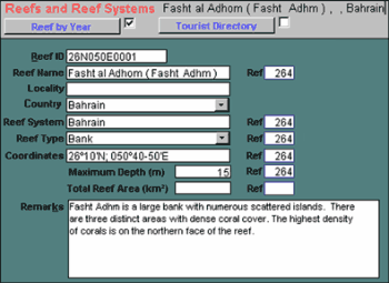
ReefBase text data for Fasht al Adhom, Bahrain. |