| |
 |
Aqua Launch
Aqua was launched at 2:55 a.m. PDT on May 4, 2002 on board
a Boeing Delta II 7920-10L launch vehicle from Vandenberg Air Force Base, California. This animation [48 MB QuickTime] shows the area surrounding the
launch pad, the countdown, the rocket lift-off, and the spacecraft separation from the Delta rocket.
(Animation by Reto Stockli)
|
|
 |
Solar Panel and Instrument Deployments
Shortly after achieving orbit,
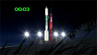
Aqua deployed its solar array, x-band antenna, and instruments. This time-accelerated sequence [20.1 MB QuickTime] shows the following
deployments: solar array, AMSR-E antenna, CERES aft, CERES fore, X-Band antenna, MODIS Earth shield, and
AIRS Earth shield. (Animation by Reto Stockli)
|
 |
Instrument Sensing
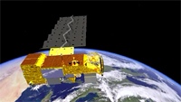
This animation [87 MB QuickTime] shows schematically the
sensing of Aqua's six Earth-observing instruments, in the following order: CERES, AIRS, AMSU, HSB,
MODIS, and AMSR-E. (Animation by Jesse Allen)
|
 |
Aqua Orbit
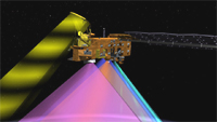
Aqua is positioned in a near-polar orbit around the Earth
at an altitude of 705 km in synchronization with the Sun, with its path over the ground ascending across
the equator at the same local time every day, approximately 1:30 p.m. Correspondingly, on the other side
of its orbit, Aqua descends across the equator at approximately 1:30 a.m. [36.2 MB QuickTime] (Animation by Jesse
Allen)
|
 |
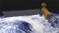
Aqua and Terra Orbits
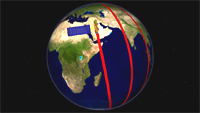
Aqua's early afternoon observation time
complements the 10:30-10:45 a.m. equatorial crossing time (descending in this case) of the EOS Terra
satellite, launched in December 1999. The two daytime crossing times account for why the Terra and Aqua
satellites were originally named "EOS AM" and "EOS PM," respectively. The combination of morning and
afternoon observations will allow studies concerning the diurnal variability of the many parameters
measured by both satellites. [34 MB QuickTime]
(Animation by Jesse Allen)
|
 |
Afternoon Constellation
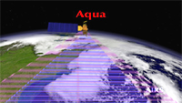
Because NASA has plans to launch a substantial
number of Earth-observing spacecraft over the next 15 years, it would be more efficient to operate these
spacecraft in groups, as opposed to single entities. In particular, the science output from the Aqua
mission will be enhanced through coordinated flying with several other satellites that will be obtaining
complementary data sets. These other satellites, in order after Aqua in the lead, are CALIPSO, CloudSat,
PARASOL, and Aura. Because this sequence starts with Aqua and ends with Aura, it has been termed the
"A-Train." [55.1 MB] (Animation by Jesse
Allen)
|
 |
Atmospheric Infrared Sounder (AIRS)
The AIRS on Aqua is the first AIRS
instrument and a major advance over earlier sounders flown in space. AIRS will measure atmospheric
temperatures, humidities, and a host of other products, in order to improve weather forecasting and the
understanding of climate processes. This artist's concept animation [18 MB QuickTime] shows the AIRS instrument
measuring air temperatures at five levels in the atmosphere, each level indicated by a separate color.
(Animation by Jesse Allen)
|
 |
Advanced Microwave Sounding Unit (AMSU)
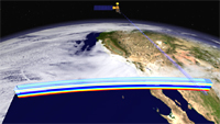
On Aqua, AMSU is integrally
coupled with the AIRS instrument. Since 1998, AMSU instruments have also flown on satellites of the
National Oceanic and Atmospheric Administration. This artist's concept animation [12 MB QuickTime] shows the AMSU
instrument measuring air temperatures at five levels in the atmosphere, each level indicated by a
separate color. (Animation by Jesse Allen)
|
 |
Humidity Sounder for Brazil (HSB)
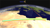
On Aqua, it is particularly
important to obtain humidities under overcast conditions. This artist's concept animation [17 MB QuickTime] shows the HSB instrument
measuring humidities at four levels in the atmosphere, each level indicated by a separate color.
(Animation by Jesse Allen)
|
 |
Clouds and the Earth's Radiant Energy System (CERES)
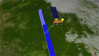
There are two
CERES on Aqua, following two on the Terra satellite, launched in 1999, and one on the Tropical Rainfall
Measuring Mission, launched in 1997. This artist's concept animation [16.6 MB QuickTime] shows the CERES
instruments (one in cross-track scan mode, the other in biaxial scan mode) measuring heat emitted
(outgoing longwave radiation) to space from the Earth's surface. (Animation by Jesse Allen)
|
 |
Moderate Resolution Imaging Spectroradiometer (MODIS)
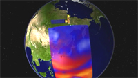
The Aqua MODIS
is the second MODIS, the first having been launched in 1999 on board the Terra satellite. This artist's
concept animation [19.9 MB QuickTime] shows the
MODIS instrument measuring clouds, land surface cover, snow cover on the land, and sea ice cover on the
oceans. (Animation by Jesse Allen) |
 |
 Aqua Aqua
|
|


