Pioneering agricultural projects were planned to encourage people to leave the very heavily populated Nile Delta and to seek economic opportunities in the desert.
Published Dec 16, 2018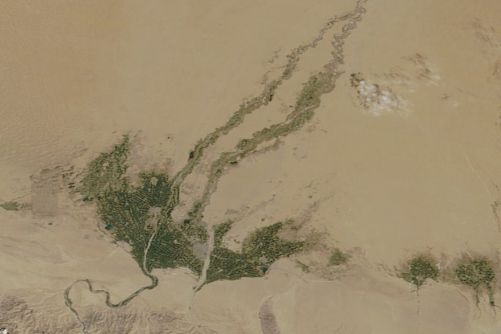
Even in China’s largest, driest, and hottest desert, vegetation sprouts in the spring.
Published May 5, 2020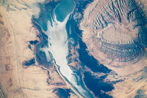
An astronaut’s lens captures the diversity of textures in a central Iranian landscape.
Published Jan 19, 2016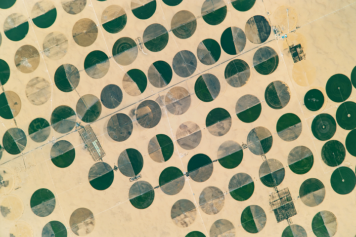
Greenery sprouts from the Sahara Desert in Egypt thanks to the Nubian Sandstone Aquifer System.
Published Sep 18, 2017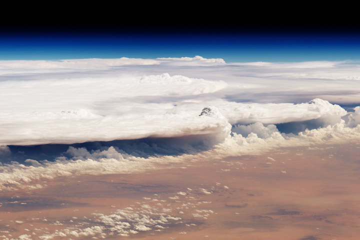
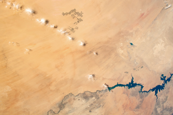
A line of thunderclouds marched across the desert of central Saudi Arabia on the way toward Yemen.
Published Oct 28, 2018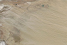
Acquired March 12, 2011, this natural-color image shows dust plumes blowing from the west margin of the Taklimakan Desert.
Published Mar 14, 2011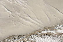
Acquired March 2, 2011, this natural-color image shows dust hovering over the Taklimakan Desert.
Published Mar 2, 2011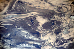
The lack of soil and vegetation allows parallel lines and sweeping curves of geological structure to appear quite clearly.
Published Mar 31, 2014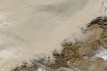
Acquired October 22, 2010, this natural-color image shows dust over the eastern half of the Taklimakan Desert.
Published Oct 22, 2010
This detailed astronaut photograph illustrates a portion of the Nile Delta that includes two royal cemeteries, Abusir and Saqqara-North.
Published Dec 1, 2008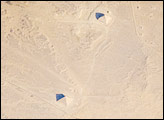
While the pyramids of Giza are perhaps the most famous, there are several other ancient Egyptian royal necropolis (“city of the dead”) sites situated along the Nile River and its delta. One of these sites is near the village of Dashur, illustrated in this astronaut photograph.
Published Aug 11, 2008
This part of the eastern Sahara is very dry, but greenery has been cropping up in recent decades.
Published Mar 11, 2017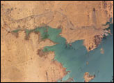
Heavy rains in the source regions of the Nile in the 1990s resulted in record water levels in Lake Nasser. In 1997, Lake Nasser began flooding westward down a spillway into the Toshka depression in southern Egypt, creating four new lakes over the next few years.
Published Jan 2, 2006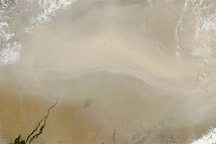
Acquired August 28, 2010, this natural-color image shows a dust plume spanning hundreds of kilometers blowing eastward from the Taklimakan Desert.
Published Aug 26, 2010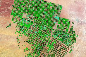
Over the course of 25 years, farms have sprouted in the Arabian Desert, fueled by deep and old groundwater.
Published May 12, 2012alert message
