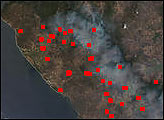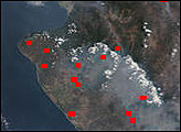

As can be seen in this true-color scene acquired on April 9, 2002, many fires dotted the landscape across portions of Central America. This image spans from Mexico’s Yucatan Peninsula across Guatemala and into El Salvador and Honduras.
This image was acquired by the Moderate-resolution Imaging Spectroradiometer (MODIS), flying aboard NASA’s Terra satellite. Please note that the high-resolution scene provided here is 500 meters per pixel. For a copy of this scene at the sensor’s fullest resolution, visit the MODIS Rapidfire site.
Image courtesy Jacques Descloitres, MODIS Land Rapid Response Team at NASA GSFC
The burning across the Mexican and Central American landscape throughout April has continued into May. On May 22, 2002, there were still scores of fires burning in the Sierra Madre Mountains in Mexico.


