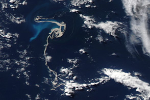
Midway on its 800-kilometer (500-mile) voyage from Auckland to Raoul Island, New Zealand, the HMNZS Canterbury received an intriguing report: a maritime patrol aircraft had spotted a vast area of open ocean covered with floating pumice. Soon after, the ship was sailing through a mass of buoyant volcanic rocks. Up to two feet thick, the pumice raft was about half a nautical mile (1 kilometer) wide, and “extended sideways as far as the eye could see,” wrote Rebecca Priestley, a science writer aboard the ship. Although the lightweight, gas-filled pumice posed no threat to the Canterbury, enough got stuck in the water filters to provide samples for analysis.
Though the pumice was spread over a vast area of the South Pacific, the origin was a mystery to the crew of the ship. An undersea volcano several hundred kilometers to the north of the pumice—Monowai—had erupted on August 3, but an airline pilot reported seeing pumice as early as August 1. Two data sources provided clues to pinpoint the volcano: earthquake records and satellite imagery. After reports of the pumice rafts surfaced, scientists from Tahiti and New Zealand’s GNS Science connected the eruption with a cluster of earthquakes in the Kermadec Islands on July 17 and 18.
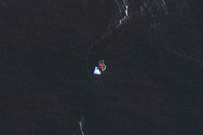
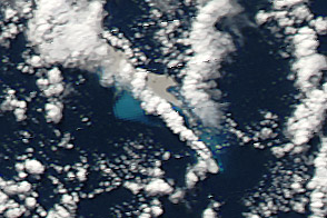
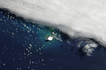
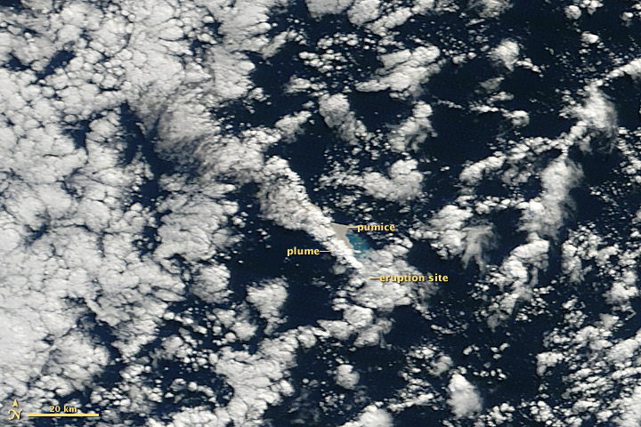
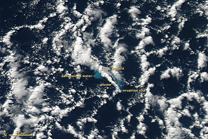
Working independently of GNS, volcanologist Erik Klemetti and NASA visualizer Robert Simmon examined a month’s worth of satellite imagery from NASA’s Moderate Resolution Imaging Spectroradiometer (MODIS). They discovered the first signs of the eruption—ash-stained water, gray pumice, and a volcanic plume—in imagery from 9:50 a.m. and 2:10 p.m. (local time) on July 19, 2012. (Although the Kermadec Islands are east of the International Date Line, they follow New Zealand time.)
Hidden by clouds in the morning image (above, top), the site of the eruption is clearly visible in the afternoon image (lower). Klemetti matched the satellite imagery with ocean floor bathymetry to identify Havre Seamount as the likely source. The eruption was strong enough to breach the ocean surface from a depth of 1,100 meters (3,600 feet).
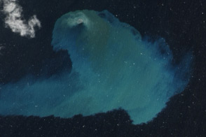
Alain Bernard of the Laboratoire de Volcanologie, Université Libre de Bruxelles analyzed nighttime imagery from MODIS and found heat from the eruption at 10:50 p.m. on July 18, 2012, the earliest evidence of the Havre Seamount eruption reaching the ocean surface.
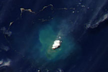
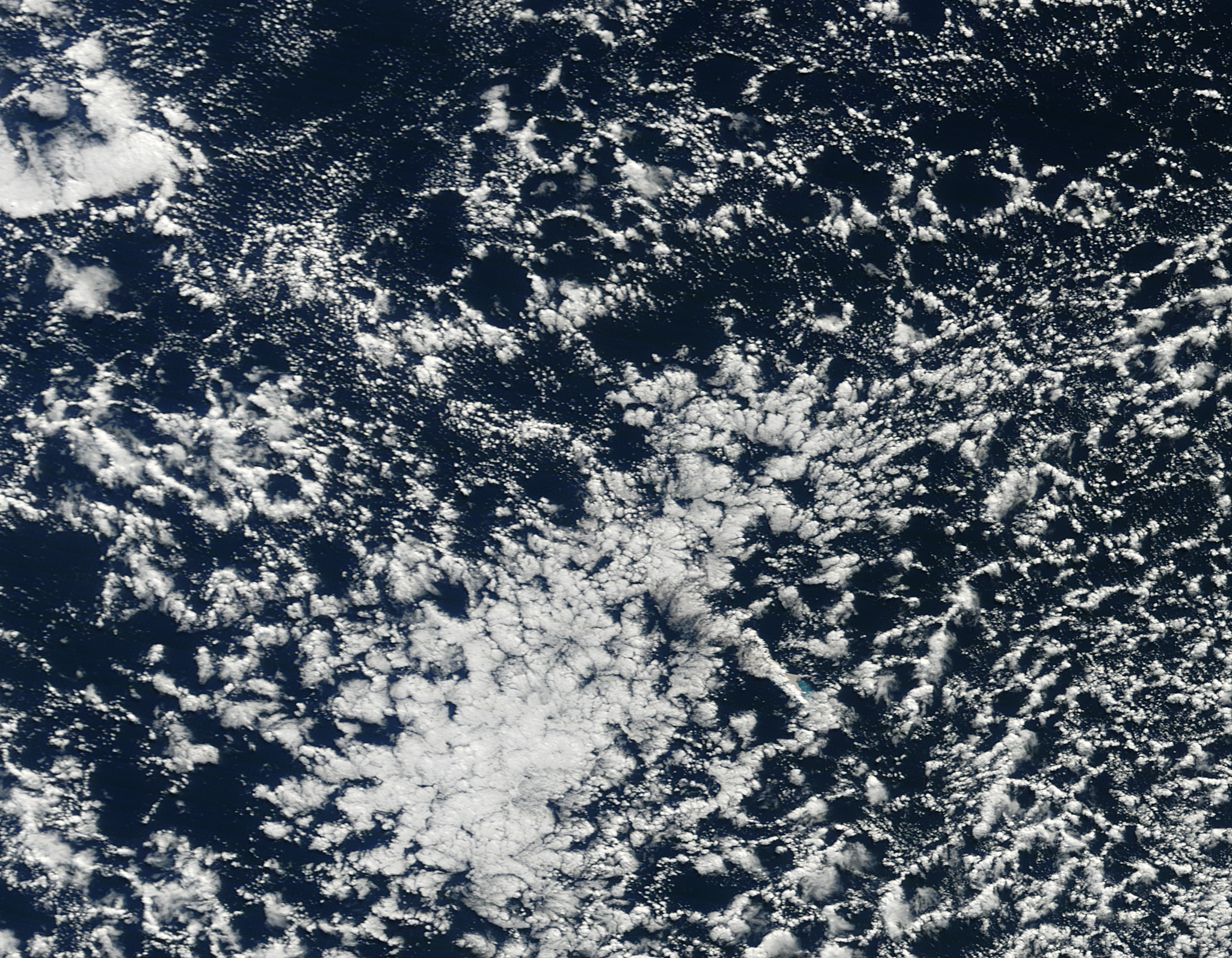
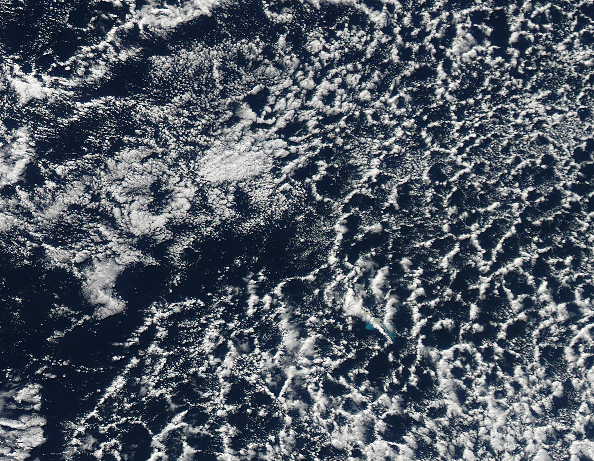
By July 21, the eruption appeared to have waned, leaving behind the dense rafts of pumice. Winds and currents spread the pumice into a series of twisted filaments, spread over an area about 450 by 250 kilometers (280 by 160 miles) as of August 13.
NASA image courtesy Jeff Schmaltz, LANCE MODIS Rapid Response Team at NASA GSFC. Caption by Robert Simmon. Detective work by Erik Klemetti.