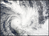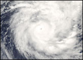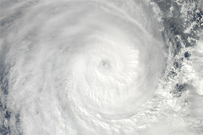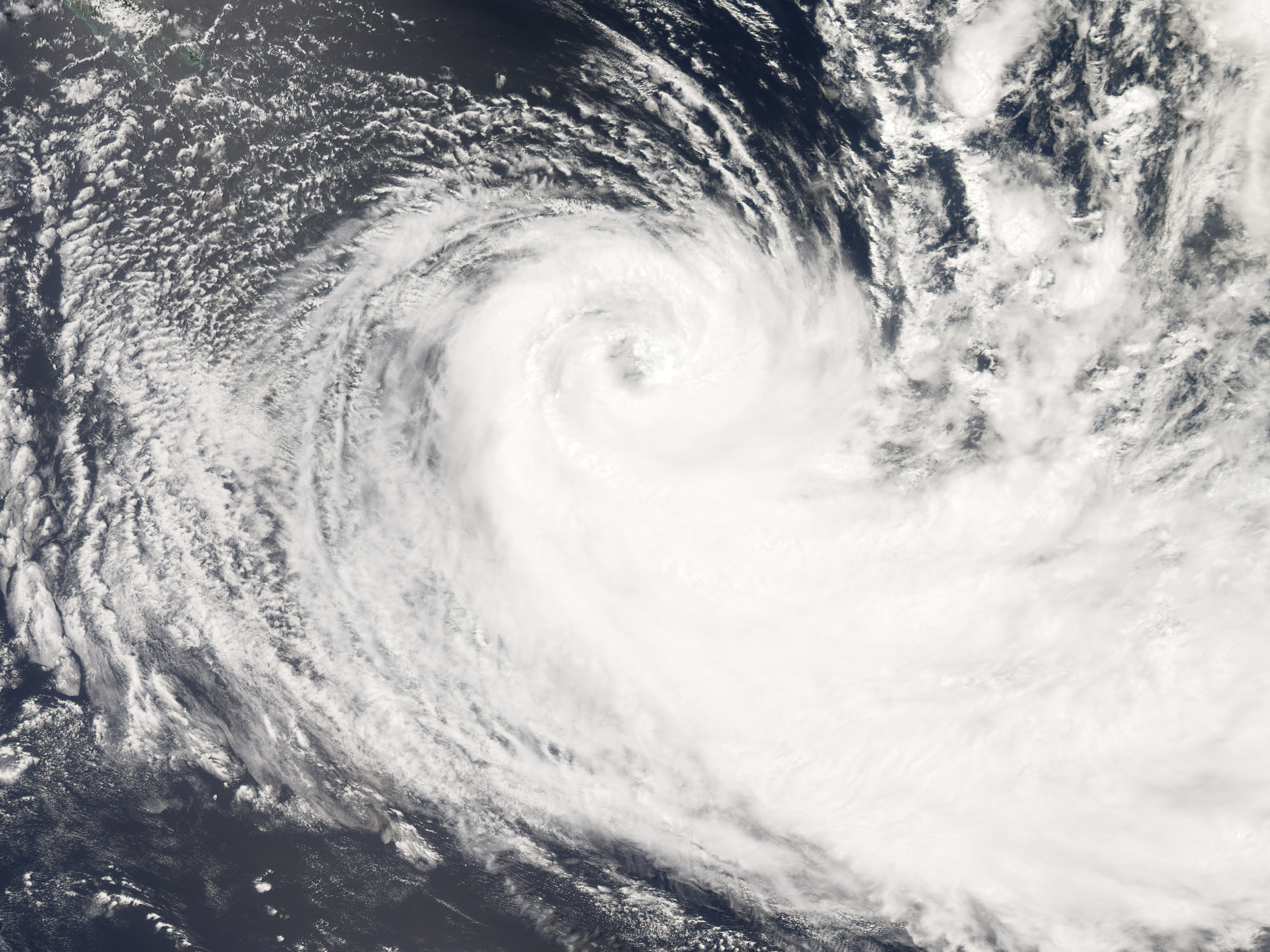
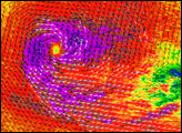
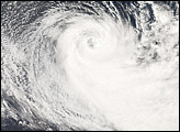
Tropical Cyclone Gene was slowly fading away when the Moderate Resolution Imaging Spectroradiometer (MODIS) on NASA’s Aqua satellite captured this photo-like image on the afternoon of February 4, 2008. At its height on January 31, the storm reached Category 3 status, with winds of 185 kilometers per hour (115 miles per hour or 100 knots), according to the Joint Typhoon Warning Center. By the time MODIS captured this image at 2:25 p.m., local time, Gene’s winds had dropped to between 102 and 83 km/hr (63-52 mph or 45-55 knots), making it a tropical storm. In this image, Gene still has the distinct spiral structure seen in well-formed storms. Well-defined bands of clouds spiral around a loose eye. The storm was moving southeast over the South Pacific as it degraded.
Throughout its lifetime, Gene left serious damage on the island nations of Fiji and Vanuatu. The storm struck Fiji’s islands between January 27 and January 30, causing 7 deaths and widespread minor damage to crops and buildings, said the Asia-Pacific Center for Emergency and Development Information. The storm was stronger by the time it crossed over Vanuatu. The islands of Futuna and Anatom reported the loss of many homes, schools, churches, and other buildings, said the Asia-Pacific Center for Emergency and Development Information. As of February 5, the storm was moving away from inhabited islands.
NASA image created by Jesse Allen, using data provided courtesy of the MODIS Rapid Response team. Caption by Holli Riebeek.
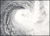
Tropical Cyclone Gene crashed through the Fiji Islands and Vanuatu in the South Pacific Ocean between January 27 and January 30, 2008.
alert message