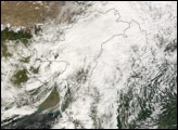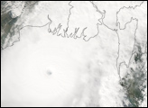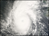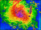

Tropical Cyclone Sidr was gathering strength when the Moderate Resolution Imaging Spectroradiometer (MODIS) on NASA’s Terra satellite captured this photo-like image on November 12, 2007. The storm’s swirling clouds straddle the center of the Bay of Bengal, with the eastern shores of Sri Lanka and India forming the left edge of the image. At the time that this image was taken, Sidr was relatively small, with sustained winds estimated at 100 kilometers per hour (60 miles per hour or 55 knots), the equivalent of an Atlantic tropical storm. Despite its small size, Sidr is well-formed, with a dark spot near the center where an eye may be developing surrounded by tight bands of clouds. On November 12, the Joint Typhoon Warning Center forecast that Sidr would grow to the equivalent of a Category 2 storm, with sustained winds of 170 km/hr (100 mph or 90 knots) by November 14.
NASA image by Jesse Allen, using data provided courtesy of the MODIS Rapid Response team.
Tropical Cyclone Sidr spun north over the Bay of Bengal in mid-November 2007. It was forecast to become a Category 4 storm.


