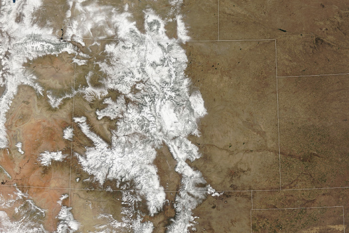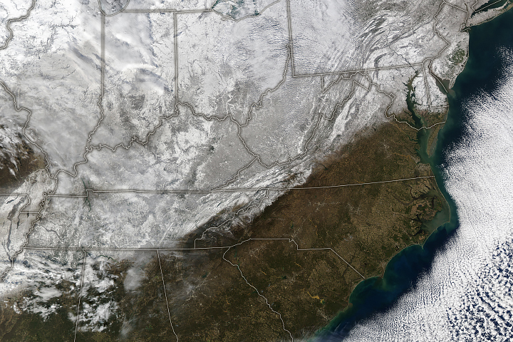
A large mass of Arctic air spilled south from Canada and lingered for several days over much of the contiguous United States in mid-January 2024. The system brought a wintry mix of bitterly cold temperatures, freezing rain, and snow that extended from the Pacific Northwest all the way to the East Coast.
As the airmass came south, sub-zero air temperatures settled over Montana and the Dakotas on January 13 and 14. Air temperatures at a National Weather Service station in Billings, Montana, reached -30 degrees Fahrenheit (-34 degrees Celsius) on January 13, the lowest temperature recorded there since the site was established in 1999.
Wind chill—which describes how cold it feels to human skin due to wind—in Montana and the Dakotas reached as low as -60°F (-51°C). A wind chill of -20°F (-29°C) can cause frostbite in as few as 30 minutes. As of January 14, over 95 million citizens were under a wind chill advisory, according to the weather service. Dangerously cold temperatures remained over large swaths of the U.S. for several days.
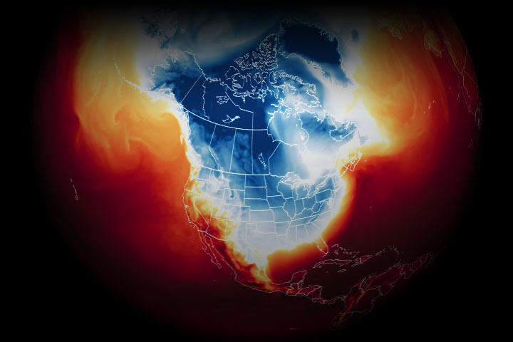
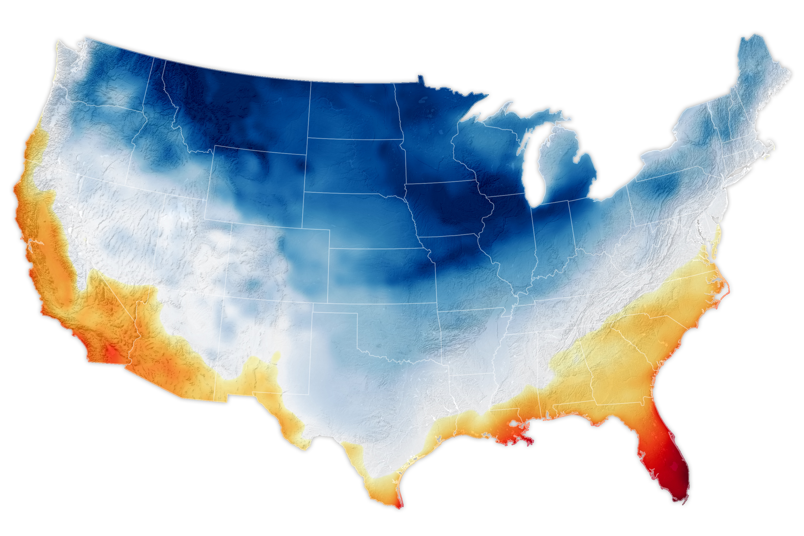
The map above shows air temperatures at 2 meters (around 6.5 feet) above the ground at 7 a.m. Eastern Standard Time (12:00 Universal Time) on January 15, as represented by the Goddard Earth Observing System Model. GEOS is a global atmospheric model that uses mathematical equations to represent physical processes. Measurements of temperature, moisture, wind speeds, and other conditions are compiled from NASA satellites and other sources, then added to the model to closely simulate observed reality.
The cold air extended as far south as Texas and Louisiana, where temperatures dropped into the teens on January 15 and 16. On January 16, the airport in Houston, Texas, registered 19°F—a new all-time low for that date.
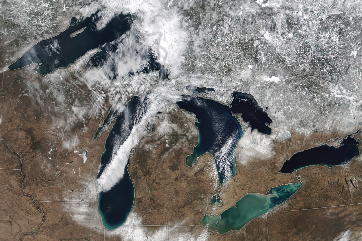
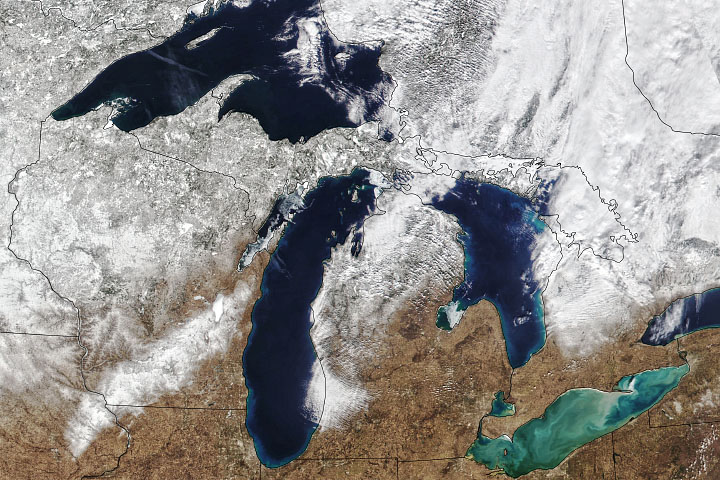
The frigid air came with bouts of heavy snow, especially downwind of the Great Lakes. When the Arctic air passed over the relatively warm open water, it quickly warmed and gained the moisture necessary to form narrow bands of clouds. These long, parallel bands of cumulus clouds, known as cloud streets, can be seen in this natural-color image acquired by the MODIS (Moderate Resolution Imaging Spectroradiometer) instrument on NASA’s Aqua satellite on January 16, 2024.
The transfer of warmth and moisture from the lakes to the lower atmosphere, which produced lake-effect snow, dropped 1 to 3 inches of snow per hour to cities downwind. Areas of western New York were buried in more than 2 feet of snow on January 13 and 14. According to news reports, the treacherous conditions forced the National Football League to delay a playoff football game in Buffalo, New York.
The Great Lakes have been unusually low on ice so far this winter, and the lack of ice cover results in more lake-effect snow. According to AccuWeather, Grand Rapids, Michigan, has accumulated almost 27 inches of snow since the start of 2024, with most of that falling between January 8 and 16. The city has exceeded the typical 23 inches received in the month of January and was forecast to receive more through January 20.
Another surge of frigid Arctic air is forecast to spread over the eastern half of the country on January 19 and 20. Although the system will not be as extreme as this first wave, according to the weather service, “daytime highs across the Plains into the Mississippi Valley could be 20-30 degrees below normal, with wind making it feel even colder.”
NASA Earth Observatory images by Michala Garrison, using GEOS data from the Global Modeling and Assimilation Office at NASA GSFC, MODIS data from NASA EOSDIS LANCE, and GIBS/Worldview. Story by Emily Cassidy.