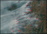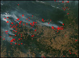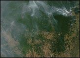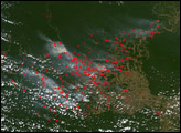

Along the southeastern margin of the Amazon Rainforest, people are creating islands of rainforest surrounded by farms and ranches. This image from the Moderate Resolution Imaging Spectroradiometer (MODIS) on NASA’s Aqua satellite was captured on July 23, 2005. At upper right, a deep green forest island is surrounded by lighter green and tan areas of agricultural land. To the southwest of the smaller island, a larger pocket of forest appears to be in the process of being isolated from the intact expanse of forest to the northwest—if it has not been separated already. Fire is a common land-clearing or land-management tool in the region, and numerous fires were detected by MODIS in the image and are marked with red dots.
NASA image created by Jesse Allen, Earth Observatory, using data obtained from the MODIS Rapid Response team.
In the southeastern Amazon, biomass burning is transforming the landscape. Fires were burning along the margins of the forest and roads in July and August 2005.


