The Earth Observatory has published its last Image of the Day on this website. Please join us on our new home at science.nasa.gov/earth/earth-observatory.
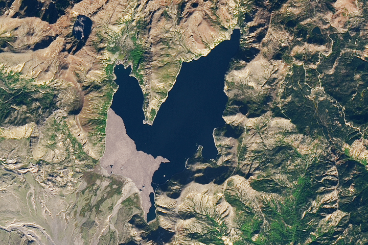
Perched on the Qinghai-Tibetan Plateau in western China, Qinghai Lake is a biodiverse outpost within the arid steppe—and a sensitive indicator of the region’s climatic shifts. The lake’s fluctuating water level serves as a de facto gauge of climate change in this high-altitude watershed.
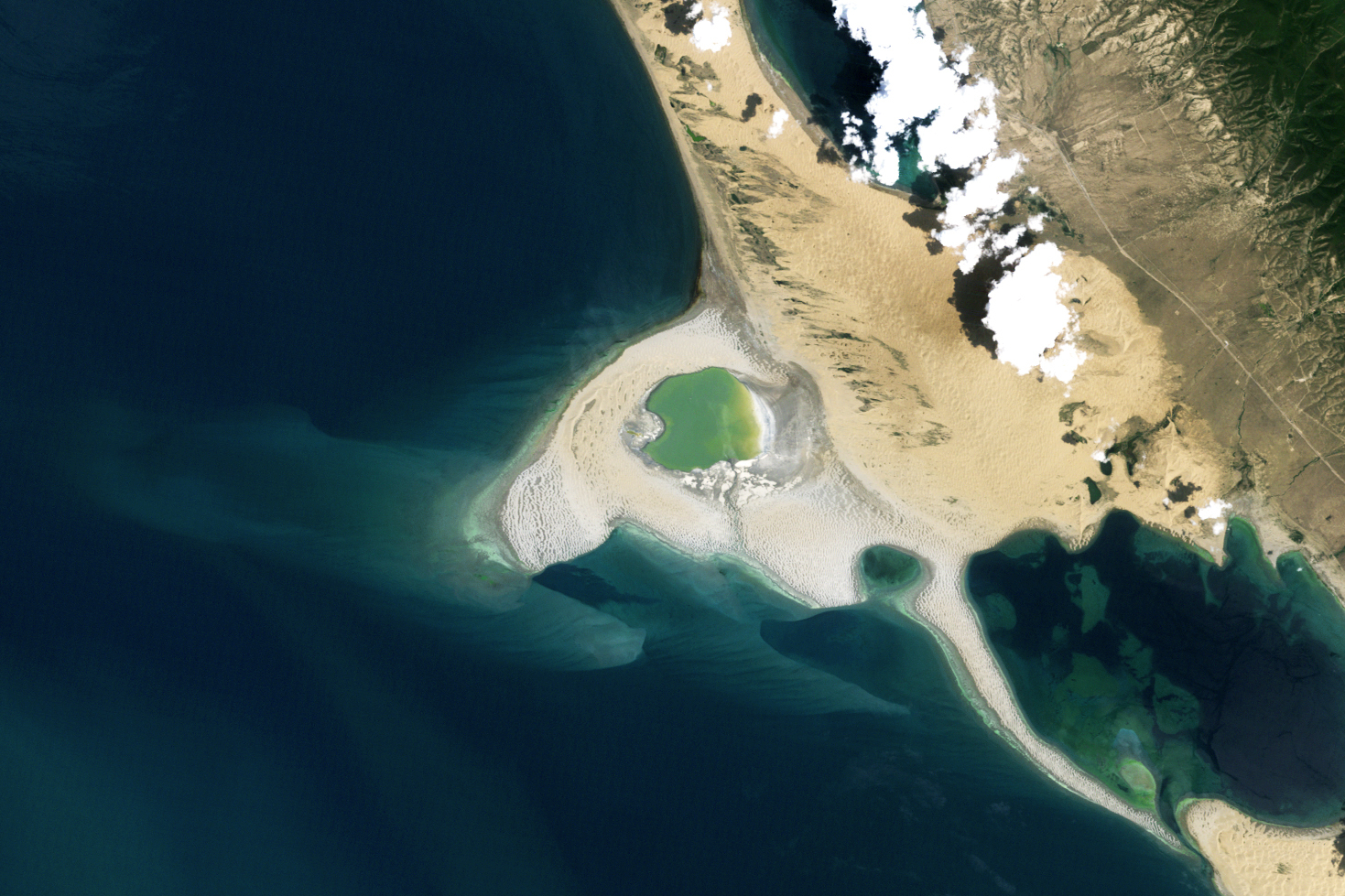
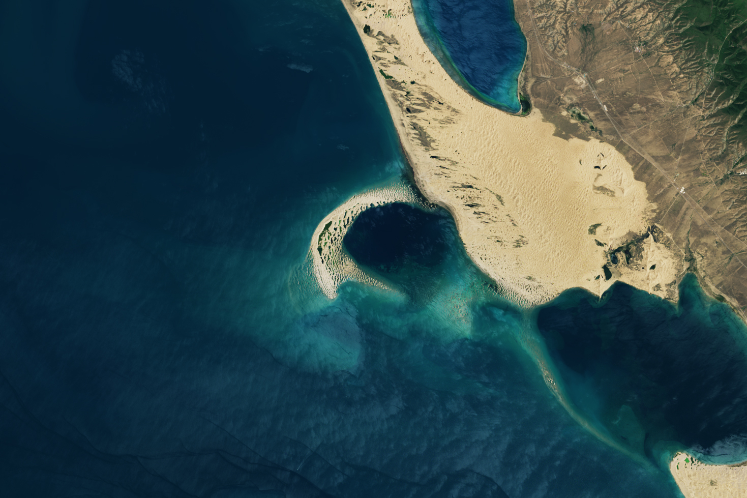
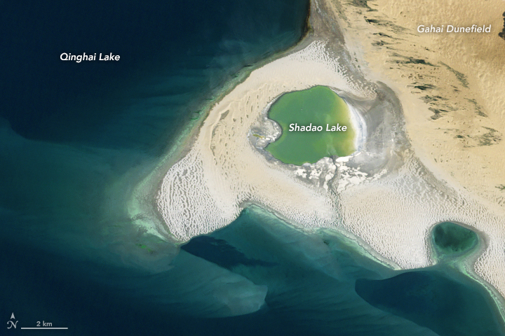
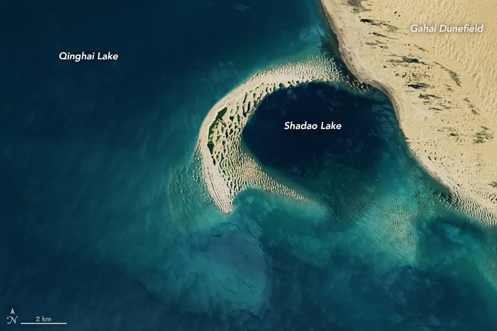
Recent changes in the lake level are apparent in this pair of satellite images, captured by the Thematic Mapper (TM) on Landsat 5 on July 29, 2010 (left), and by the Operational Land Imager-2 (OLI-2) on Landsat 9 on July 22, 2022 (right). Sand spits stretching nearly 25 kilometers (15 miles) once cleared the water’s surface and cordoned off lakes within the lake. However, they were mostly submerged by 2022.
Researchers measuring water levels in Qinghai Lake reported that the level declined steadily at an average rate of 8 centimeters (3 inches) per year from 1961 to 2004. At that point, the trend reversed, and the lake started rising at 18 centimeters (7 inches) per year through the end of the study period in 2019.
The striking turnaround coincided with trends of warming and wetting, according to the authors. Lake levels declined prior to 2004 primarily due to decreased river runoff. The subsequent rise in lake levels was driven by increasing precipitation and river runoff, as well as decreasing evaporation. (There is no outflow from the lake.) Though less evaporation doesn’t intuitively track with warming temperatures, the researchers note that temperature increases were more significant in winter months, when the lake was covered with ice, than in summer months. Summers saw more precipitation, which meant more cloudy days, higher humidity, and therefore less evaporation.
The evolution of the sand spit is one of the more dynamic effects of the lake’s fluctuations. When water levels were lower, more lakebed sediments were exposed to the prevailing westerly winds, which swept the sediments to the eastern shore of the lake. As dunes built up there, they divided Qinghai Lake into several sub-lakes, including Shadao Lake (centered in the top-left image) and Haiyan Bay (toward the bottom-right of the wider view). These lakes appear isolated from Qinghai Lake in the 2010 image but were mostly reincorporated in 2022.
The importance of Qinghai Lake and its wetlands goes beyond its climate signals. Many species are endemic to the plateau, and the endangered Przewalski’s gazelle lives only around Qinghai Lake. The ecosystem also plays a critical role as a breeding and stopover site for many migratory waterbirds along the Central Asian and East Asian Flyways.
NASA Earth Observatory images by Allison Nussbaum, using Landsat data from the U.S. Geological Survey. Story by Lindsey Doermann.


