In recent years, sea surface temperatures in the central and eastern tropical Pacific have been abnormally low—about 0.5. to 1.0°C lower than average. However, this prolonged “triple dip” La Niña came to an end in February 2023 as shifting winds halted the upwelling of cool water offshore of Peru and Ecuador.
As the influx of cool water slowed in March and April 2023, Pacific Ocean surface temperatures soared several degrees above normal in a zone that extended up to a few hundred kilometers westward from the South American coast. The changes have been large enough that Peru's National Meteorology and Hydrology Service (Senamhi) has said the area is now experiencing a coastal El Niño.
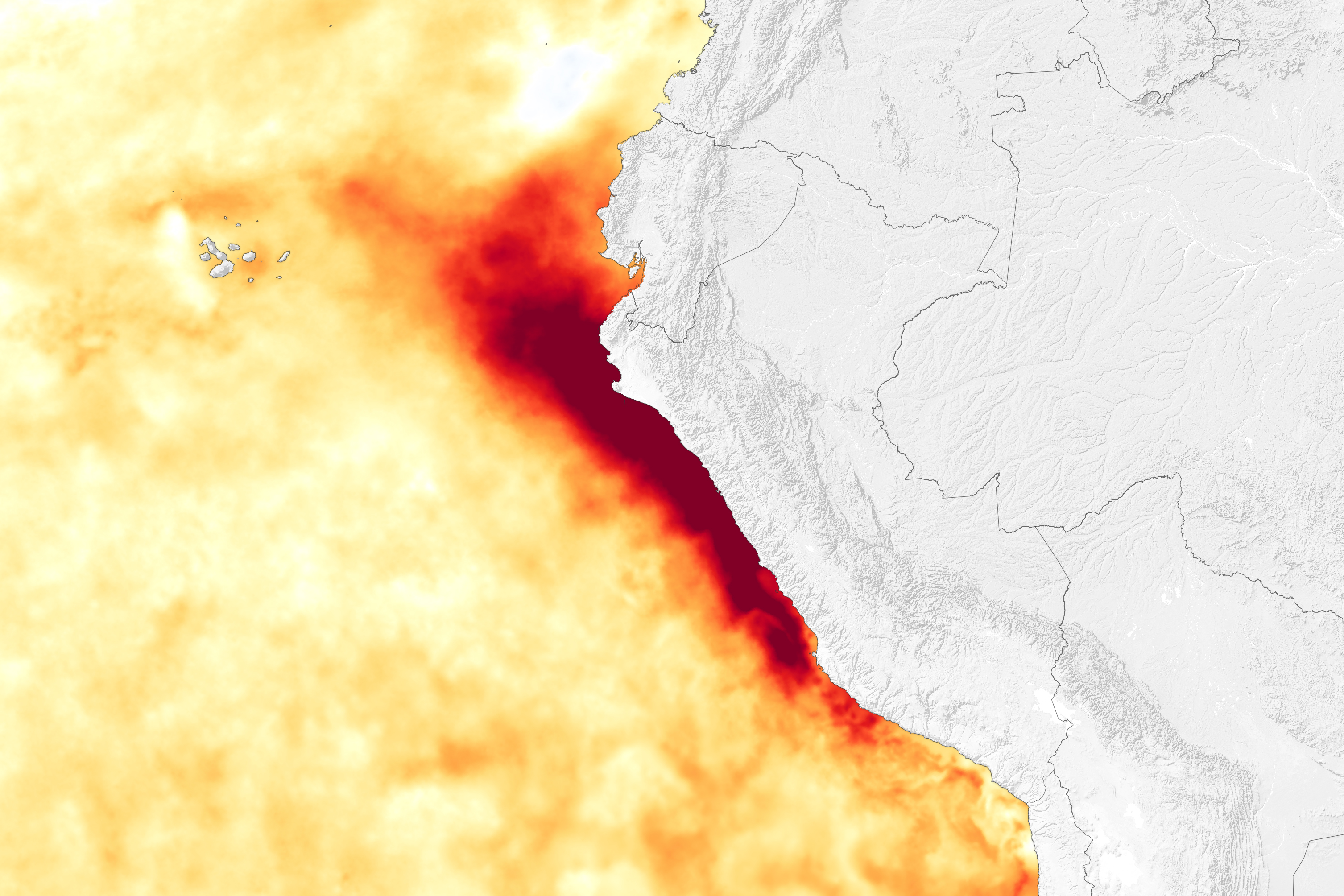
The map below shows sea surface temperature anomalies on April 4, 2023. Surface waters were roughly 6°C (10.8°F) warmer than usual offshore of Peru for that date, according to data from the Multiscale Ultrahigh Resolution Sea Surface Temperature (MUR SST) project. MUR SST blends measurements of sea surface temperatures from multiple NASA, NOAA, and international satellites, as well as ship and buoy observations. (Scientists also use instruments floating within the sea to project underwater temperatures.)
The unusually warm waters have played a role in energizing intense rainfall onshore, with northern Peru, Ecuador, and parts of western Brazil receiving frequent heavy rains since mid-March. The rains became especially intense after the rising ocean temperatures helped fuel Tropical Cyclone Yaku, which pumped even more rain into the normally dry region. The storm, the first tropical cyclone to hit the area in decades, was disorganized and lacked an eye, but it dropped record amounts of rain in semi-arid northern Peru on March 9, 2023. Pacasmayo received 13.7 centimeters of rain in a 24-hour period, and Chiclayo saw 8.7 centimeters.
The warm sea surface temperatures coincided with the part of the year when Peru normally sees its highest water temperatures offshore, explained René Garreaud, an environmental scientist at the University of Chile. This pushed sea surface temperatures above 27°C (80°F), speeding evaporation, making the air more humid, and fueling the formation of tall convective clouds that produce downpours and thunderstorms. The situation is similar to 2017, the last time a coastal El Niño flooded the area with rain.
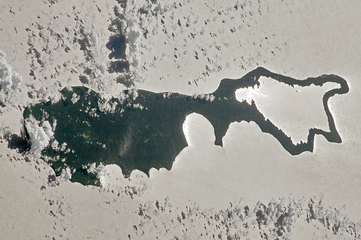
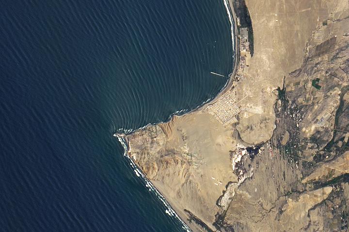
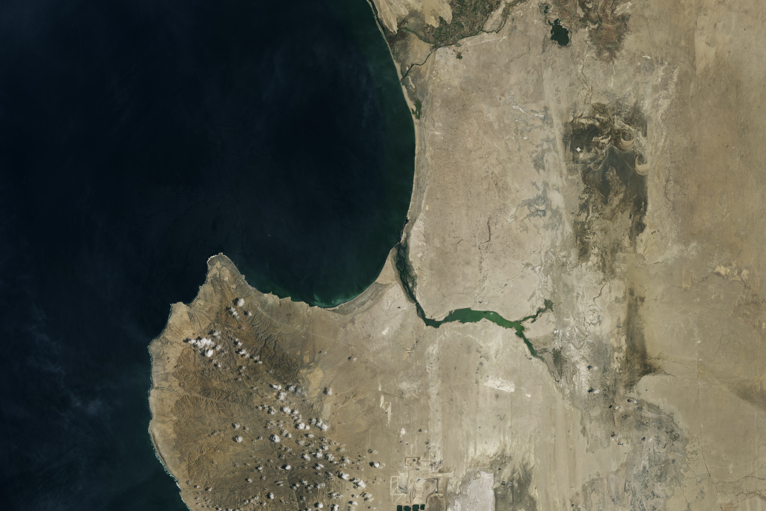
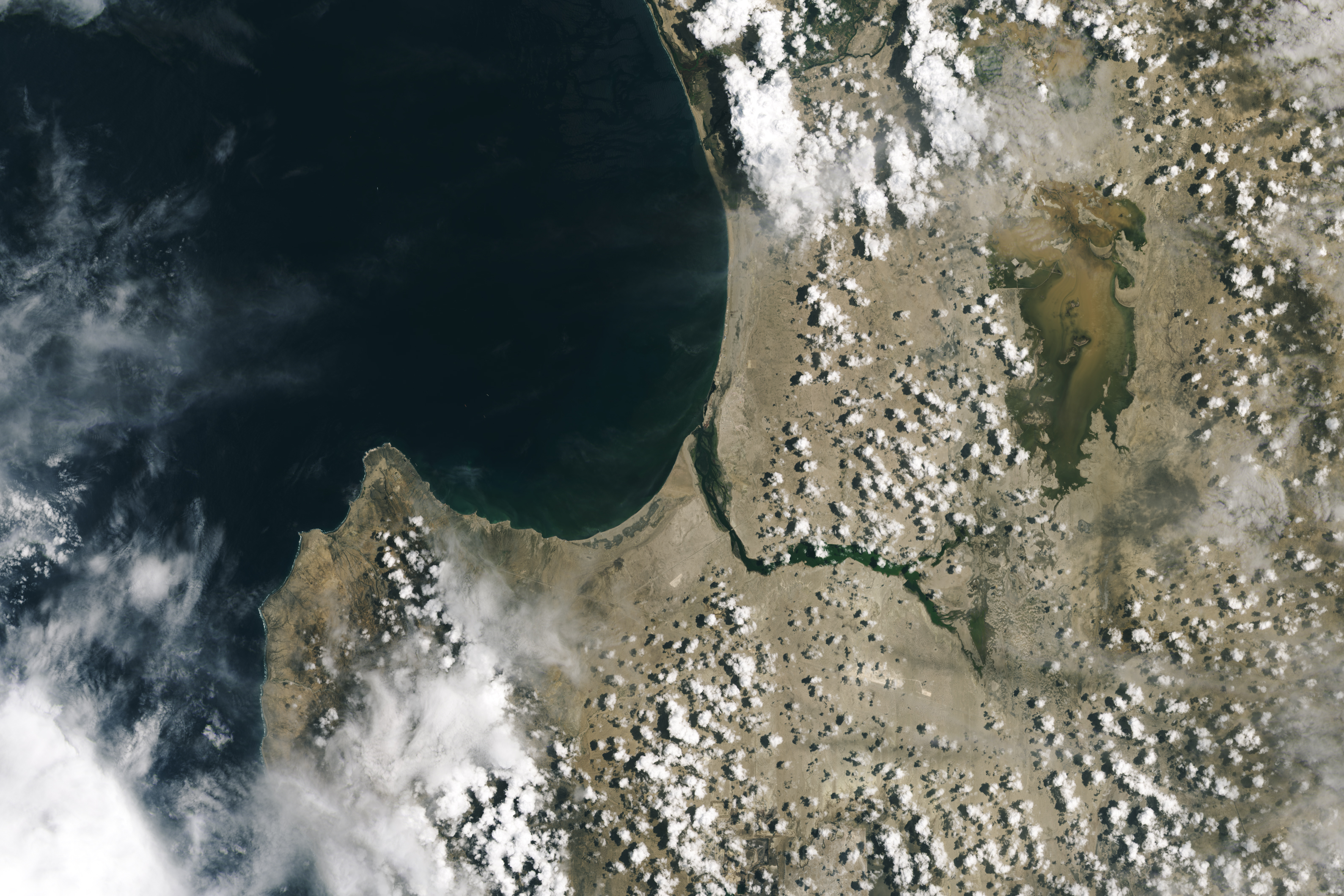
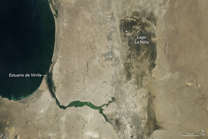
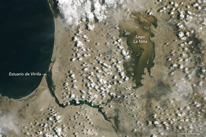
The Landsat images at the top of this page show extra water that accumulated in Lago La Niña, an ephemeral lagoon that fills when rains are unusually heavy and the nearby Piura and La Leche rivers flood. The first image (left), acquired by the Operational Land Imager-2 (OLI-2) on Landsat 9, shows the same area on February 24, 2023, before the worst of the rains. The second image (right) shows the lagoon on March 12, 2023, when it was swollen with floodwater. On March 23, overflow from the lagoon destroyed a section of a nearby highway, cutting off the towns of Parachique and Bayóvar. Floodwaters continued to pour across the normally dry landscape in the following days and weeks, with satellite data showing much more of the lagoon submerged by the end of the month.
The deluge caused widespread impacts on the ground. More than 10,000 homes were rendered uninhabitable, hundreds of thousands of kilometers of water infrastructure were affected, and large numbers of schools closed, according to the United Nations Office for the Coordination of Humanitarian Affairs.
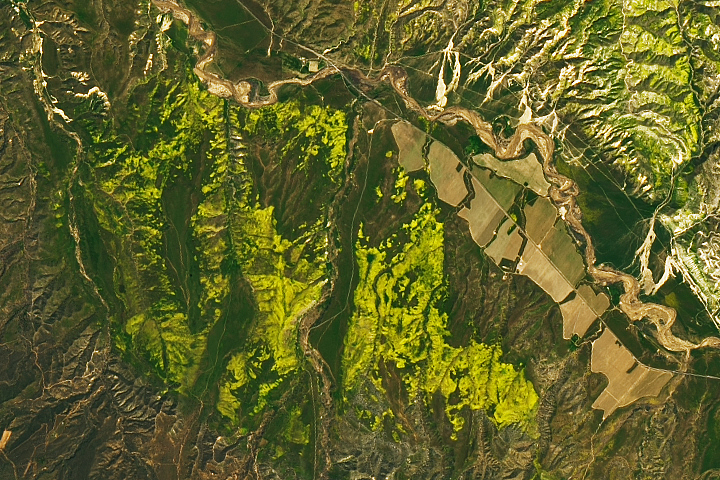
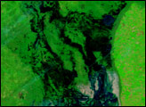
There has been at least one positive consequence of all the rain. “Satellite imagery shows widespread greening this year compared to last on the Pacific side of the Andes,” noted Garreaud.
NASA Earth Observatory images by Lauren Dauphin and Allison Nussbaum, using data from the Multiscale Ultra-high Resolution Sea Surface (MUR SST) project and Landsat data from the U.S. Geological Survey. Story by Adam Voiland.