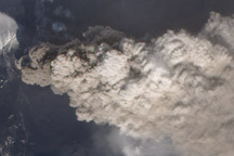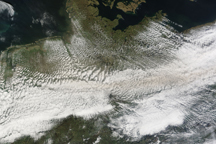
November brought a new round of explosions, volcanic tremors, and gas and steam emissions to Ecuador’s most active volcano. In the early part of the month, the steep-sided, glacier-covered Sangay volcano also coughed up ash.
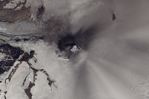
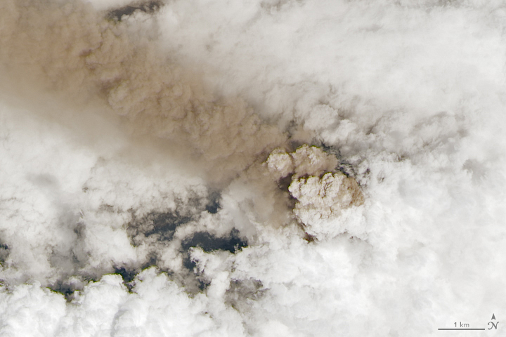
On a day when the volcanic plume was particularly straight due to southeasterly winds, the Landsat 8 satellite captured this image despite some afternoon cloud cover. The natural-color image was acquired by the satellite’s Operational Land Imager (OLI) on November 5, 2022. The second image is a closer view of the eruption column.
According to the Ecuadoran Geophysical Institute of the National Polytechnic School (IG-EPN), satellites and webcams observed an ash-and-gas plume daily between November 1-8. Plumes generally rose to a height of 1.8 kilometers (1.2 miles) during that period, though they also reported one plume being lofted as high as 8.3 kilometers on November 4, 2022.
The activity has caused minor to moderate amounts of ash to fall in several nearby cities including Riobamba, Guamote, Colta, Alausí, Pallatanga, Chambo, and Chunchi. According to news reports, ash fell on at least 1,824 hectares (7 square miles) of crops, affecting thousands of farmers and ranchers.
Sangay’s latest eruption has been ongoing since March 2019, with frequent ash plumes in recent months and years. Prior to that, the Global Volcanism Program reported ten other confirmed eruptions since 1628.
NASA Earth Observatory images by Lauren Dauphin, using Landsat data from the U.S. Geological Survey. Story by Adam Voiland.
alert message