This story is the answer to the October puzzler.
In 1798, with a yellow fever epidemic raging in New York City, fifteen-year-old Washington Irving was sent north to stay with a family friend in the lower Hudson River Valley in the hope that fresh air and open space would help him elude the deadly virus. He ended up in Tarrytown, a small town about 25 miles (40 kilometers) north of Manhattan on the eastern side of the river.
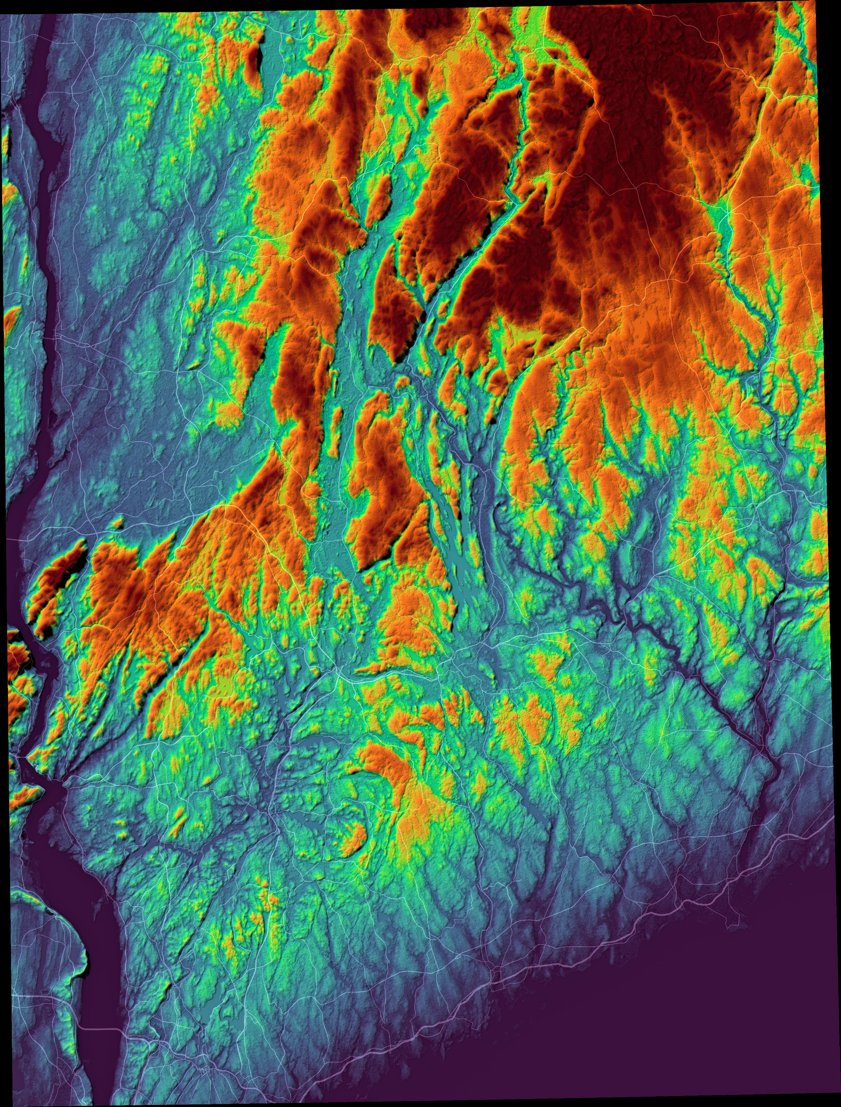
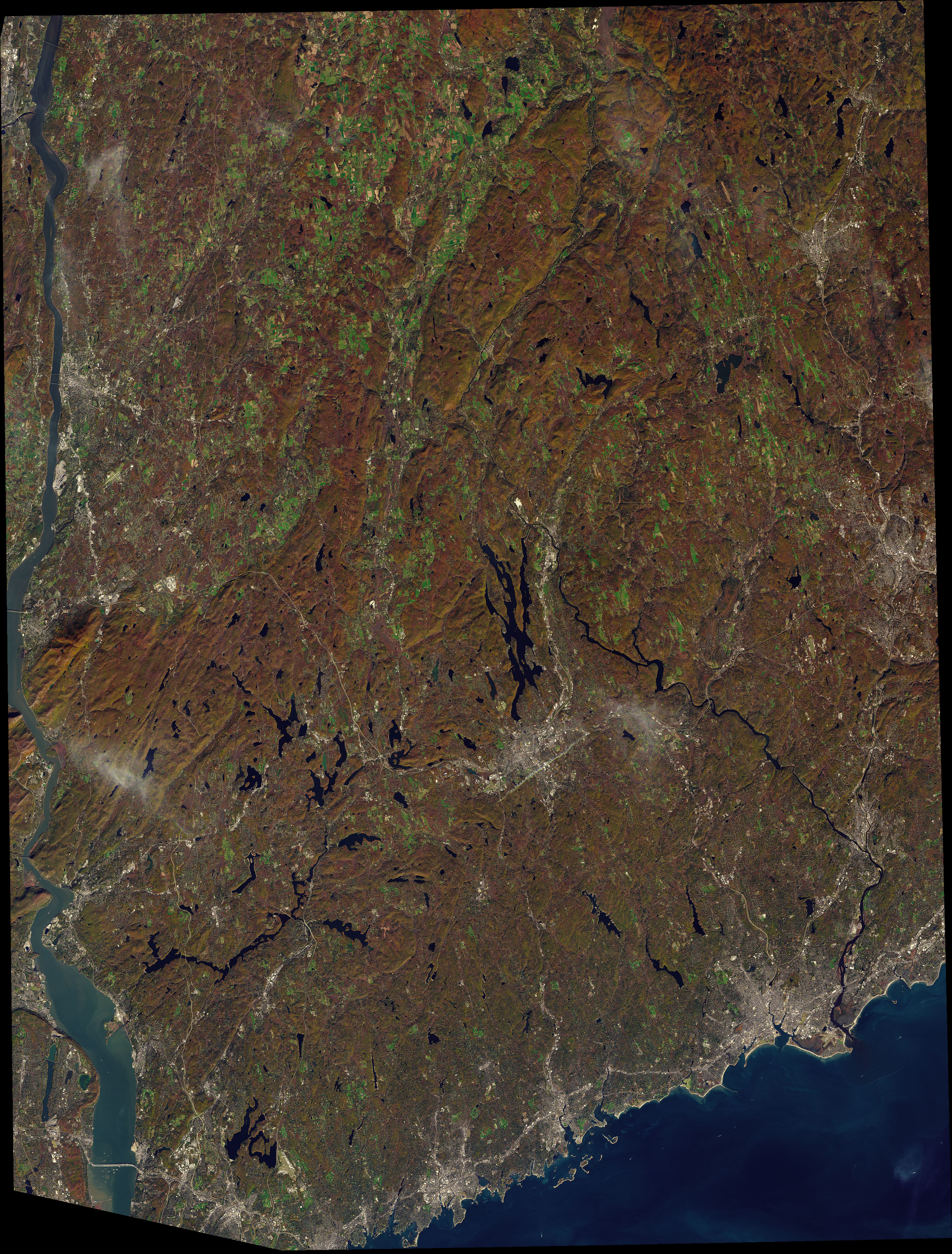
Irving delighted in exploring the verdant, rocky landscapes north of Tarrytown, particularly an area later named Sleepy Hollow. He found the forests and streams there to be perfect for wandering, daydreaming, and fishing. He later settled there, and many of the landscapes he had explored as a teen became nostalgic backdrops for his short stories.One of his most famous—The Legend of Sleepy Hollow—is set in the area highlighted in the map above. The map is composed from elevation data from the Shuttle Radar Topography Mission (SRTM). It is false-color to emphasize the topography; red areas are the highest elevations, and blue areas are closer to sea level. The Operational Land Imager (OLI) on Landsat 8 acquired a natural-color image (below) of the same area on October 27, 2017.
Much of the rock beneath this landscape is Fordham gneiss, an ancient bedrock that formed more than one billion years ago under the intense heat and pressure of colliding land masses. The smashing and suturing of continents that produced a supercontinent called Rodinia was followed by countless cycles of erosion, mountain building, and the ebb and flow of ice ages. Over time, these and other geologic processes formed the worn, hilly landscapes that are found today around Sleepy Hollow.
According to Irving’s tale, the forests and swamps of this uneven, corrugated terrain are where a headless horseman—perhaps a Hessian soldier killed during the Revolutionary War—is said to roam at night looking for his missing head. The Sleepy Hollow Cemetery and Old Dutch Church, landmarks that feature prominently in the story, sit on a small ridge near the center of the image.
The Pocantico River, what Irving calls that “wizard stream,” flows through a valley that appears as a dark, thin line in the elevation map. In the story’s climax, the Headless Horseman chases the protagonist across a wooden bridge over the river. To the east, in the Pocantico Hills, lies Raven Rock, a large glacial erratic transported and deposited by melting ice in a glen haunted by the ghost of a woman who perished there. The cliff on the western side of the river, part of the Palisades, formed roughly 200 million years ago when a sheet of rising magma was trapped between layers of sedimentary rock as a different supercontinent was breaking apart.
Irving died and was buried in the Sleepy Hollow Cemetery in 1859, but his words about Sleepy Hollow live on. They still resonate, especially on Halloween, when the town celebrates its literary history with a festival each year. “The place still continues under the sway of some witching power, that holds a spell over the minds of the good people, causing them to walk in a continual reverie,” Irving wrote in the opening of The Legend of Sleepy Hollow. “The whole neighborhood abounds with local tales, haunted spots, and twilight superstitions; stars shoot and meteors glare oftener across the valley than in any other part of the country, and the nightmare, with her whole ninefold, seems to make it the favorite scene of her gambols.”
NASA Earth Observatory images by Joshua Stevens. using topographic data from the Shuttle Radar Topography Mission (SRTM) and Landsat data from the U.S. Geological Survey. Story by Adam Voiland.