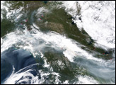
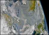
This large-scale image was made by stitching together four images collected by the Moderate Resolution Imaging Spectroradiometer (MODIS) instruments aboard both the Terra and Aqua satellites. The mosaic shows the extent to which smoke from fires burning in Alaska has spread all the way across Canada and into the Great Lakes region of the United States.
The high-resolution version available here is 1 kilometer per pixel.
NASA image by Jesse Allen, Earth Observatory, using data courtesy MODIS Rapid Response
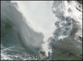
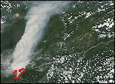
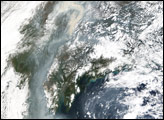
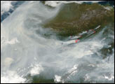
Smoke from large forest fires in Alaska has made the rounds across several parts of the Northern Hemisphere since the fires began in mid-June 2004. In this scene, smoke is spreading southward along the western arc of the Alaska Range Mountains and the Alaska Peninsula.
alert message