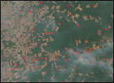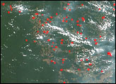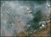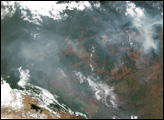

In South America’s Amazon River Basin, the annual dry season is drawing to a close, but fires are still burning over a wide area near the Xingu National Park, a large park that acts as an indigenous peoples reserve in the rapidly changing Amazon frontier. In this scene, the green pendulum of intact rainforest in the park dominates the right edge of the scene, while fires (red dots) and smoke are spread over the whole image. Slash-and-burn deforestation continues to be a prime tool for clearing land for agriculture in the region, especially for cattle ranching and, increasingly, for soybean production. This image was captured by the Moderate Resolution Imaging Spectroradiometer (MODIS) on NASA’s Terra satellite on September 28, 2004. The high-resolution image provided above is 250 meters per pixel. The MODIS Rapid Response System provides this image at additional resolutions.
Image courtesy the MODIS Rapid Response Team, NASA-Goddard Space Flight Center
In South America’s Amazon River Basin, the annual dry season is drawing to a close, but fires are still burning over a wide area near the Xingu National Park on September 28 and 29, 2004.


