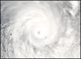

Cyclone Heta approaches the island of Niue in this Moderate Resolution Imaging Spectroradiometer (MODIS) image taken by the Aqua satellite on January 6, 2004, at 1:00 UTC. The storm blew through Samoa, seen in the top center, on January 5 with 105 mile-per-hour winds, which blew down trees and knocked out communications and power. The storm intensified as it moved southeast toward Niue. At the time this image was taken, Heta’s winds reached a powerful 150 miles per hour with gusts up to 184 miles per hour.
The high resolution image provided above is at 500 meters per pixel. The image is available in additional resolutions, including MODIS’ maximum spatial resolution of 250 meters per pixel.
Image courtesy Jeff Schmaltz, MODIS Land Rapid Response Team at NASA GSFC
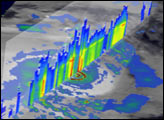
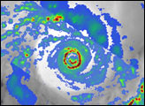
These images show Cyclone Heta as it moves through the South Pacific over Samoa and Niue.


