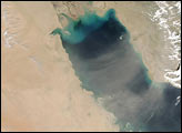

On Wednesday morning, March 19, 2003, the Moderate Resolution Imaging Spectroradiometer (MODIS) on the Terra satellite captured this image of an immense dust storm blowing over the Middle East. Countries shown are Iraq (top), Saudi Arabia (bottom), Kuwait (right of center), and Iran (top right).
A huge wave of tan-colored dust is washing over the region, muting the underlying terrain. In the bottom part of the image, the wave of dust appears to crash like surf across the bright orange sands of the deserts of Saudi Arabia. All of Iraq is under the cloud, which reaches just over the border into Iran (notice the crisply defined terrain to the east of the line of dust), as is Kuwait. The dust stretches out over the blue-green waters of the Persian Gulf at image right. Concentrated in Iran are several scattered fires, detected by MODIS and marked with red dots.
The high-resolution image provided above is 500 meters per pixel. The MODIS Rapid Response System provides this image at MODIS’ maximum spatial resolution of 250 meters.
Image courtesy Jeff Schmaltz, MODIS Rapid Response Team, NASA GSFC
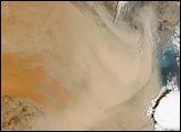
On April 17, 2003, the Aqua satellite captured this image of a dust storm continuing to blow over Saudi Arabia, the Persian Gulf, and Iran.


