The Earth Observatory has published its last Image of the Day on this website. Please join us on our new home at science.nasa.gov/earth/earth-observatory.
Reconciling the Differences |
|||
Currently, both Lindzen and Lin stand by their findings and there is ongoing debate between the two teams. At present, the Iris Hypothesis remains an intriguing hypothesis—neither proven nor disproven. The challenge facing scientists is to more closely examine the assumptions that both teams made about tropical clouds in conducting their research because therein lies the uncertainty. The next step in resolving the Iris debate will be to use satellite-based measurements of clouds’ physical properties—like cloud altitude, fraction, thickness, and ice/water particle phase. Sensors on the TRMM and Terra satellite missions routinely measure these cloud physical properties, which scientists will match in time and space with CERES’ new measurements of radiant energy fluxes. This matching will then allow scientists to determine whether the Iris Hypothesis works for a wide range of ice cloud conditions. The Moderate Resolution Imaging Spectroradiometer (MODIS), aboard Terra, has a channel uniquely sensitive to cirrus clouds. By discreetly measuring radiant energy at a wavelength of 1.38 micrometers, MODIS can precisely measure thin cirrus clouds even when they occur over bright low clouds, providing scientists their first ability to examine the Iris Hypothesis in the context of multiple cloud layers. MODIS can also determine whether clouds are made up of ice particles or water droplets. |
|||
Historically, it has been very difficult for scientists to measure clouds’ properties in multi-layer cloud formations using passive remote sensors. In 2004, scientists grappling with this problem will gain one of the most powerful tools ever developed for studying multi-layer cloud properties on a global scale. In that year, NASA will complete the launch of its “A-train”—a series of satellites that fly in formation around the Earth. In the lead will be the Aqua spacecraft planned for launch this spring (2002), carrying both the MODIS and CERES sensors. Following Aqua will be the Calipso and Cloudsat missions for making vertical profiles down through cloud layers nearly simultaneous with MODIS and CERES observations. These new tools will enable scientists to explore clouds on a global scale in ways only dreamed of in the past. Perhaps then these arbiters of the Earth’s energy will finally reveal their secrets. References
|
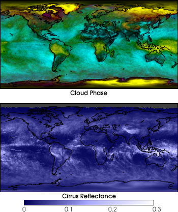
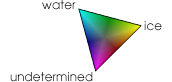
New data products from NASA’s most recent satellites will help scientists resolve the controversy
surrounding the Iris Hypothesis. The top image at left shows cloud phase for February 2002 from the
Moderate Resolution Imaging Spectroradiometer (MODIS Science Team). Yellow indicates cold, high-altitude
ice clouds, cyan corresponds to water clouds, and magenta shows undetermined (possibly ice clouds over
water) clouds. The lower image shows cirrus clouds. Dark colors indicate no cirrus clouds, and white
indicates cirrus clouds reflecting 30% or more of the incoming sunlight. Notice how the areas of ice
clouds in the tropics (in the top image) correspond to cirrus clouds (bottom image). |