
 | |||
Ask just about anyone who’s lived along the Southern California coast what it’s like to plan a picnic or a day at the beach during the months of May and June. Chances are they’ll warn you about the seemingly endless chain of dreary, overcast days known locally as “May Gray” and “June Gloom.” The heavy cloud banks rolling in off the ocean do little more than spoil an otherwise-perfect sunny day and drop a harmless drizzle from time to time. To someone hoping to spend a day basking in the sun and surf, these clouds are just gray, gloomy, and boring. But scientists who study cloud behavior are learning that these dismal clouds hold a lot more interest than meets the eye. Researchers are finding that the western coasts of continents where May Gray and June Gloom-type cloud systems occur are bountiful hunting grounds for unique formations called actinoform clouds. Named after the Greek word for “ray” due to their radial structure, these previously overlooked clouds are only now coming into focus as scientists use satellite data to better understand their complexity. |
|||
 | |||
Children around the world learn that clouds take on unique shapes in the sky and that cloud patterns often foretell the oncoming weather. Yet scientists still know very little about what determines the shape of individual clouds. Michael Garay, a graduate student at the University of California, Los Angeles (UCLA), is one of a handful of experts who are trying to discover what gives actinoform clouds their complex shape and what role they play in climate and weather systems. “In a general sense, we understand that stratus [sheet-like] clouds are formed by one type of process and one type of atmospheric conditions, while cumulus—the puffy clouds—are formed by another process,” said Garay. “But when it gets down to the details of ‘why does this cloud look like a bunny and this cloud look like a horse,’ that’s really hard to understand.” The actinoform clouds that Garay and his colleagues are studying are not the kind that you can see while gazing at the sky. They are actually cloud fields—collections of clouds that can be up to 300 kilometers across, an area roughly the size of the state of South Carolina. Seeing the entire cloud field requires a field of view much larger than the naked eye. In addition, actinoform clouds can form “trains” that are up to six times the length of the original cloud field, yet they maintain their own, distinct identity. Using satellite data from the Multi-angle Imaging SpectroRadiometer (MISR)—one of five instruments onboard NASA’s Terra spacecraft—scientists are finding these clouds to be much more prevalent and complex than they originally thought. |
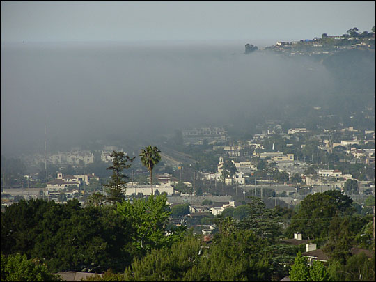
Fog is typical in coastal California in spring. In this photo, taken in late April 2004, fog rolls in off the Pacific Ocean and blankets Santa Barbara Harbor. These dreary conditions are common during “May Gray.” (Photo courtesy Ted Eckmann) | ||