|
Where Storm Clouds Gather
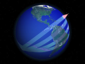
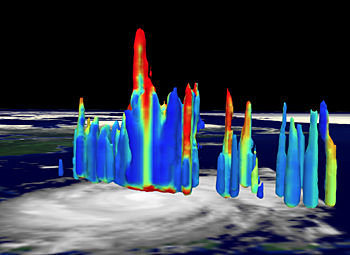
We cannot measure the latent heat contained within clouds. We can, however, measure tropical rainfall. Currently, there is a 50 percent uncertainty in estimates of annual global rainfall. If we are to more accurately determine how much energy our atmosphere receives from latent heat, then we must more accurately measure rainfall. In 1997, NASDA and NASA jointly developed and launched the Tropical Rainfall Measuring Mission (TRMM) into a mid-inclination (35°) precessing orbit. Scientists estimate about 60 percent of our world’s precipitation falls within the band spanning ± 30° north and south of the equator. TRMM carries three instruments designed to measure rainfall—the Precipitation Radar (PR), the TRMM Microwave Imager (TMI), and the Visible and Infrared Scanner (VIRS). Designed and built by NASDA, the Precipitation Radar is the first satellite sensor to provide three-dimensional images of the internal structures of storm clouds. Its measurements show scientists the intensity and distribution of rain within a storm, the total height of a storm, and the elevation at which ice crystals melt into raindrops. Most importantly, the Precipitation Radar can measure rain rates as accurately as 0.7 mm per hour. While scientists expected to use ground-based Doppler Radar stations to validate TRMM’s Precipitation Radar measurements, much to their pleasant surprise they found that the latter exceeds most ground-based measurements in accuracy and spatial resolution.
The TMI is a “passive” sensor designed to measure minute amounts of microwave energy emitted by the Earth’s surface and from within its atmosphere. (Whereas “active” sensors send pulses of energy and then measure how much gets absorbed and reflected by the target, “passive” sensors measure only energy originating from, or reflected by external sources.) These measurements allow TMI to quantify the amount of water vapor, cloud water, and rainfall intensity within the atmosphere. Based upon the design heritage of the Defense Meteorological Satellite Program’s Special Sensor Microwave/Imager (SSM/I), the TMI has a wider viewing swath (780 km) and finer spectral resolution than its predecessors. The TRMM VIRS detects radiant energy in five spectral bands, ranging from visible to infrared wavelengths (from 0.63 to 12 microns). Ideally designed to measure temperature, VIRS can precisely determine cloud top temperatures that scientists can then indirectly correlate with rainfall amounts. next: Conclusion |
Remote Sensing
Related Articles
Related Datasets |