 | |||
Like the rest of their colleagues at weather prediction centers around the world, the weather modelers at the European Centre for Medium-Range Weather Forecasts (ECMWF) have a problem. They’re a little short. Well, more than a little short, says the head of the center’s satellite research section, Jean-Noël Thépaut. In reality, he says, they are probably a few million short. Thépaut isn’t talking about the center’s budget. He’s talking about the group’s medium-range (3- to 10-day) weather-forecasting model and the number of additional observations of the atmosphere they would need to fill the observational gaps with data. |
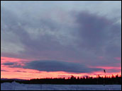 Satellite pictures of Arctic clouds are helping forecasters predict the weather in Northern Europe and other high-latitude areas. (Photograph courtesy NASA JPL Microwave Temperature Profiling program) | ||
“Every time we run our global model—every 12 hours—we estimate the current state of the atmosphere using about eight million data points. Typically, we have only two to three million observations to work with over a 12-hour time period, with a large redundancy among some observations” says Thépaut. To make up the missing information, they rely on the values predicted by the previous forecast. In other words, a large part of the model’s input is based on the previous model run’s output. Thus, errors can snowball in the model’s subsequent output. |
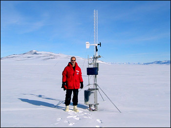
Weather forecasts in polar regions rely on remote, widely spaced weather stations. Forecasters are looking for new ways to fill in the gaps of missing data, hoping to improve weather predictions. (Photograph courtesy Jeff Key) | ||
In 2003, modeling centers around the world got a little help in filling some of the observational holes in their models when Jeff Key and a few of his colleagues at the Cooperative Institute for Meteorological Satellite Studies (CIMSS) in Madison, Wisconsin, began calculating the speed, height, and direction of the wind in polar regions using imagery collected by NASA’s Terra and Aqua satellites. Thépaut and his colleague Niels Bormann discovered that plugging even a tiny percentage of those observational holes with real-world atmospheric data extends the window of accuracy of their medium-range weather forecasts about three hours—a significant improvement in the world of weather prediction. |
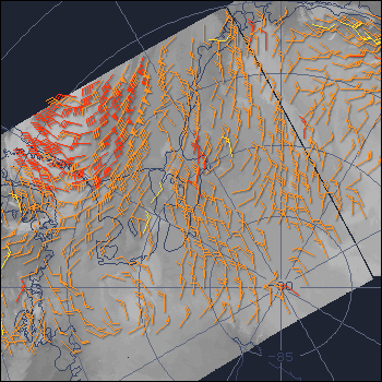
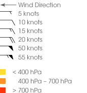 Observations from polar-orbiting satellites augment the coverage of ground-based weather stations around the poles. Scientists use the satellite data to track the motion of clouds and water vapor, which corresponds to wind speed. The map at left shows wind speed and direction at high (yellow), medium (orange), and low (red) altitudes over Antarctica. (Map courtesy NOAA/NESDIS Polar Winds) | ||
